MyTopo
Jaycox Mountain Arizona US Topo Map
Couldn't load pickup availability
Also explore the Jaycox Mountain Forest Service Topo of this same quad for updated USFS data
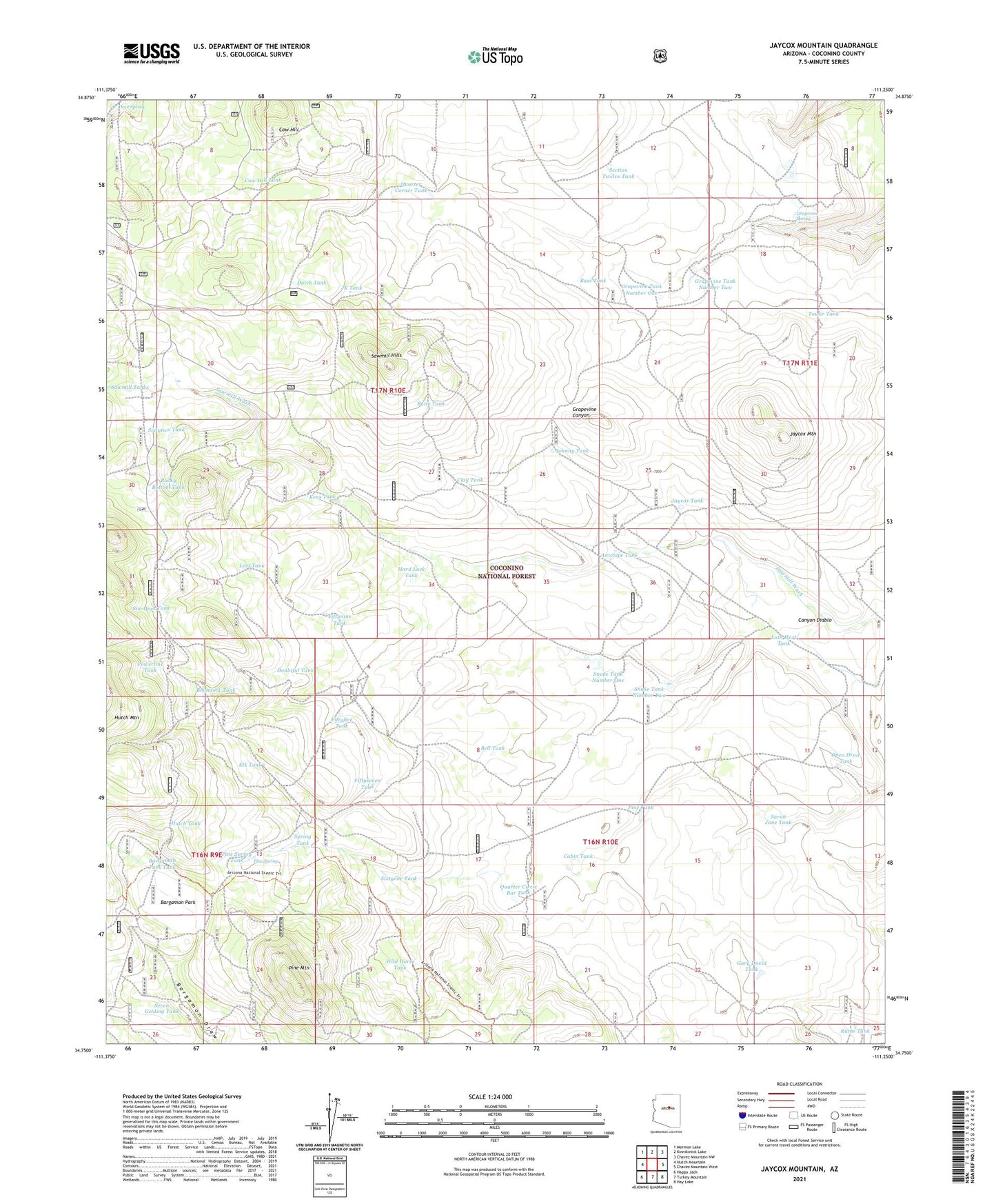
2021 topographic map quadrangle Jaycox Mountain in the state of Arizona. Scale: 1:24000. Based on the newly updated USGS 7.5' US Topo map series, this map is in the following counties: Coconino. The map contains contour data, water features, and other items you are used to seeing on USGS maps, but also has updated roads and other features. This is the next generation of topographic maps. Printed on high-quality waterproof paper with UV fade-resistant inks.
Quads adjacent to this one:
West: Hutch Mountain
Northwest: Mormon Lake
North: Kinnikinick Lake
Northeast: Chavez Mountain NW
East: Chavez Mountain West
Southeast: Hay Lake
South: Turkey Mountain
Southwest: Happy Jack
This map covers the same area as the classic USGS quad with code o34111g3.
Contains the following named places: Antelope Tank, Bargaman Park, Bargaman Park Tank, Bell Tank, Boondock Tank, Buss Tank, Butte Tank, Cabin Tank, Clay Tank, Cow Hill, Cow Hill Tank, Doubtful Tank, Dove Spring, Dutch Tank, Elk Tank, Fiftyfive Tank, Fiftynine Tank, Fiftyseven Tank, Game and Fish Tank, Gary David Tank, Grapevine Spring, Grapevine Tank Number One, Grapevine Tank Number Two, Hard Luck Tank, Hutch Tank, Indian Ruin Tank, Jaycox Mountain, Jaycox Tank, JK Tank, Johnny Tank, Kens Tank, Lost Tank, Luth Hart Tank, Open Draw Tank, Pine Mountain, Pine Spring, Pine Spring Tank, Pine Tank, Powerline Tank, Quarter Circle Bar Tank, Quarter Corner Tank, Rocky Bottom Tank, Ruths Tank, Sarah Jane Tank, Sawmill Hills, Sawmill Tanks, Section Twelve Tank, Seven Gelding Tank, Sin Agua Tank, Sixtyone Tank, Sixtytwo Tank, Snake Number Two Dam, Snake Tank Number One, Snake Tank Number Two, Soldier Annex Canal, Spring Tank, Tower Tank, Wild Horse Tank