MyTopo
Chavez Mountain West Arizona US Topo Map
Couldn't load pickup availability
Also explore the Chavez Mountain West Forest Service Topo of this same quad for updated USFS data
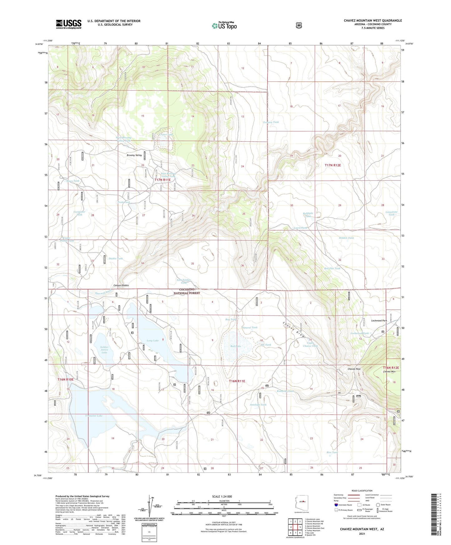
2021 topographic map quadrangle Chavez Mountain West in the state of Arizona. Scale: 1:24000. Based on the newly updated USGS 7.5' US Topo map series, this map is in the following counties: Coconino. The map contains contour data, water features, and other items you are used to seeing on USGS maps, but also has updated roads and other features. This is the next generation of topographic maps. Printed on high-quality waterproof paper with UV fade-resistant inks.
Quads adjacent to this one:
West: Jaycox Mountain
Northwest: Kinnikinick Lake
North: Chavez Mountain NW
Northeast: Chavez Mountain NE
East: Chavez Mountain East
Southeast: Quayle Hill
South: Hay Lake
Southwest: Turkey Mountain
This map covers the same area as the classic USGS quad with code o34111g2.
Contains the following named places: Antelope Tank, Antelope Tank Ditch, Ash Tank, Bog Tank, Borrow Tank, Broomy Valley, Bullfight Tank, Carpenter Tank, Chavez Pass, Chavez Well, Crater Lake, Diablo Tank, East Broomy Valley Tank, East Soldier Tank, Hidden Tank, Lewis Tank, Limestone Tank, Lockwood Park, Lockwood Tank, Long Lake, Long Lake North Boat Launch, Long Lake South Boat Launch, Natural Tank, Pratt Tank, Red Flat Tank, Red Lake, Rice Tank, Roadside Tank, Sawmill Wash, Sears Tank, Soldier Annex Dam, Soldier Annex Lake, Soldier Lake, Tommie Tank, Tremaine Lake, Upper Chavez Tank, Upper Diablo Tank, West Broomy Valley Tank