MyTopo
La Tortuga Butte Arizona US Topo Map
Couldn't load pickup availability
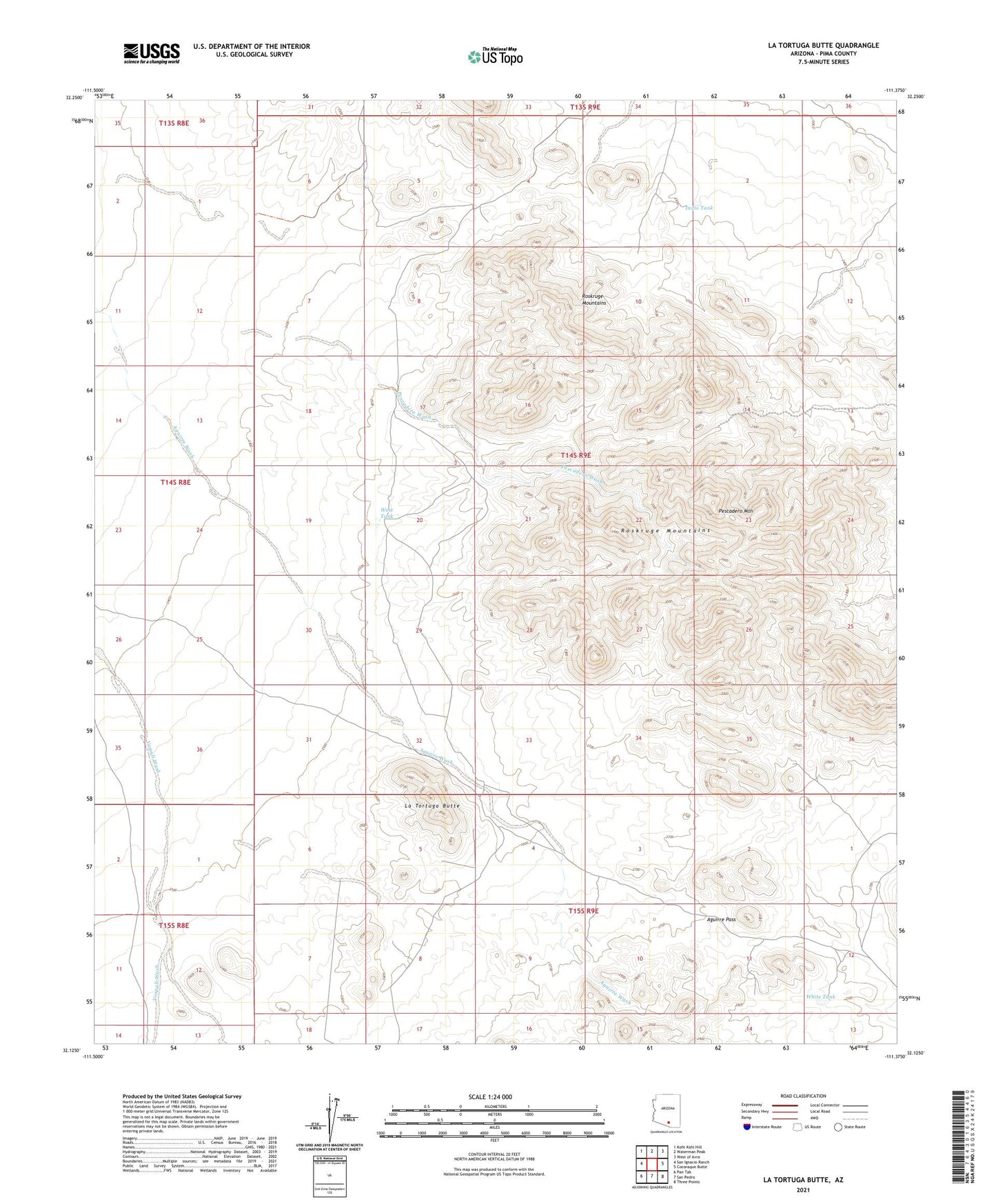
2021 topographic map quadrangle La Tortuga Butte in the state of Arizona. Scale: 1:24000. Based on the newly updated USGS 7.5' US Topo map series, this map is in the following counties: Pima. The map contains contour data, water features, and other items you are used to seeing on USGS maps, but also has updated roads and other features. This is the next generation of topographic maps. Printed on high-quality waterproof paper with UV fade-resistant inks.
Quads adjacent to this one:
West: San Ignacio Ranch
Northwest: Koht Kohl Hill
North: Waterman Peak
Northeast: West of Avra
East: Cocoraque Butte
Southeast: Three Points
South: San Pedro
Southwest: Pan Tak
This map covers the same area as the classic USGS quad with code o32111b4.
Contains the following named places: Aguirre Pass, Indio Tank, La Tortuga Butte, La Tortuga Well, Middle Windmill, Pescadero Mountain, Pescadero Wash, Roskruge Mountains, West Tank, White Tank