MyTopo
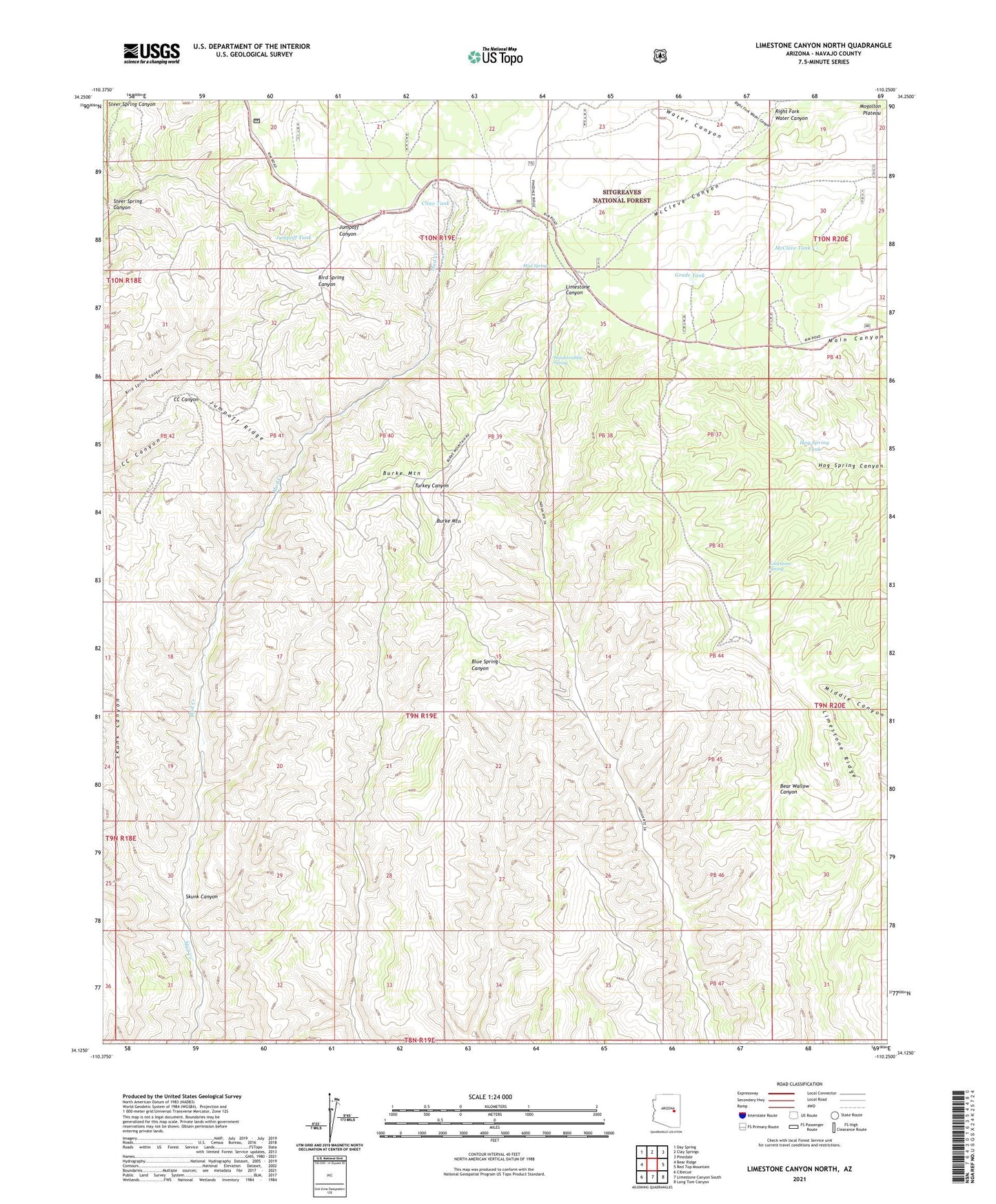
Limestone Canyon North Arizona US Topo Map
Couldn't load pickup availability
Also explore the Limestone Canyon North Forest Service Topo of this same quad for updated USFS data
2021 topographic map quadrangle Limestone Canyon North in the state of Arizona. Scale: 1:24000. Based on the newly updated USGS 7.5' US Topo map series, this map is in the following counties: Navajo. The map contains contour data, water features, and other items you are used to seeing on USGS maps, but also has updated roads and other features. This is the next generation of topographic maps. Printed on high-quality waterproof paper with UV fade-resistant inks.
Quads adjacent to this one:
West: Bear Ridge
Northwest: Day Spring
North: Clay Springs
Northeast: Pinedale
East: Red Top Mountain
Southeast: Long Tom Canyon
South: Limestone Canyon South
Southwest: Cibecue
This map covers the same area as the classic USGS quad with code o34110b3.
Contains the following named places: Burke Mountain, Clino Tank, Fill Tank, Grade Tank, Hardscrabble Spring, Hog Spring Tank, Jumpoff Ridge, Jumpoff Tank, Limestone Fire Station, Limestone Ridge, Limestone Spring, McCleve Tank, Mud Spring, Right Fork Water Canyon, Skunk Canyon, Steer Spring Canyon, ZIP Code: 85911