MyTopo
Long Tom Canyon Arizona US Topo Map
Couldn't load pickup availability
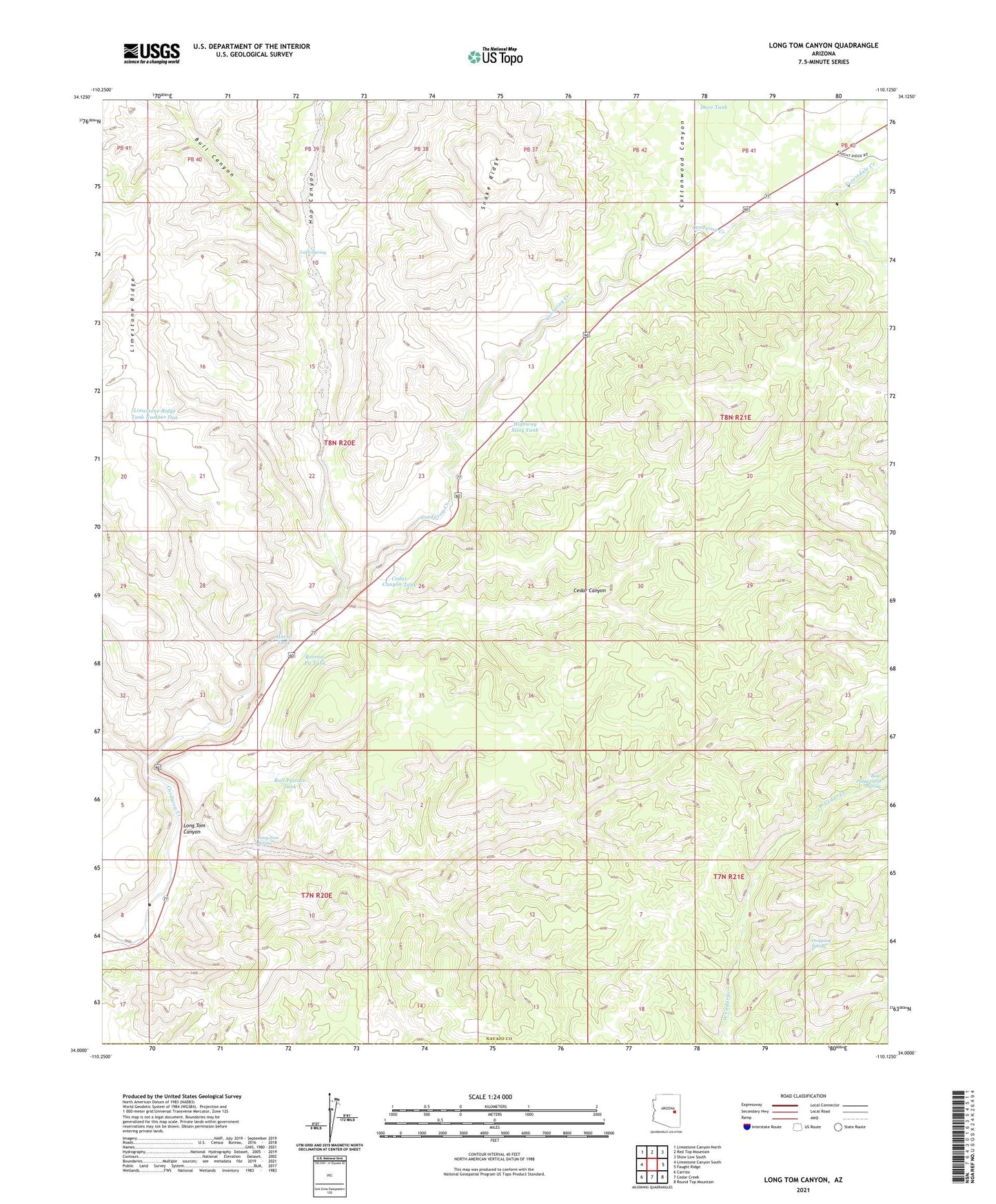
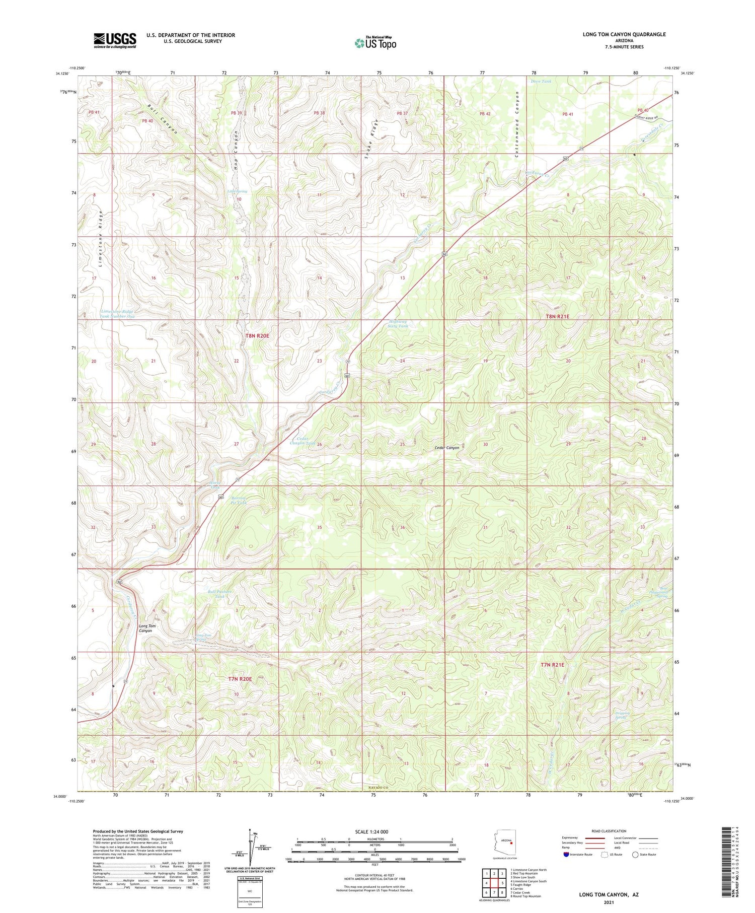
2021 topographic map quadrangle Long Tom Canyon in the state of Arizona. Scale: 1:24000. Based on the newly updated USGS 7.5' US Topo map series, this map is in the following counties: Navajo, Gila. The map contains contour data, water features, and other items you are used to seeing on USGS maps, but also has updated roads and other features. This is the next generation of topographic maps. Printed on high-quality waterproof paper with UV fade-resistant inks.
Quads adjacent to this one:
West: Limestone Canyon South
Northwest: Limestone Canyon North
North: Red Top Mountain
Northeast: Show Low South
East: Faught Ridge
Southeast: Round Top Mountain
South: Cedar Creek
Southwest: Carrizo
This map covers the same area as the classic USGS quad with code o34110a2.
Contains the following named places: Bear Playground Spring, Borrow Pit Tank, Bull Canyon, Bull Pasture Tank, Cedar Canyon, Cedar Canyon Tank, Cottonwood Canyon, Dove Tank, Dripping Spring, Forestdale Creek, Highway Sixty Tank, Hop Canyon, Horse Tank, Limestone Ridge Tank Number One, Little Spring, Long Tom Canyon, Long Tom Spring, Snake Ridge