MyTopo
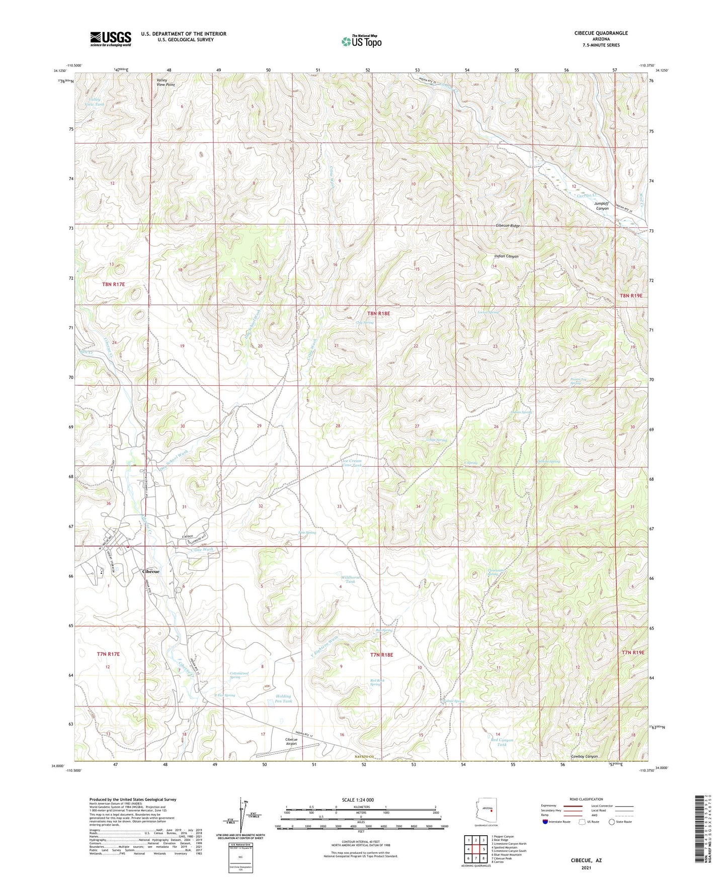
Cibecue Arizona US Topo Map
Couldn't load pickup availability
2021 topographic map quadrangle Cibecue in the state of Arizona. Scale: 1:24000. Based on the newly updated USGS 7.5' US Topo map series, this map is in the following counties: Navajo, Gila. The map contains contour data, water features, and other items you are used to seeing on USGS maps, but also has updated roads and other features. This is the next generation of topographic maps. Printed on high-quality waterproof paper with UV fade-resistant inks.
Quads adjacent to this one:
West: Spotted Mountain
Northwest: Pepper Canyon
North: Bear Ridge
Northeast: Limestone Canyon North
East: Limestone Canyon South
Southeast: Carrizo
South: Cibecue Peak
Southwest: Blue House Mountain
This map covers the same area as the classic USGS quad with code o34110a4.
Contains the following named places: Apache Mission School, Box Spring, Bureau of Indian Affairs Ranger Station, C One Wash, Cibecue, Cibecue Airport, Cibecue Census Designated Place, Cibecue Chapter House, Cibecue Community School, Cibecue Health Center White River Service Unit, Cibecue Trading Post, Clay Spring, Clearwater Spring, Cottonwood Spring, Day School Wash, DeHose Spring, Grape Spring, Holding Pen Tank, Ice Cream Cone Tank, Indian Spring, Jumpoff Canyon, Locust Spring, Mud Creek, N Five Spring, Pine Spring, Poison Ivy Spring, Red Canyon Tank, Red Rock Spring, Salt Creek, V Eighteen Wash, V Spring, Valley View Point, Valley View Tank, Walnut Spring, White Mountain Apache Tribal Fire and Rescue Department Station 820 Cibecue, Wildhorse Tank