MyTopo
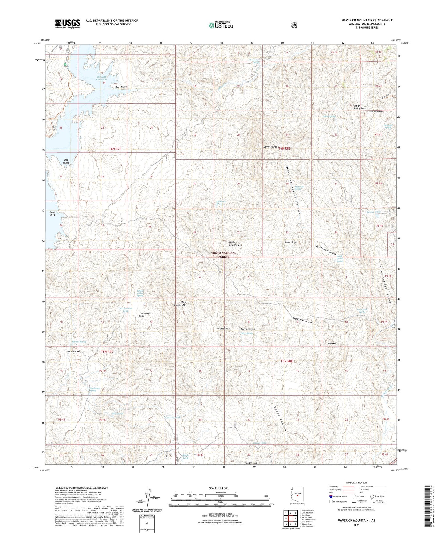
Maverick Mountain Arizona US Topo Map
Couldn't load pickup availability
Also explore the Maverick Mountain Forest Service Topo of this same quad for updated USFS data
2021 topographic map quadrangle Maverick Mountain in the state of Arizona. Scale: 1:24000. Based on the newly updated USGS 7.5' US Topo map series, this map is in the following counties: Maricopa. The map contains contour data, water features, and other items you are used to seeing on USGS maps, but also has updated roads and other features. This is the next generation of topographic maps. Printed on high-quality waterproof paper with UV fade-resistant inks.
Quads adjacent to this one:
West: Bartlett Dam
Northwest: Horseshoe Dam
North: Lion Mountain
Northeast: Reno Pass
East: Boulder Mountain
Southeast: Mine Mountain
South: Adams Mesa
Southwest: Fort McDowell
This map covers the same area as the classic USGS quad with code o33111g5.
Contains the following named places: Alder Creek, Alder Point, Brush Corral Canyon, Brush Corral Spring, Camp Creek, Carlock Tank, Chinatown Spring, Cottonwood Basin, Cottonwood Tank, Diamond Spring, Dos S Ranch, Granite Mountain, Hog Island, Indian Point, Indian Spring, Indian Spring Peak, Indian Springs Canyon, Indian Springs Tank, Little Granite Mountain, Log Corral Canyon, Log Corral Spring, Log Corral Wash, Maverick Mountain, Maverick Mountain Wash, Maverick Spring, Maverick Spring Canyon, Otero Spring, Otero Tank, Panic Rock, Pine Creek, Quartz Tank, Red Mountain, Rock Spring, Round Butte, Round Valley, Ryan Tank, Sandstone Spring, SB Cove Administrative Site, Summit Spring, Sycamore Spring, West Granite Mountain, Yellow Jacket Spring, ZIP Code: 85263