MyTopo
Boulder Mountain Arizona US Topo Map
Couldn't load pickup availability
Also explore the Boulder Mountain Forest Service Topo of this same quad for updated USFS data
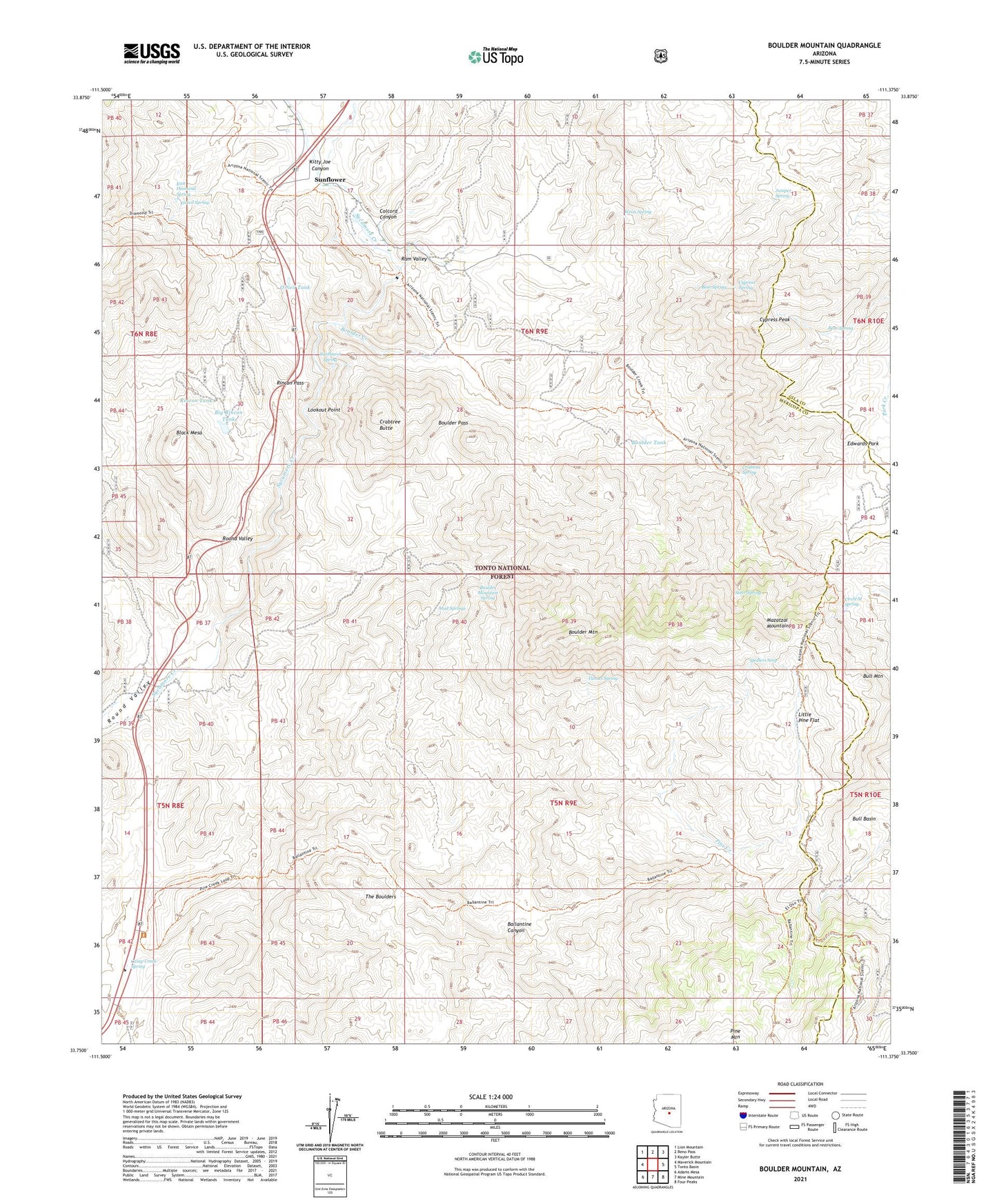
2021 topographic map quadrangle Boulder Mountain in the state of Arizona. Scale: 1:24000. Based on the newly updated USGS 7.5' US Topo map series, this map is in the following counties: Maricopa, Gila. The map contains contour data, water features, and other items you are used to seeing on USGS maps, but also has updated roads and other features. This is the next generation of topographic maps. Printed on high-quality waterproof paper with UV fade-resistant inks.
Quads adjacent to this one:
West: Maverick Mountain
Northwest: Lion Mountain
North: Reno Pass
Northeast: Kayler Butte
East: Tonto Basin
Southeast: Four Peaks
South: Mine Mountain
Southwest: Adams Mesa
This map covers the same area as the classic USGS quad with code o33111g4.
Contains the following named places: Ballantine Canyon, Ballantine Trailhead, Bear Spring, Big Rincon Tank, Black Mesa, Boulder Bobs Cabin, Boulder Creek, Boulder Creek Trail, Boulder Mountain, Boulder Mountain Spring, Boulder Pass, Boulder Tank, Bull Mountain, Bushnell Sheep Tank, Camp Creek Spring, Circle M Spring, Colcord Canyon, Crabtree Butte, Crabtree Spring, Cypress Peak, Cypress Spring, Diamond Mountain, Diamond Ranch, East Diamond Spring, El Oso Mine, Holbrook Ridge, Jolene Mine, Juniper Spring, Kitty Joe Canyon, Little Pine Flat, Lookout Point, Medlers Seep, Mud Springs, O'Neil Spring, O'Neil Tank, Pine Mountain Trail, Pipeline Trail, Ram Valley, Rincon Pass, Rincon Tank, Rock Tank, Steer Spring, Sunflower, Sunflower Spring, The Boulders, Tunnel Spring, Weiss Spring