
MyTopo
Meteor Crater Arizona US Topo Map
Couldn't load pickup availability
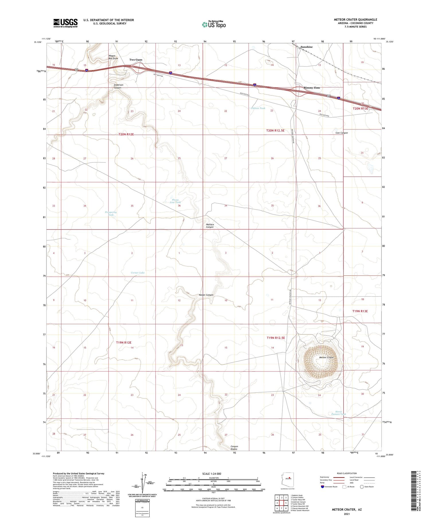
2021 topographic map quadrangle Meteor Crater in the state of Arizona. Scale: 1:24000. Based on the newly updated USGS 7.5' US Topo map series, this map is in the following counties: Coconino. The map contains contour data, water features, and other items you are used to seeing on USGS maps, but also has updated roads and other features. This is the next generation of topographic maps. Printed on high-quality waterproof paper with UV fade-resistant inks.
Quads adjacent to this one:
West: Anderson Canyon
Northwest: Babbitt Wash
North: Canyon Diablo
Northeast: Tucker Mesa NW
East: Tucker Mesa SW
Southeast: West Sunset Mountain
South: Chavez Mountain NE
Southwest: Chavez Mountain NW
This map covers the same area as the classic USGS quad with code o35111a1.
Contains the following named places: Anderson Canyon, Bumpy Road Well, Canyon Diablo Dam, Canyon Diablo Reservoir, Canyon Diablo Well, Chilson Tank, Clounch Well, Corner Lake, Horse Pasture Tank, Meteor Crater, Phone Line Tank, Prosperity Tank, Rimmy Jims, Sunshine, Sunshine Microwave Relay Station, Sunshine Railroad Station, Two Guns, Wagon Box Draw, Wallace Canyon, Yaeger Canyon


