MyTopo
Mexican Water Arizona US Topo Map
Couldn't load pickup availability
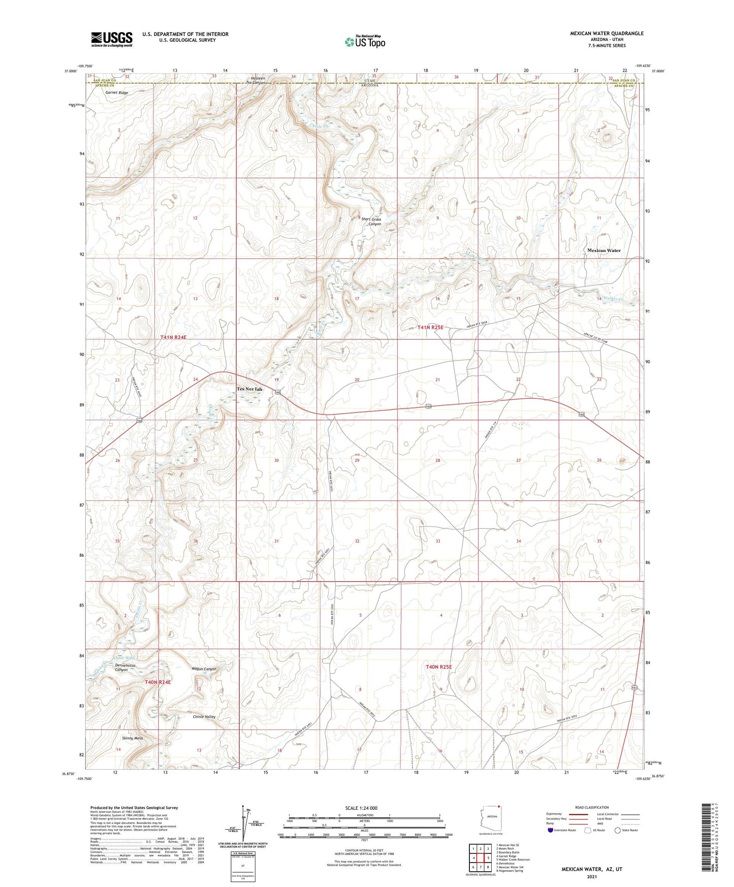
2021 topographic map quadrangle Mexican Water in the states of Arizona, Utah. Scale: 1:24000. Based on the newly updated USGS 7.5' US Topo map series, this map is in the following counties: Apache, San Juan. The map contains contour data, water features, and other items you are used to seeing on USGS maps, but also has updated roads and other features. This is the next generation of topographic maps. Printed on high-quality waterproof paper with UV fade-resistant inks.
Quads adjacent to this one:
West: Garnet Ridge
Northwest: Mexican Hat SE
North: Moses Rock
Northeast: Boundary Butte
East: Walker Creek Reservoir
Southeast: Hogansaani Spring
South: Mexican Water SW
Southwest: Dennehotso
Contains the following named places: Chinle Wash, Dennehotso Canyon, Garnet Ridge, Greyhouse Well, Hosteen Tso Canyon, Laguna Creek, Mexican Water, Short Grass Canyon, Tes Nez Iah, Wagon Canyon, Walker Creek