MyTopo
Walker Creek Reservoir Arizona US Topo Map
Couldn't load pickup availability
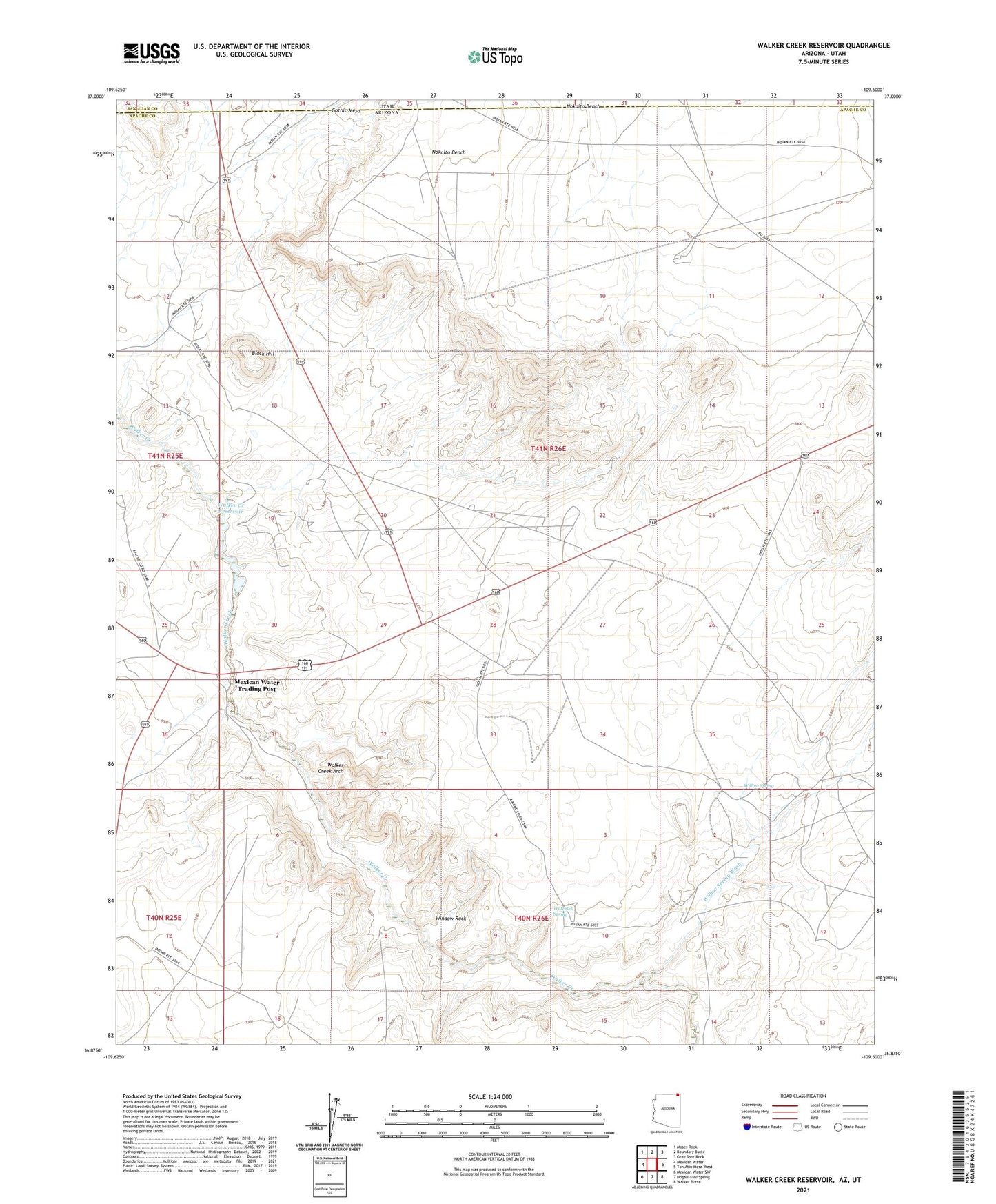
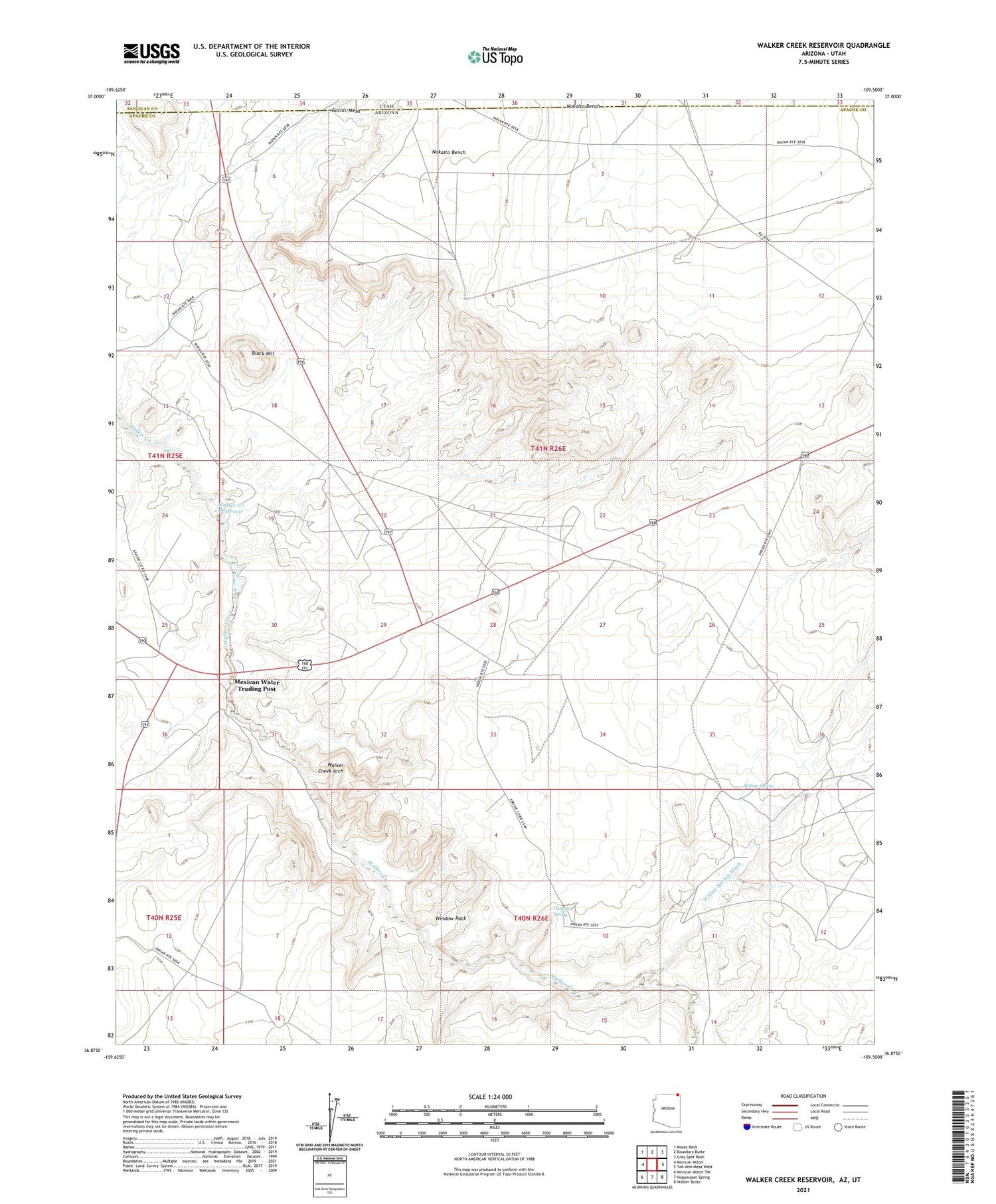
2021 topographic map quadrangle Walker Creek Reservoir in the state of Arizona. Scale: 1:24000. Based on the newly updated USGS 7.5' US Topo map series, this map is in the following counties: Apache, San Juan. The map contains contour data, water features, and other items you are used to seeing on USGS maps, but also has updated roads and other features. This is the next generation of topographic maps. Printed on high-quality waterproof paper with UV fade-resistant inks.
Quads adjacent to this one:
West: Mexican Water
Northwest: Moses Rock
North: Boundary Butte
Northeast: Gray Spot Rock
East: Toh Atin Mesa West
Southeast: Walker Butte
South: Hogansaani Spring
Southwest: Mexican Water SW
Contains the following named places: Black Hill, Gothic Mesa, Mexican Water Recreation Area, Mexican Water Trading Post, Nokaito Bench, Walker Creek Arch, Walker Creek Reservoir, Waterfall Spring, Willow Spring, Willow Spring Wash, Window Rock