MyTopo
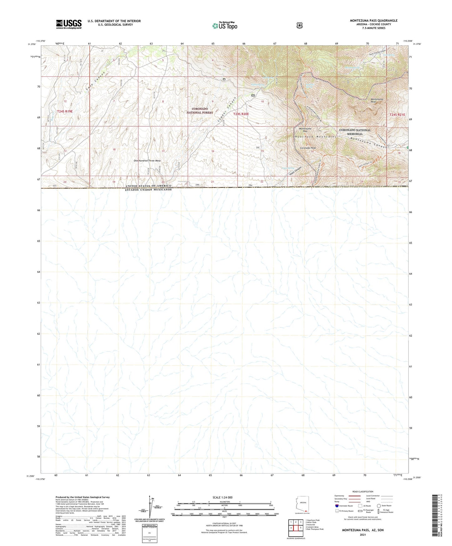
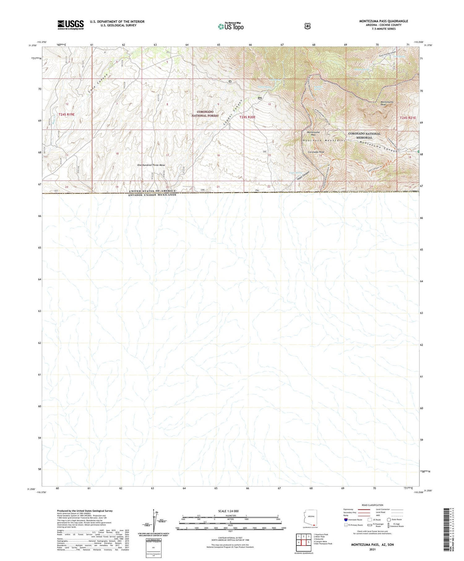
Montezuma Pass Arizona US Topo Map
Couldn't load pickup availability
Also explore the Montezuma Pass Forest Service Topo of this same quad for updated USFS data
2021 topographic map quadrangle Montezuma Pass in the state of Arizona. Scale: 1:24000. Based on the newly updated USGS 7.5' US Topo map series, this map is in the following counties: Cochise. The map contains contour data, water features, and other items you are used to seeing on USGS maps, but also has updated roads and other features. This is the next generation of topographic maps. Printed on high-quality waterproof paper with UV fade-resistant inks.
Quads adjacent to this one:
West: Campini Mesa
Northwest: Huachuca Peak
North: Miller Peak
Northeast: Nicksville
East: Bob Thompson Peak
This map covers the same area as the classic USGS quad with code o31110c3.
Contains the following named places: Bear Creek, Bob Lucy Corral, Cave Trail, Copper Canyon, Coronado Memorial Headquarters, Coronado National Memorial, Coronado Peak, Coronado Peak Trail, Eighty Spring, Fork Spring, Grubstake Corral, Joaquin Creek, Joes Canyon Trail, Lone Mountain International Airport, Montezuma Pass, Montezuma Pass Trail Head, Montezuma Peak, Morgan Mine, Morgan Spring, Oak Spring, One Hundred Three Mesa, State of Texas Mine, Swallow Spring, Yaqui Canyon, Yaqui Ridge Trail, Yaqui Spring