MyTopo
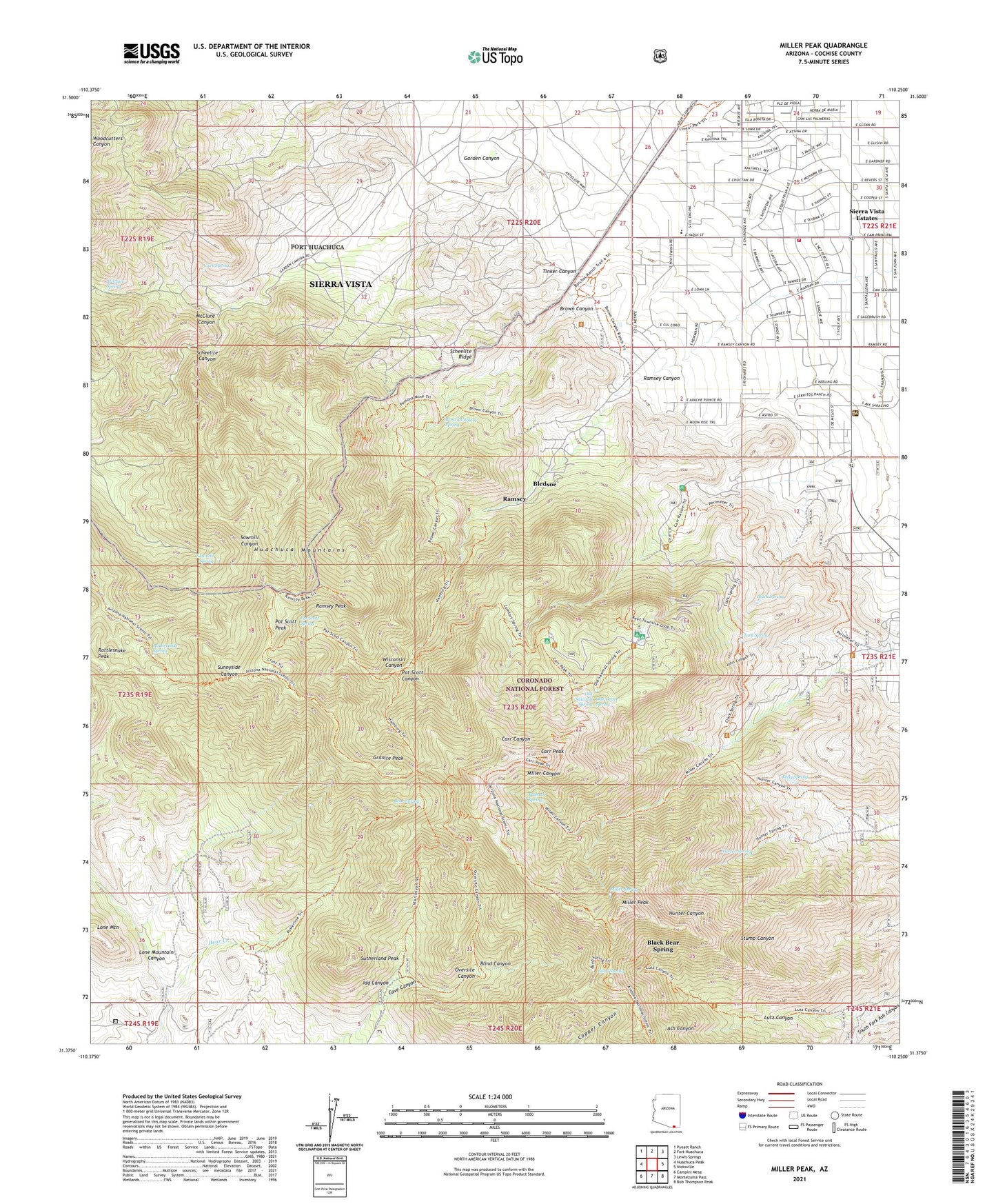
Miller Peak Arizona US Topo Map
Couldn't load pickup availability
Also explore the Miller Peak Forest Service Topo of this same quad for updated USFS data
2021 topographic map quadrangle Miller Peak in the state of Arizona. Scale: 1:24000. Based on the newly updated USGS 7.5' US Topo map series, this map is in the following counties: Cochise. The map contains contour data, water features, and other items you are used to seeing on USGS maps, but also has updated roads and other features. This is the next generation of topographic maps. Printed on high-quality waterproof paper with UV fade-resistant inks.
Quads adjacent to this one:
West: Huachuca Peak
Northwest: Pyeatt Ranch
North: Fort Huachuca
Northeast: Lewis Springs
East: Nicksville
Southeast: Bob Thompson Peak
South: Montezuma Pass
Southwest: Campini Mesa
This map covers the same area as the classic USGS quad with code o31110d3.
Contains the following named places: All Saints Catholic School, Ash Canyon Trail One Hundred Four, Barchas Ranch, Bathtub Spring, Bear Corral, Bear Spring, Bear Springs Trail One Hundred Ten, Black Bear Spring, Black Spring, Bledsoe, Blind Canyon, Bond Spring, Broken Arrow Ranch, Brown Canyon, Brown Canyon Spring, Brown Trailhead, Carr Canyon Administration Site, Carr Canyon Ranch, Carr Peak, Carr Peak - Canyon Loop, Cave Spring, Clark Spring, Clark Spring Trail, Copper Glance Mine, Copper Glance Trail One Hundred Seventeen, Country Estates Southern Baptist Church, Crest Trail Number One Hundred Three, D'Albini Ranch, Faith Presbyterian Church, Fry Fire District Station 2, Garden Canyon, Golden Fleece Mine, Granite Peak, Hamburg Mine, Huachuca Mountains, Hunter Spring, Ida Canyon, Ida Canyon Trailhead, Indianada, KCCA-TV (Sierra Vista), Kelly Spring, Lone Mountain Canyon, Lutz Canyon, Lutz Tunnel, McClure Canyon, McClure Spring, Miller Canyon Perimeter Trailhead, Miller Canyon Recreation Area, Miller Peak, Miller Peak Trail, Miller Peak Wilderness, Miller Spring, Miller Wilderness, Oak Grove Spring, Old Sawmill Spring, Oversite Canyon, Oversite Canyon Trail Head, Oversite Trail One Hundred Twelve, Pat Scott Canyon, Pat Scott Peak, Pat Scott Spring, Pomono Mine, Ramsey, Ramsey Canyon, Ramsey Peak, Ramsey Road Church of Christ, Ramsey Vista Campground, Ramsey Vista Trail Head, Rattlesnake Spring, Reef Campground, Reef Mine, Richards Ranch, Sawmill Spring, Sawmill/Carr Peak Trail Head, Scheelite Canyon, Scheelite Ridge, Sierra Summit Academy, Sierra Vista Estates, Sierra Vista United Korean Church, South Fork Ash Canyon, Sutherland Peak, Tinker Canyon, Wakefield Camp, Wakefield Mine, Wisconsin Canyon