MyTopo
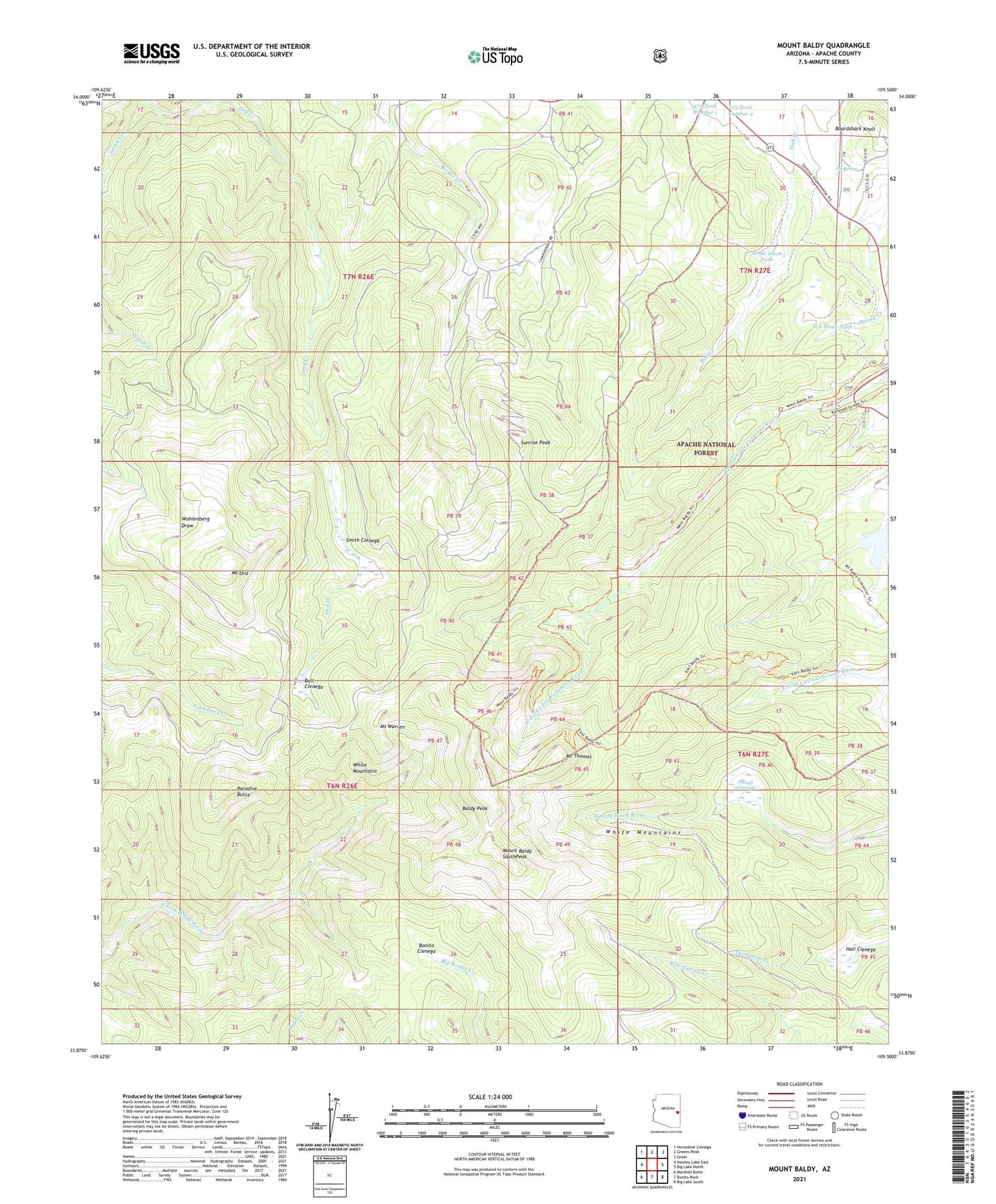
Mount Baldy Arizona US Topo Map
Couldn't load pickup availability
Also explore the Mount Baldy Forest Service Topo of this same quad for updated USFS data
2023 topographic map quadrangle Mount Baldy in the state of Arizona. Scale: 1:24000. Based on the newly updated USGS 7.5' US Topo map series, this map is in the following counties: Apache. The map contains contour data, water features, and other items you are used to seeing on USGS maps, but also has updated roads and other features. This is the next generation of topographic maps. Printed on high-quality waterproof paper with UV fade-resistant inks.
Quads adjacent to this one:
West: Hawley Lake East
Northwest: Horseshoe Cienega
North: Greens Peak
Northeast: Greer
East: Big Lake North
Southeast: Big Lake South
South: Bonito Rock
Southwest: Marshall Butte
This map covers the same area as the classic USGS quad with code o33109h5.
Contains the following named places: 273 Tank Number 1, 273 Tank Number 2, Baldy Peak, Boardshack Knoll, Bonito Cienega, Bull Cienega, Damoff Cabin, Draw Stock Tank, H L Draw Tank, Hall Cienega, Lee Valley Reservoir, Mitt Tank, Mount Baldy, Mount Baldy Wilderness, Mount Ord, Mount Thomas, Mount Warren, Paradise Butte, Pit Spring, Purcell Cienega, Sheep Crossing Campground, Sheep Crossing/Baldy Ninetyfour Trail, Slade Ranch, Smith Cienega, Sunrise Peak, Sunrise Peak Ski Area, Sunrise Ski Lodge, White Mountains