MyTopo
Greer Arizona US Topo Map
Couldn't load pickup availability
Also explore the Greer Forest Service Topo of this same quad for updated USFS data
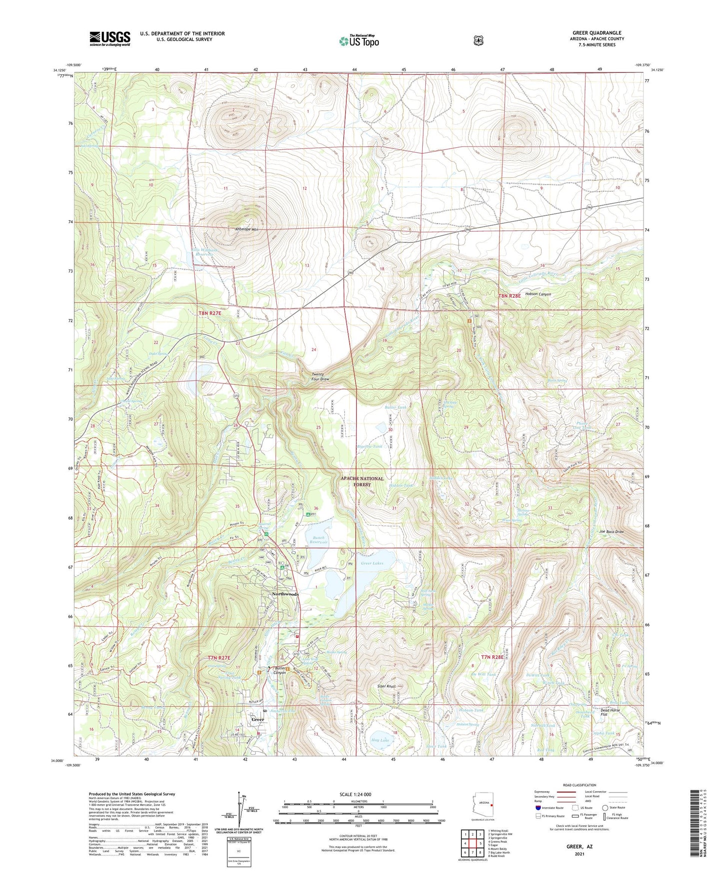
2021 topographic map quadrangle Greer in the state of Arizona. Scale: 1:24000. Based on the newly updated USGS 7.5' US Topo map series, this map is in the following counties: Apache. The map contains contour data, water features, and other items you are used to seeing on USGS maps, but also has updated roads and other features. This is the next generation of topographic maps. Printed on high-quality waterproof paper with UV fade-resistant inks.
Quads adjacent to this one:
West: Greens Peak
Northwest: Whiting Knoll
North: Springerville NW
Northeast: Springerville
East: Eagar
Southeast: Rudd Knoll
South: Big Lake North
Southwest: Mount Baldy
This map covers the same area as the classic USGS quad with code o34109a4.
Contains the following named places: Alpha Tank, Amberon Flat, Antelope Mountain, Banke Spring, Basin Spring, Benny Creek, Benny Creek Campground, Benny Tank, Beta Tank, Bigelow Tank, Bill Riley Creek, Brian Spring, Bunch Reservoir, Bunch Reservoir Boat Launch, Bunch Reservoir Dam, Butler Canyon, Butler Canyon Spring, Butler Tank, Cheese Spring, Chi Tank, Clay Spring, De Witt Tank, Dead Horse Flat, DeWitt Tank, Duke Spring, Eagar-Springerville Division, East Fork Little Colorado River, Ellis Wiltbank Dam, Ellis Wiltbank Reservoir, Filler Ditch, Fish Creek, Fish Creek Corral, Greer, Greer Campground, Greer Census Designated Place, Greer Fire District Bellinger Fire Station 1, Greer Fire District Leeds Station 2, Greer Forest Service Facility, Greer Lakes, Greer Lakes Campground, Greer Post Office, Half Tank Spring, Hall Creek, Hay Lake, Hidden Lake, Hidden Tank, Hoashead Tank, Hobson Canyon, Hobson Spring, Hobson Tank, Jake Spring, Joe Baca Draw, KTHQ-FM (Eagar), Lang Creek, Lang Creek Tank, Lone Wolf Spring, Luke Spring, Melissa Spring, Mexican Hay Lake Dam, Northwoods, P C Spring, Phone Line Tank, Red Tank, River Reservoir, River Reservoir Dam, River Reservoir Number Three Dam, Rolfe C Hoyer Campground, Rosey Creek, Rosey Creek Campground, Shelter Spring, Sidehill Tank, Sizer Knoll, South Fork Campground, South Fork Little Colorado River, Springerville Ranger District, Spud Patch Tank, Squirrel Spring, Steve Tank, Ted Seep Spring, Trail Spring, Trail Spring Tank, Tunnel Dam, Tunnel Reservoir, Tunnel Reservoir Boat Launch, Twenty Four Draw, West Fork Little Colorado River, Winch Tank, Wonderland Park, ZIP Code: 85927