MyTopo
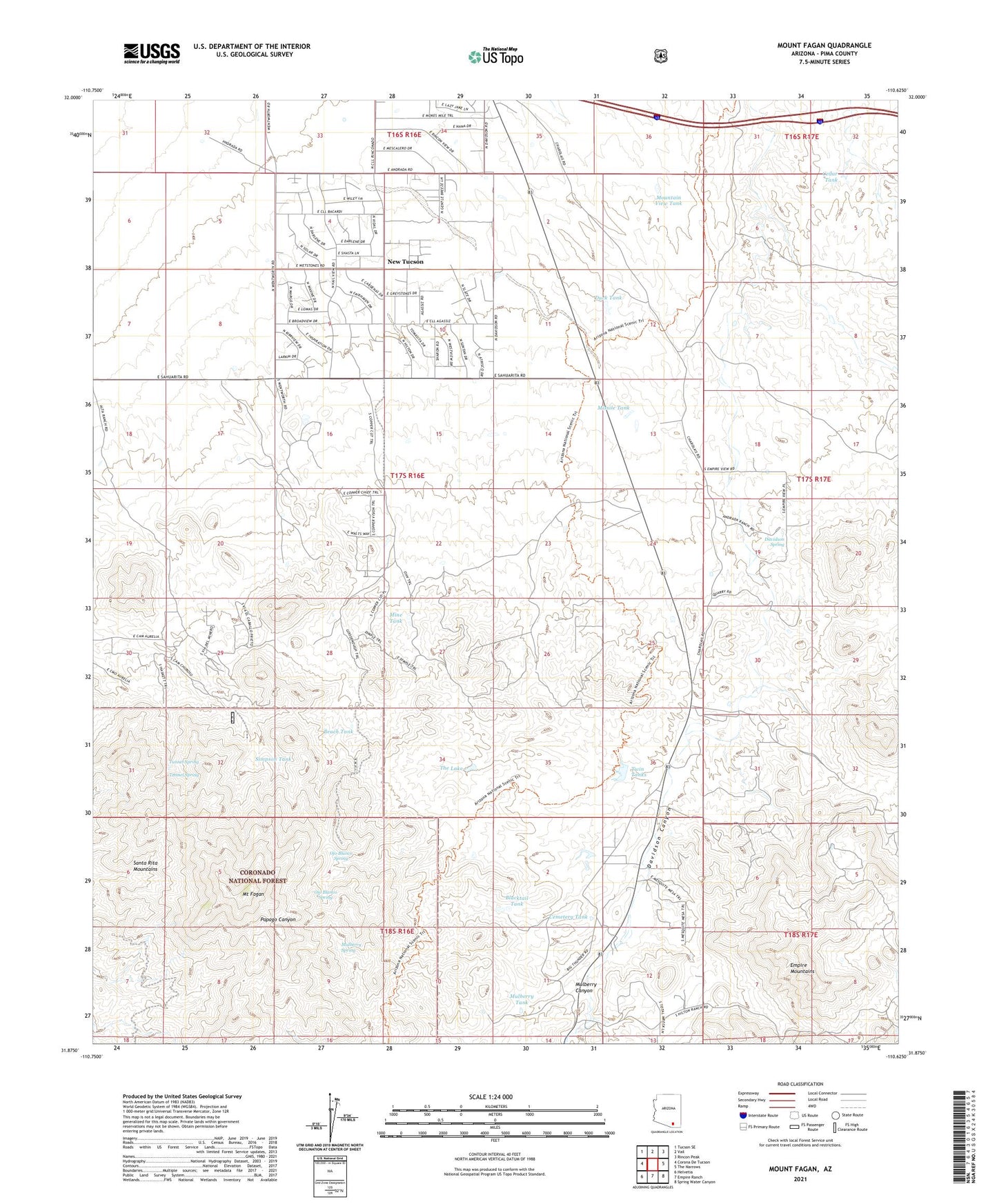
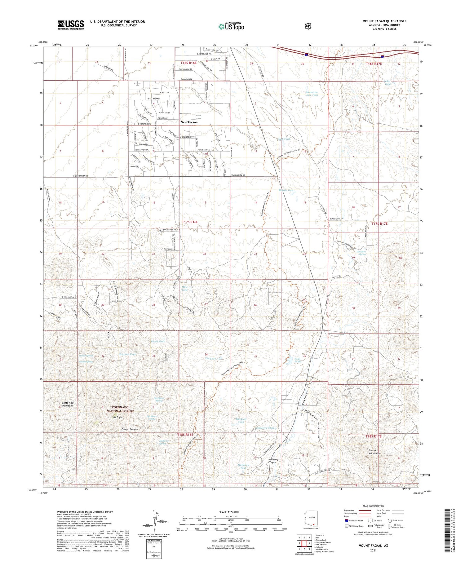
Mount Fagan Arizona US Topo Map
Couldn't load pickup availability
Also explore the Mount Fagan Forest Service Topo of this same quad for updated USFS data
2021 topographic map quadrangle Mount Fagan in the state of Arizona. Scale: 1:24000. Based on the newly updated USGS 7.5' US Topo map series, this map is in the following counties: Pima. The map contains contour data, water features, and other items you are used to seeing on USGS maps, but also has updated roads and other features. This is the next generation of topographic maps. Printed on high-quality waterproof paper with UV fade-resistant inks.
Quads adjacent to this one:
West: Corona De Tucson
Northwest: Tucson SE
North: Vail
Northeast: Rincon Peak
East: The Narrows
Southeast: Spring Water Canyon
South: Empire Ranch
Southwest: Helvetia
This map covers the same area as the classic USGS quad with code o31110h6.
Contains the following named places: Andrada Ranch, Beach Tank, Blacktail Tank, California Mine, Cedar Tank, Cemetery Tank, Cuprite Mine, Davidson Spring, Dimple Mine, Duck Tank, Empire Mountains, Hillton Ranch, Martinez Ranch, Mine Tank, Missile Tank, Mount Fagan, Mountain View Tank, Mulberry Canyon, Mulberry Spring, Mulberry Tank, New Tucson, Ojo Blanco Spring, Pauline Mine, Simpson Tank, The Lake, Tunnel Spring, Twin Tanks