MyTopo
Vail Arizona US Topo Map
Couldn't load pickup availability
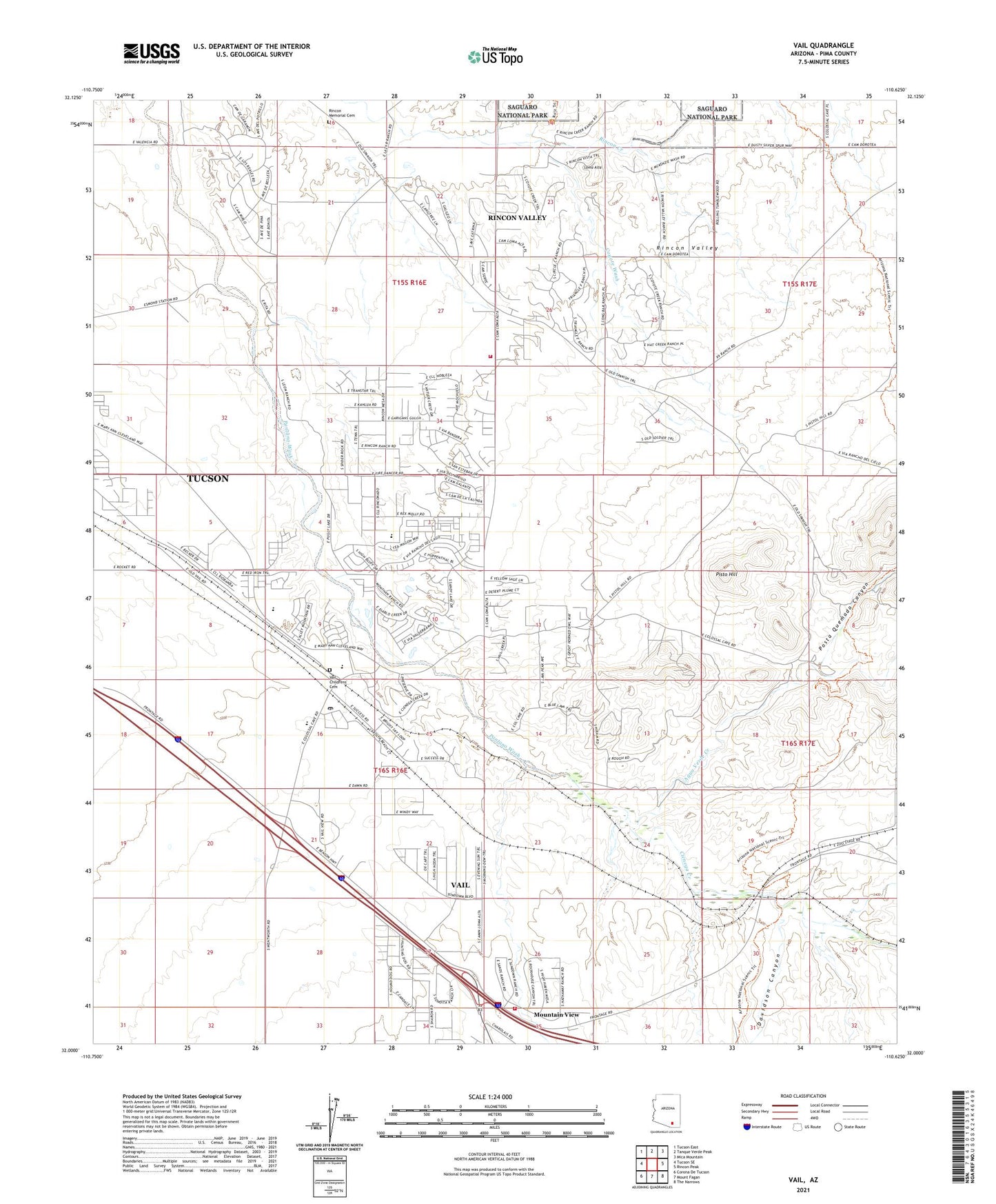
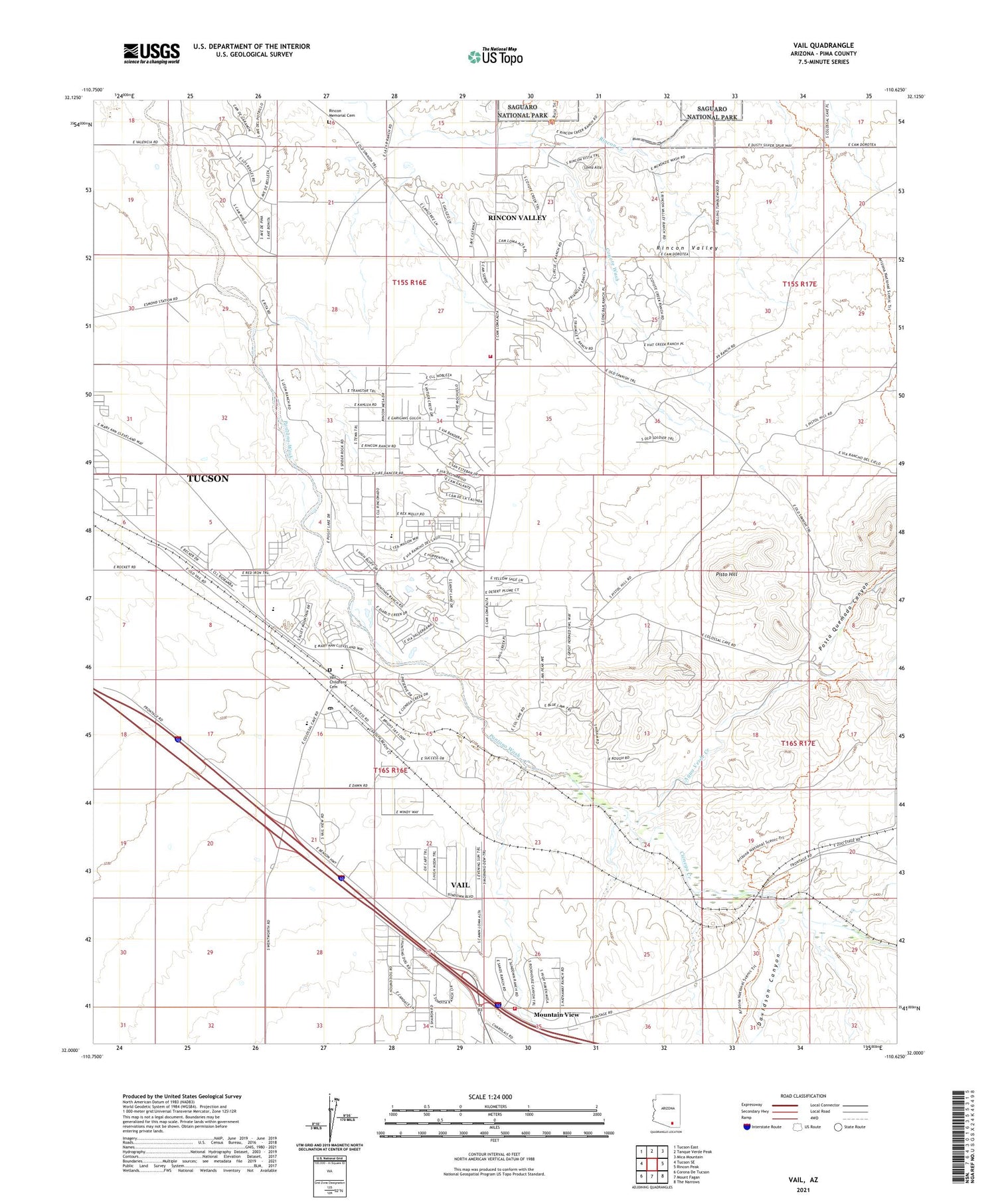
2021 topographic map quadrangle Vail in the state of Arizona. Scale: 1:24000. Based on the newly updated USGS 7.5' US Topo map series, this map is in the following counties: Pima. The map contains contour data, water features, and other items you are used to seeing on USGS maps, but also has updated roads and other features. This is the next generation of topographic maps. Printed on high-quality waterproof paper with UV fade-resistant inks.
Quads adjacent to this one:
West: Tucson SE
Northwest: Tucson East
North: Tanque Verde Peak
Northeast: Mica Mountain
East: Rincon Peak
Southeast: The Narrows
South: Mount Fagan
Southwest: Corona De Tucson
This map covers the same area as the classic USGS quad with code o32110a6.
Contains the following named places: Acacia Elementary School, Agua Verde Creek, Cienega Creek, Cienega High School, Colossal Cave Mountain Park, Coyote Wash, Davidson Canyon, Day Ranch, Del Lago Golf Club, El Bosquecito Picnic Area, Heavy Boy Mine, La Posta Quemada Ranch, Loma Alta, Mountain View, Mountain View Overpass, N Lazy H Ranch, Ocotillo Ridge Elementary School, Old Vail Middle School, Pisto Hill, Posta Quemada Canyon, Rancho del Lago, Rincon Memorial Cemetery, Rincon Sanitorium, Rincon Valley Census Designated Place, Rincon Valley Fire District Station 1, Rocking K Ranch, Rocking K Ranch Estates Dam, Saint Rita in the Desert Church, Santa Rita Shrine, Vail, Vail Census Designated Place, Vail Childrens' Cemetery, Vail Overpass, Vail Post Office