MyTopo
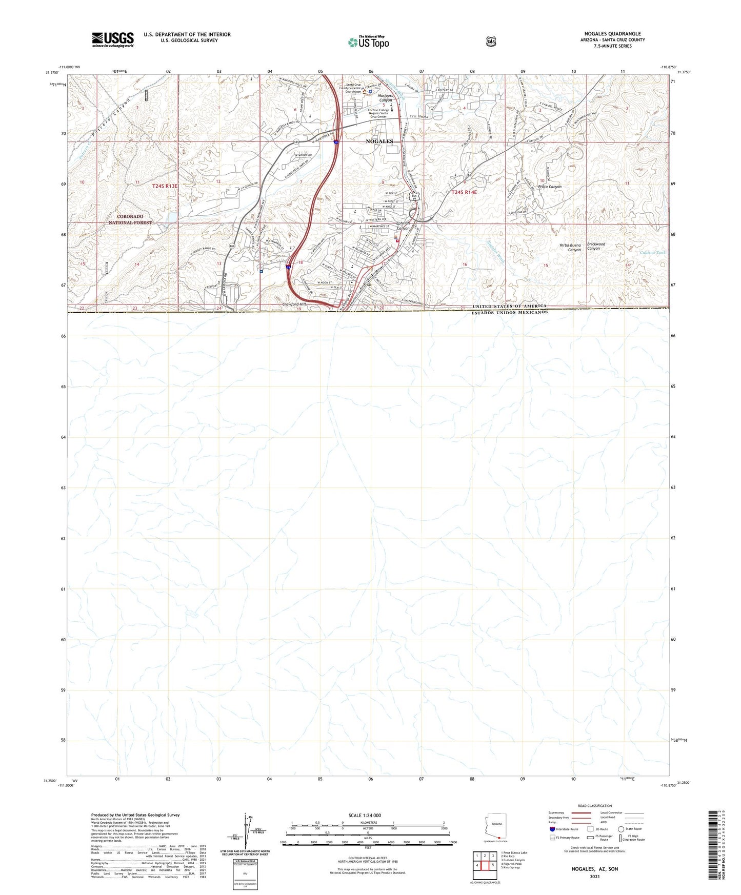
Nogales Arizona US Topo Map
Couldn't load pickup availability
Also explore the Nogales Forest Service Topo of this same quad for updated USFS data
2021 topographic map quadrangle Nogales in the state of Arizona. Scale: 1:24000. Based on the newly updated USGS 7.5' US Topo map series, this map is in the following counties: Santa Cruz. The map contains contour data, water features, and other items you are used to seeing on USGS maps, but also has updated roads and other features. This is the next generation of topographic maps. Printed on high-quality waterproof paper with UV fade-resistant inks.
Quads adjacent to this one:
West: Pajarito Peak
Northwest: Pena Blanca Lake
North: Rio Rico
Northeast: Cumero Canyon
East: Kino Springs
This map covers the same area as the classic USGS quad with code o31110c8.
Contains the following named places: A J Mitchell Elementary School, Abundant Life Assembly of God, Carondelet Holy Cross Hospital, Challenger Elementary School, City of Nogales, Cochise College Nogales Santa Cruz Center, Coronado Elementary School, Crawford Hill, El Mesias United Methodist Church, Elm Street School, Emmanuel Baptist Church, Ephriah Canyon, First Baptist Church of Nogales, Ione Marcus Gordon Memorial Park, KFBR-AM (Nogales), Kingdom Hall of Jehovahs Witnesses Spanish Congregation, Kino Park, Lincoln Elementary School, Lourdes Catholic School, Mariposa Canyon, Mariposa Land Port of Entry, Mary L Welty Elementary School, Mexicayotl Academy, Nasib Karam Park, Nogales, Nogales City Hall, Nogales District Ranger Office, Nogales Fire Department Station 1, Nogales High School, Nogales Police Department, Nogales Post Office, Pierson Vocational High School, Pinnacle Charter High School, Sacred Heart Catholic School, Sacred Heart Church, Santa Cruz County Sheriff's Office, Wade Carpenter Middle School