MyTopo
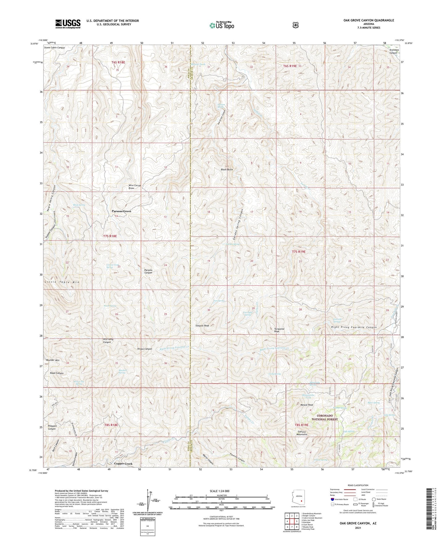
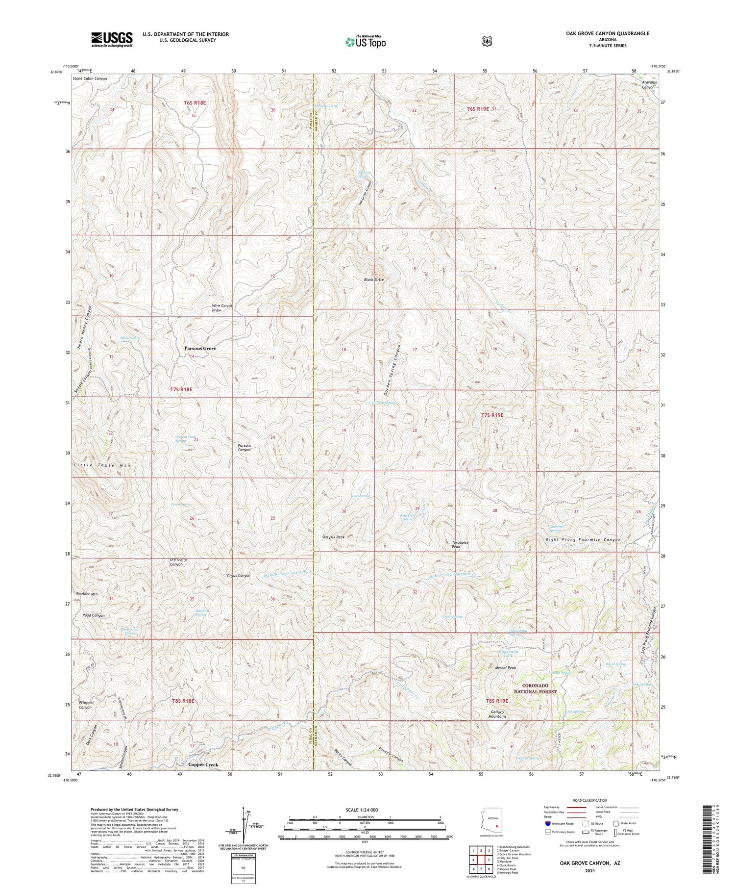
Oak Grove Canyon Arizona US Topo Map
Couldn't load pickup availability
Also explore the Oak Grove Canyon Forest Service Topo of this same quad for updated USFS data
2021 topographic map quadrangle Oak Grove Canyon in the state of Arizona. Scale: 1:24000. Based on the newly updated USGS 7.5' US Topo map series, this map is in the following counties: Graham, Pinal. The map contains contour data, water features, and other items you are used to seeing on USGS maps, but also has updated roads and other features. This is the next generation of topographic maps. Printed on high-quality waterproof paper with UV fade-resistant inks.
Quads adjacent to this one:
West: Holy Joe Peak
Northwest: Brandenburg Mountain
North: Booger Canyon
Northeast: Cobre Grande Mountain
East: Klondyke
Southeast: Kennedy Peak
South: Rhodes Peak
Southwest: Clark Ranch
This map covers the same area as the classic USGS quad with code o32110g4.
Contains the following named places: Bitter Spring, Black Butte, Bleak Spring, Bluebird Mine, Bluebird Spring, Brown Jug Spring, Cement Tank Spring, Childs and Altwilkle Mine, Cooly Spring, Copper Creek, Copper Prince Mine, Don Jose Corral, Fourmile Ranch, Fourmile Springs, Garden Spring, Garden Spring Canyon, Glory Hole Mine, Hanks Corral, Ison Spring, Jackson Spring, Left Prong Fourmile Canyon, Lime Camp, Little Table Mountain, Manzanita Spring, Manzanita Tank, Marics Canyon, Mescal Peak, Mescal Tank, Negro Henry Canyon, Oak Grove Canyon, Oak Spring, Oak Spring Tank, Parsons Grove, Peach Spring, Pipeline Canyon, Reliable Mine, Right Prong Fourmile Canyon, Right Prong Fourmile Creek, Saddle Canyon, Saloon Canyon, Sixtysix Peak, Soda Spring, Sycamore Canyon, Table Mountain Mine, The Hendrickson, Turquoise Peak, Van Dyke Spring, Walnut Spring, Willow Spring, Wire Corral