MyTopo
Rhodes Peak Arizona US Topo Map
Couldn't load pickup availability
Also explore the Rhodes Peak Forest Service Topo of this same quad for updated USFS data
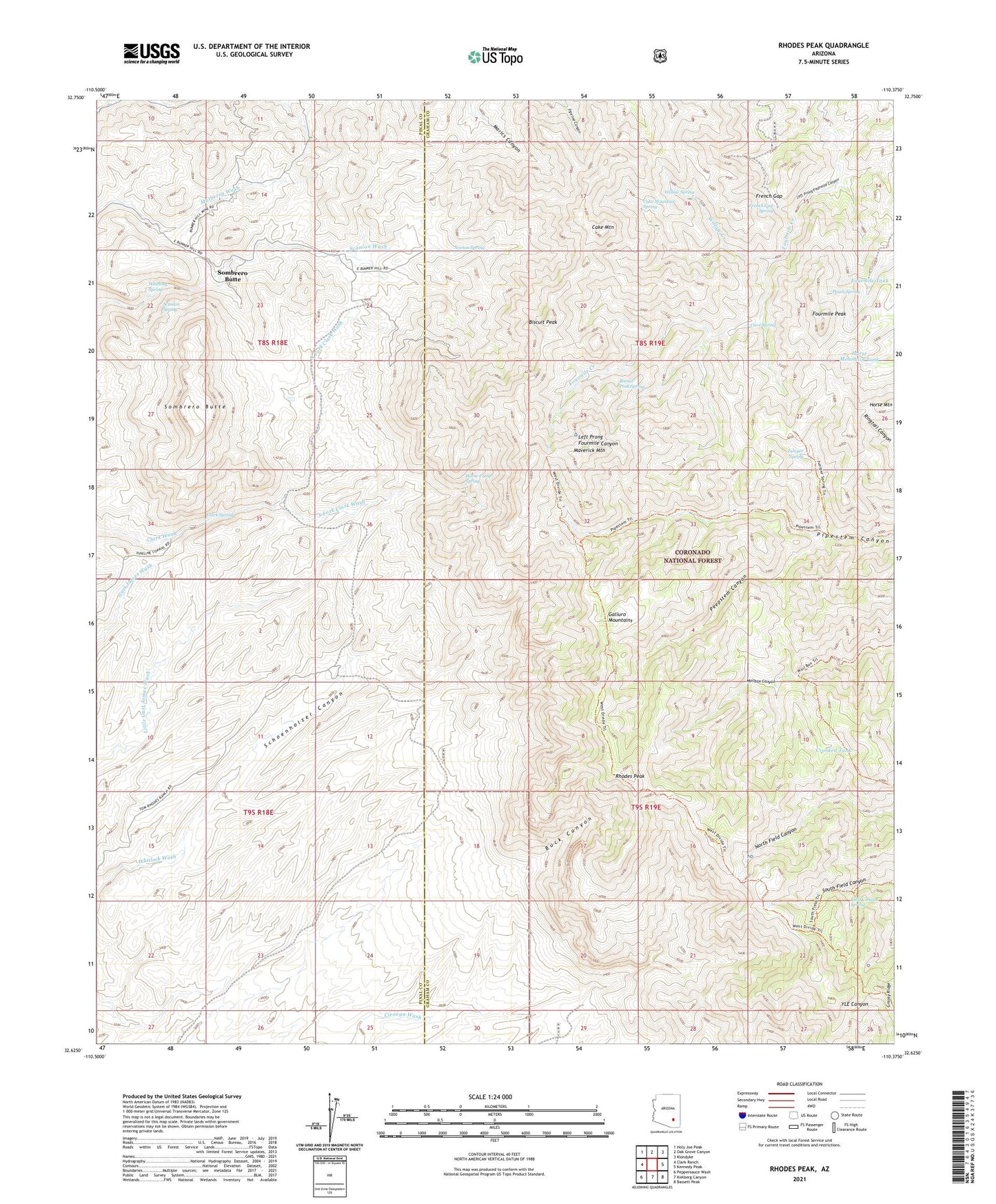
2021 topographic map quadrangle Rhodes Peak in the state of Arizona. Scale: 1:24000. Based on the newly updated USGS 7.5' US Topo map series, this map is in the following counties: Graham, Pinal. The map contains contour data, water features, and other items you are used to seeing on USGS maps, but also has updated roads and other features. This is the next generation of topographic maps. Printed on high-quality waterproof paper with UV fade-resistant inks.
Quads adjacent to this one:
West: Clark Ranch
Northwest: Holy Joe Peak
North: Oak Grove Canyon
Northeast: Klondyke
East: Kennedy Peak
Southeast: Bassett Peak
South: Kielberg Canyon
Southwest: Peppersauce Wash
This map covers the same area as the classic USGS quad with code o32110f4.
Contains the following named places: Biscuit Peak, Biscuit Peak Spring, Buck Canyon, Bunker Hill Mine, Cake Mountain, Cake Mountain Spring, Cave Spring, Clark Spring, Coffee Tank, Coffee Tank Dam, Crooked Tank, Dark Canyon, Field Canyon Spring, Fourmile Peak, Fourmile Tank, French Gap, French Gap Spring, Horse Camp Spring, Horse Mountain Tank, Juniper Spring, Magna Mine, Mailbox Tank Dam, Mailbox Well, Maverick Mountain, Maverick North Fork Dam, Maverick Tank, Mercer Ranch, North Fork Clark Wash, Norton Spring, Peach Spring, Peepstem Canyon, Rhodes Peak, Rhodes Ranch, Scanlon Spring, Schoenholzer Canyon, Sombrero Butte, South Canyon Tank, South Field Canyon Tank, South Fork Clark Wash, Upper Pipestem Dam, Whitting Spring, Willow Creek, Willow Spring