MyTopo
Page Springs Arizona US Topo Map
Couldn't load pickup availability
Also explore the Page Springs Forest Service Topo of this same quad for updated USFS data
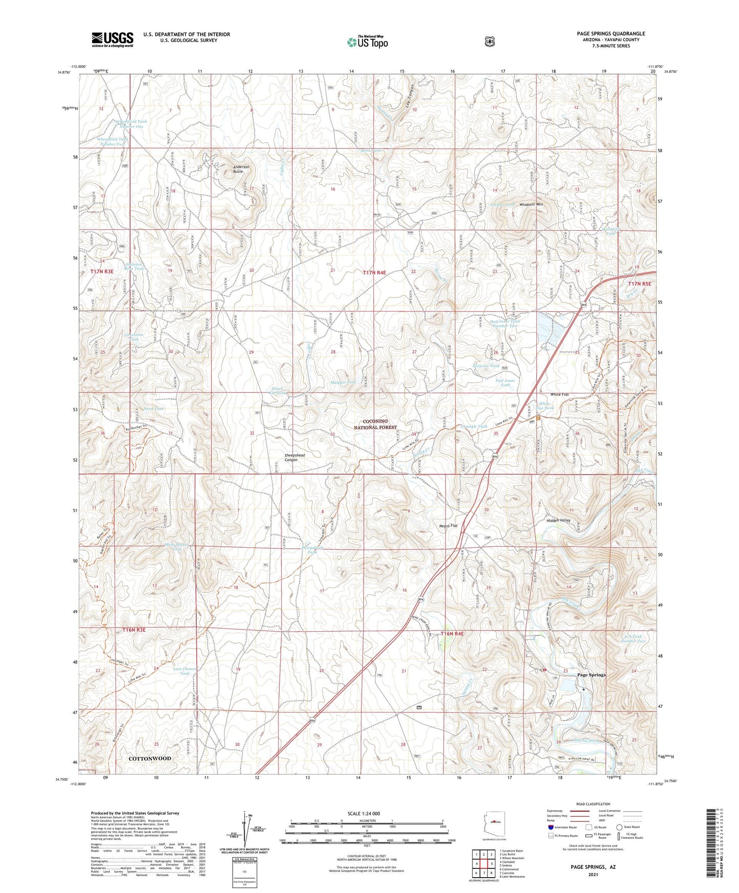
2021 topographic map quadrangle Page Springs in the state of Arizona. Scale: 1:24000. Based on the newly updated USGS 7.5' US Topo map series, this map is in the following counties: Yavapai. The map contains contour data, water features, and other items you are used to seeing on USGS maps, but also has updated roads and other features. This is the next generation of topographic maps. Printed on high-quality waterproof paper with UV fade-resistant inks.
Quads adjacent to this one:
West: Clarkdale
Northwest: Sycamore Basin
North: Loy Butte
Northeast: Wilson Mountain
East: Sedona
Southeast: Lake Montezuma
South: Cornville
Southwest: Cottonwood
This map covers the same area as the classic USGS quad with code o34111g8.
Contains the following named places: Anderson Butte, Anderson Tank, Box Tank, Coffee Creek, D A Tank Number Two, Dad Jones Tank, Dad Jones Tank Number Two, Deer Pass Ranch, Dry Creek, Dutch Kid Tank, Evans Tank, Hidden Valley, Jackass Tank, Juniper Tank, Last Chance Tank, Limestone Tank, Loy Canyon, Malpais Tank, Mesa Blanco Tank, Mesa Tank, Need Tank, Negro Flat, Oak Creek Ranch School, Page Springs, Page Springs State Fish Cultural Station, Sedona Venture Wastewater Treatment Plant, Sheepshead Tank, Skeleton Bone Tank, Spider Tank, Spring Ditch, Surprise Tank, Triangle Tank, Verde Valley Fire District Page Springs Fire Station 33, Wheatfield Tank Number One, Wheatfield Tank Number Two, White Flat, White Flat Tank, Windmill Mountain, Windmill Ranch, Windmill Tank