MyTopo
Palm Canyon Arizona US Topo Map
Couldn't load pickup availability
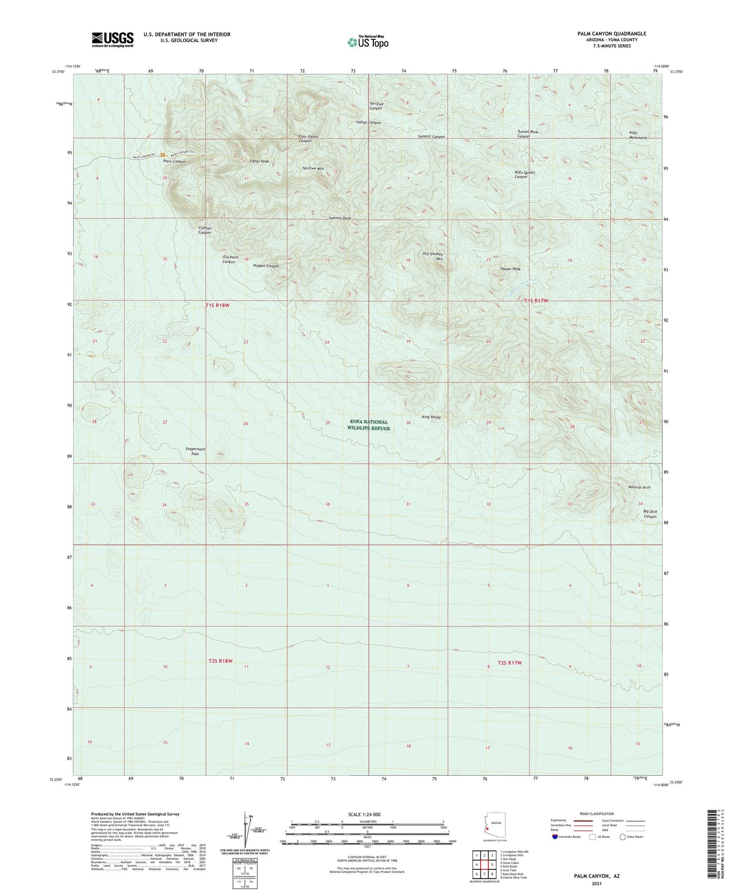
2023 topographic map quadrangle Palm Canyon in the state of Arizona. Scale: 1:24000. Based on the newly updated USGS 7.5' US Topo map series, this map is in the following counties: Yuma. The map contains contour data, water features, and other items you are used to seeing on USGS maps, but also has updated roads and other features. This is the next generation of topographic maps. Printed on high-quality waterproof paper with UV fade-resistant inks.
Quads adjacent to this one:
West: Stone Cabin
Northwest: Livingston Hills NW
North: Livingston Hills
Northeast: Owl Head
East: Kofa Butte
Southeast: Charlie Died Tank
South: Kofa Deep Well
Southwest: Arch Tank
This map covers the same area as the classic USGS quad with code o33114c1.
Contains the following named places: Big Dick Canyon, Fishtail Canyon, Hidden Canyon, Indian Canyon, Kofa Game Range, Kofa Queen Mine, Natural Arch, Old Palm Canyon, Old Smokey Mountain, Palm Canyon, Signal Peak, Squaw Peak, Squaw Tanks, Stagecoach Pass, Summit Canyon, Summit Peak, Ten Ewe Canyon, Ten Ewe Mountain