MyTopo
Owl Head Arizona US Topo Map
Couldn't load pickup availability
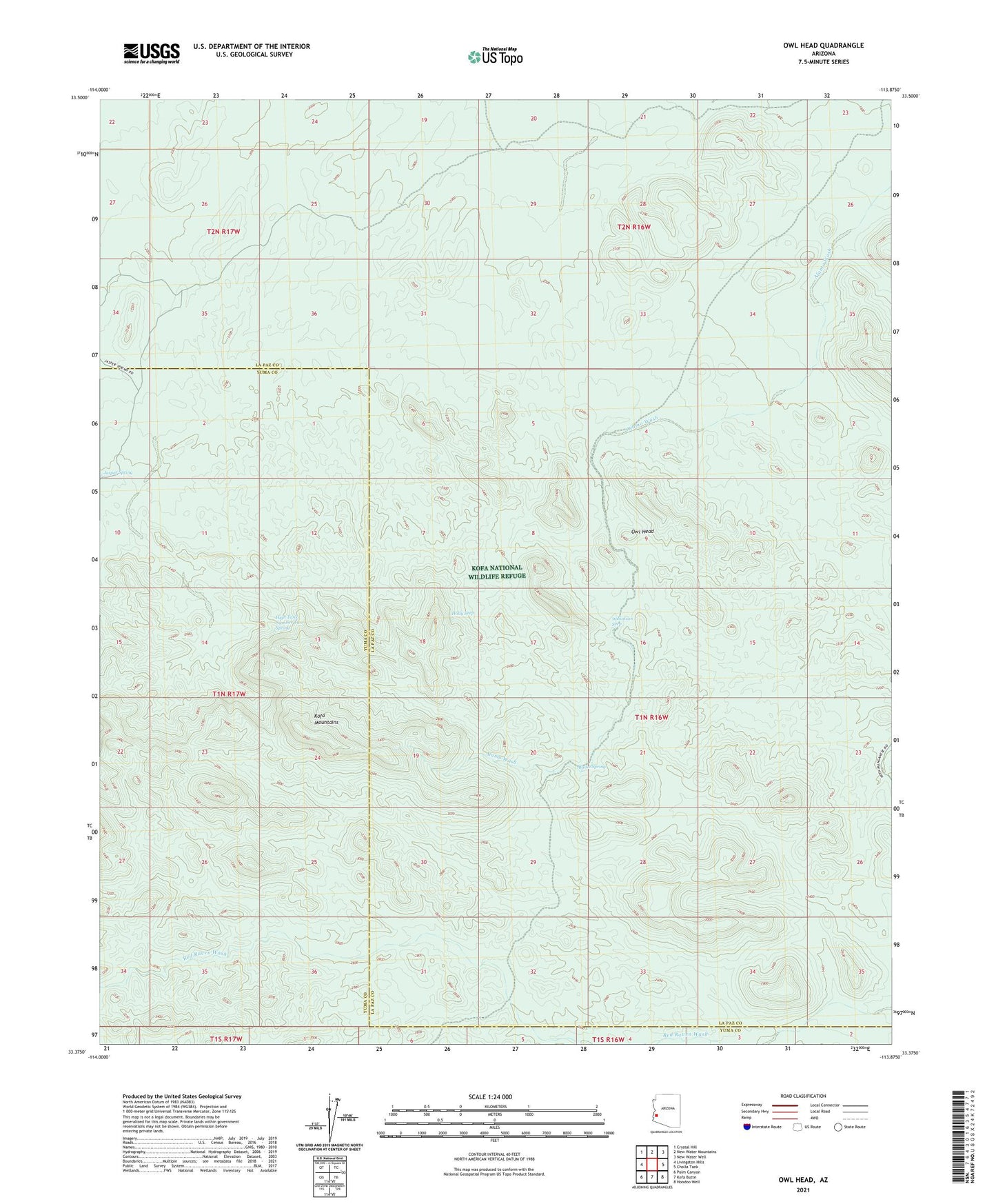
2021 topographic map quadrangle Owl Head in the state of Arizona. Scale: 1:24000. Based on the newly updated USGS 7.5' US Topo map series, this map is in the following counties: La Paz, Yuma. The map contains contour data, water features, and other items you are used to seeing on USGS maps, but also has updated roads and other features. This is the next generation of topographic maps. Printed on high-quality waterproof paper with UV fade-resistant inks.
Quads adjacent to this one:
West: Livingston Hills
Northwest: Crystal Hill
North: New Water Mountains
Northeast: New Water Well
East: Cholla Tank
Southeast: Hoodoo Well
South: Kofa Butte
Southwest: Palm Canyon
This map covers the same area as the classic USGS quad with code o33113d8.
Contains the following named places: Alamo Mine, Alamo Spring, Four Peaks Dam, Geyser Dam, High Tank Number Two Spring, Holly Seep, Jasper Spring, Kofa Monument, Midas Mine, Ocotillo Mine Group, Old Alamo Mine Camp, Owl Head, Owl Head Dam, Wilkinson Seep