MyTopo
Livingston Hills Arizona US Topo Map
Couldn't load pickup availability
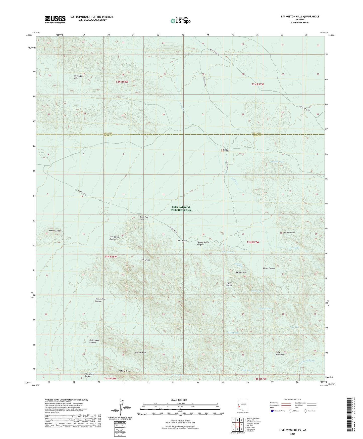
2021 topographic map quadrangle Livingston Hills in the state of Arizona. Scale: 1:24000. Based on the newly updated USGS 7.5' US Topo map series, this map is in the following counties: Yuma, La Paz. The map contains contour data, water features, and other items you are used to seeing on USGS maps, but also has updated roads and other features. This is the next generation of topographic maps. Printed on high-quality waterproof paper with UV fade-resistant inks.
Quads adjacent to this one:
West: Livingston Hills NW
Northwest: South of Quartzsite
North: Crystal Hill
Northeast: New Water Mountains
East: Owl Head
Southeast: Kofa Butte
South: Palm Canyon
Southwest: Stone Cabin
This map covers the same area as the classic USGS quad with code o33114d1.
Contains the following named places: Amuy Mine, Beehive, Beehive Tank, Brass Cap Point, Budweiser Spring, Burro Canyon, Cereus Tank, Cripple Tank, De La Ossa Well, Four Palms Canyon, High Tank, High Tank Nine, High Tank Six, Kofa Queen Canyon, Livingston Hills, Lonesome Peak, Natural Arch, Oak Canyon, Red Hill Tank, Scott Well, Surprise Canyon, Towhee Tank, Tunnel Mine Canyon, Tunnel Spring, Tunnel Spring Canyon, Tunnel Spring Mine, Twin Spires, Twin Spires Canyon