MyTopo
Sunrise Peak Arizona US Topo Map
Couldn't load pickup availability
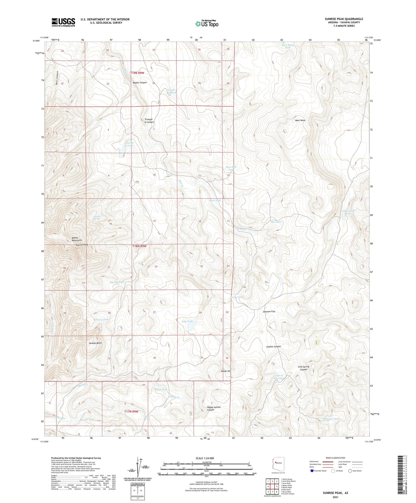
2021 topographic map quadrangle Sunrise Peak in the state of Arizona. Scale: 1:24000. Based on the newly updated USGS 7.5' US Topo map series, this map is in the following counties: Yavapai. The map contains contour data, water features, and other items you are used to seeing on USGS maps, but also has updated roads and other features. This is the next generation of topographic maps. Printed on high-quality waterproof paper with UV fade-resistant inks.
Quads adjacent to this one:
West: Mohon Peak
Northwest: Devils Hump
North: Anvil Rock Ranch
Northeast: Anvil Rock
East: Mount Hope
Southeast: Scratch Canyon
South: Burro Mesa
Southwest: Pilot Knob
This map covers the same area as the classic USGS quad with code o34113h2.
Contains the following named places: Bear Creek Camp, Bear Creek Tank, Big Ikie Tank, Bobs Tank, Brett Tank, Cherry Tree Tank, Cottonwood Tank, Cripple Cat Tank, Encino Tank, Illa Tank, Indian Hill, Jackass Basin, Johnson Flat, Jolly Tank, Jones Tank, Little Cottonwood Tank, Malpais Tank, Moffit Canyon, Oak Tank, Rimrock Tank, Sheep Creek, Sheep Tank, Sunrise Peak, Sunrise Spring, Triangle N Camp, Triangle N Canyon, Triangle N Tank, Walker Tank, Well Number Six, West Mesa, West Mesa Tank, West Split Tank, Wildman Tank