MyTopo
Pima Butte Arizona US Topo Map
Couldn't load pickup availability
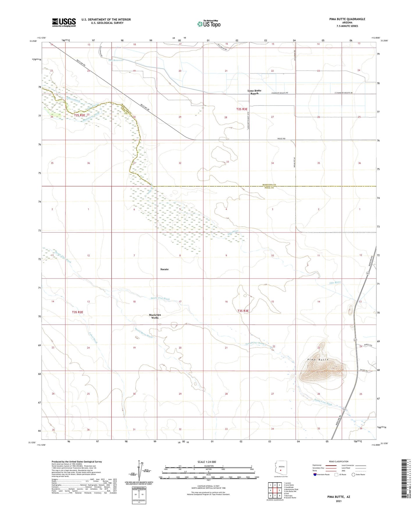
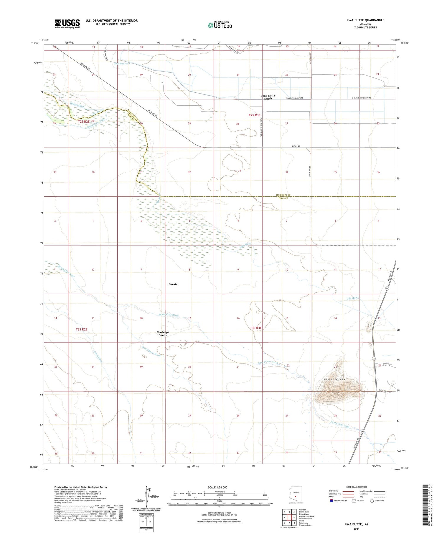
2021 topographic map quadrangle Pima Butte in the state of Arizona. Scale: 1:24000. Based on the newly updated USGS 7.5' US Topo map series, this map is in the following counties: Pinal, Maricopa. The map contains contour data, water features, and other items you are used to seeing on USGS maps, but also has updated roads and other features. This is the next generation of topographic maps. Printed on high-quality waterproof paper with UV fade-resistant inks.
Quads adjacent to this one:
West: Montezuma Peak
Northwest: Laveen
North: Lone Butte
Northeast: Guadalupe
East: Gila Butte NW
Southeast: Sacaton Butte
South: Maricopa
Southwest: Enid
This map covers the same area as the classic USGS quad with code o33112b1.
Contains the following named places: District 6, Dry Reservoir, Lone Butte Ranch, Maricopa Wells, Morgans Ferry, Pima Butte, Sacate