MyTopo
Maricopa Arizona US Topo Map
Couldn't load pickup availability
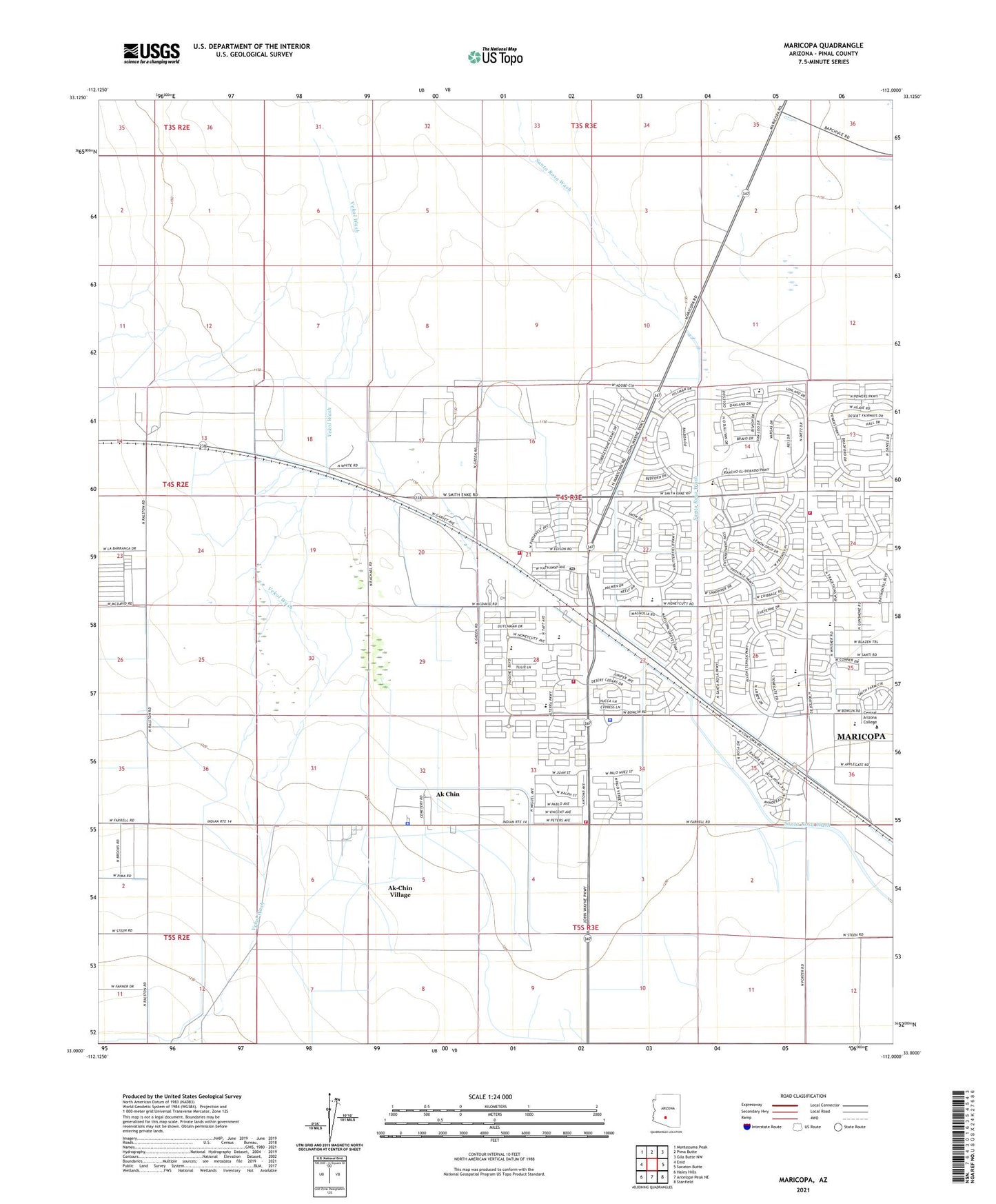
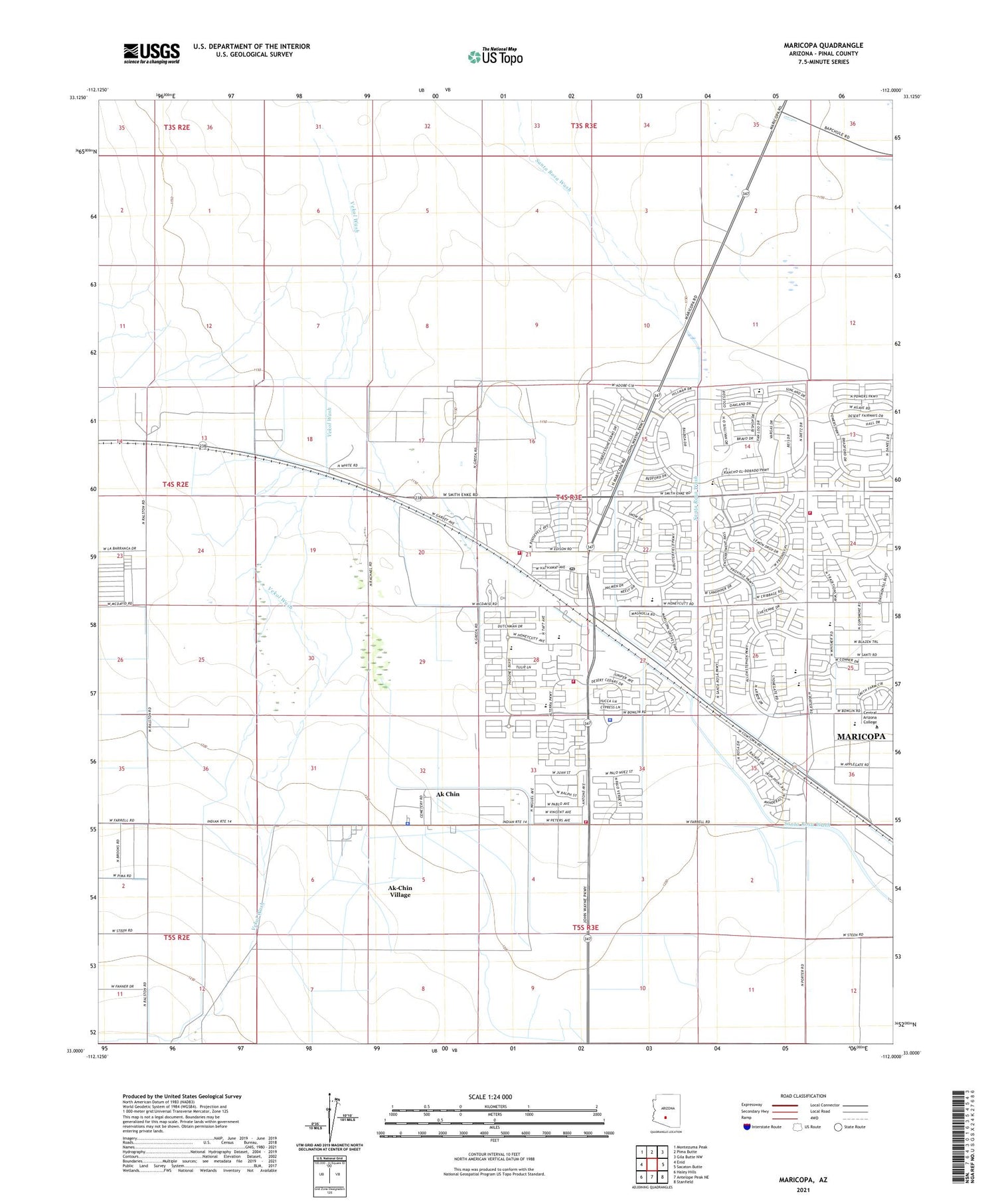
2021 topographic map quadrangle Maricopa in the state of Arizona. Scale: 1:24000. Based on the newly updated USGS 7.5' US Topo map series, this map is in the following counties: Pinal. The map contains contour data, water features, and other items you are used to seeing on USGS maps, but also has updated roads and other features. This is the next generation of topographic maps. Printed on high-quality waterproof paper with UV fade-resistant inks.
Quads adjacent to this one:
West: Enid
Northwest: Montezuma Peak
North: Pima Butte
Northeast: Gila Butte NW
East: Sacaton Butte
Southeast: Stanfield
South: Antelope Peak NE
Southwest: Haley Hills
This map covers the same area as the classic USGS quad with code o33112a1.
Contains the following named places: Ak - Chin Him - Dak Eco Museum, Ak Chin, Ak Chin Community Center, Ak Chin Health Clinic, Ak Chin Indian Community Fire Department, Ak Chin Indian Police Department, Ak-Chin Village, Ak-Chin Village Census Designated Place, Butterfield Elementary School, City of Maricopa, Harrah's Phoenix-Ak-Chin Casino Resort, Hine Airstrip, Legacy Traditional School - Maricopa, Maricopa, Maricopa Assembly of God, Maricopa Community Church, Maricopa Elementary School, Maricopa Fire Department Station 571, Maricopa Fire Department Station 574, Maricopa First Baptist Church, Maricopa High School, Maricopa Indian Reservation, Maricopa Post Office, Maricopa Railroad Station, Maricopa Unified School, Maricopa Wells Middle School, Pima Butte Elementary School, Pinal County Sheriff's Office Maricopa, Pinal Dusters Airstrip, Saddleback Elementary School, Saint Francis Mission, Santa Rosa Elementary School, Southern Dunes Golf Club, The Duke at Rancho El Dorado Golf Course