MyTopo
Point of Pines West Arizona US Topo Map
Couldn't load pickup availability
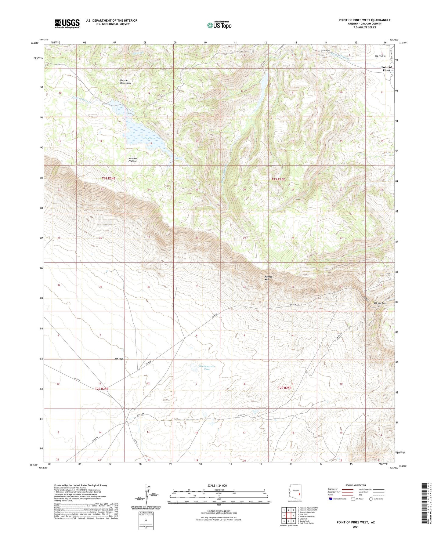
2021 topographic map quadrangle Point of Pines West in the state of Arizona. Scale: 1:24000. Based on the newly updated USGS 7.5' US Topo map series, this map is in the following counties: Graham. The map contains contour data, water features, and other items you are used to seeing on USGS maps, but also has updated roads and other features. This is the next generation of topographic maps. Printed on high-quality waterproof paper with UV fade-resistant inks.
Quads adjacent to this one:
West: Tule Tubs
Northwest: Natanes Mountains NW
North: Natanes Mountains NE
Northeast: Sawbuck Mountain
East: Point of Pines East
Southeast: Park Creek Cabins
South: Bonita Tank
Southwest: Gila Peak
This map covers the same area as the classic USGS quad with code o33109c7.
Contains the following named places: Allan Dam, Arsenic Tubs, Barlow Pass, Bob Tail Dam, Bull Spring Well, Dry Lake, Dry Lake Dam, Dry Lake Lookout, East Tule Well, Headquarters Tank, Nantac Rim, Oak Dam, Point of Pines, Point of Pines Dam, Point of Pines Lake