
MyTopo
Point of Pines East Arizona US Topo Map
Couldn't load pickup availability
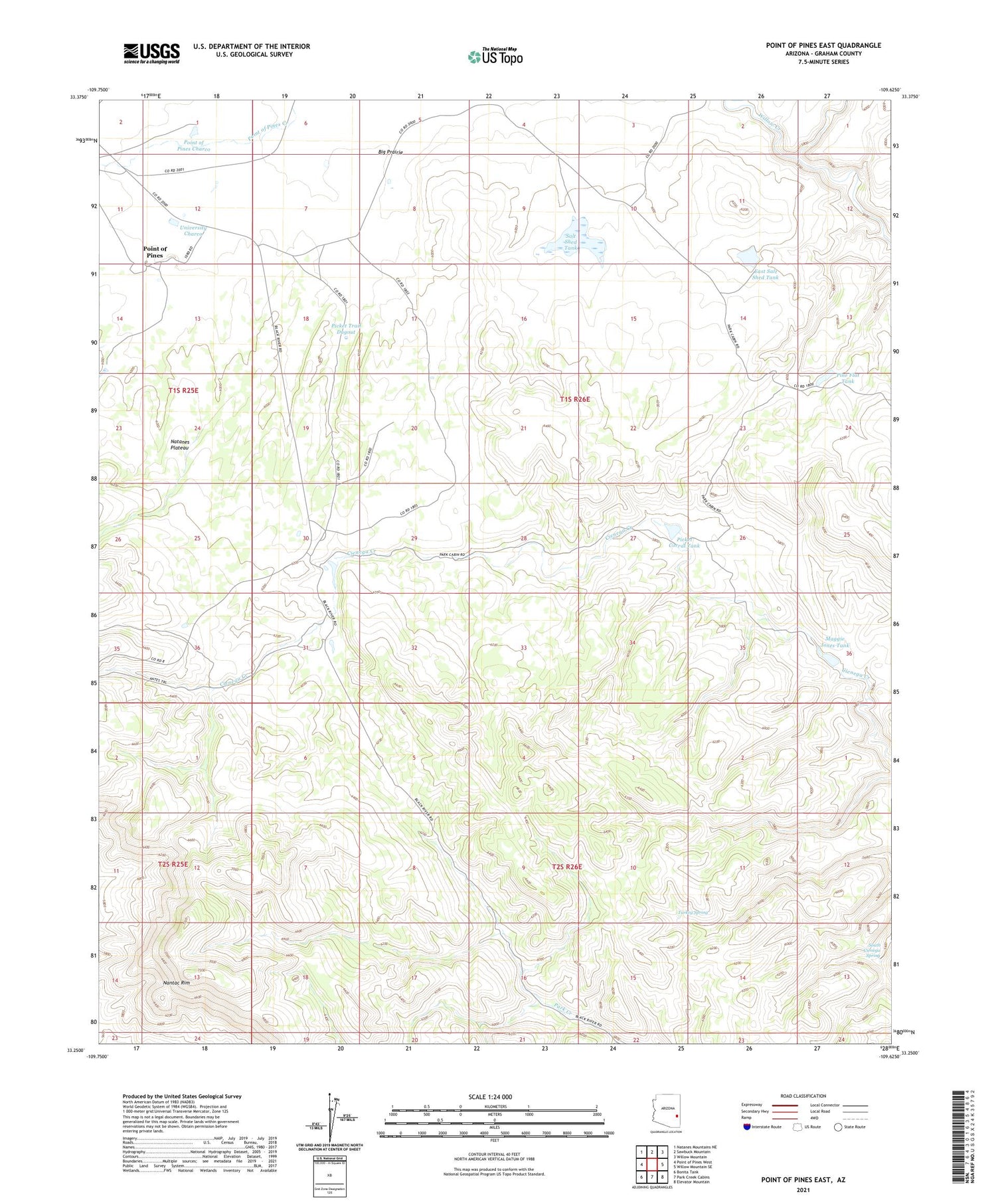
2021 topographic map quadrangle Point of Pines East in the state of Arizona. Scale: 1:24000. Based on the newly updated USGS 7.5' US Topo map series, this map is in the following counties: Graham. The map contains contour data, water features, and other items you are used to seeing on USGS maps, but also has updated roads and other features. This is the next generation of topographic maps. Printed on high-quality waterproof paper with UV fade-resistant inks.
Quads adjacent to this one:
West: Point of Pines West
Northwest: Natanes Mountains NE
North: Sawbuck Mountain
Northeast: Willow Mountain
East: Willow Mountain SE
Southeast: Elevator Mountain
South: Park Creek Cabins
Southwest: Bonita Tank
This map covers the same area as the classic USGS quad with code o33109c6.
Contains the following named places: Cienega Trap Tank, East Salt Shed Dam, East Salt Shed Tank, Maggie Jones Tank, Nantac Trail, Picket Corral Tank, Picket Trail Dugout, Pine Flat Tank, Point of Pines Charco, Salt Shed Dam, Salt Shed Tank, South Cienega Spring, Turkey Spring, University Archeological School, University Charco


