
MyTopo
Bonita Tank Arizona US Topo Map
Couldn't load pickup availability
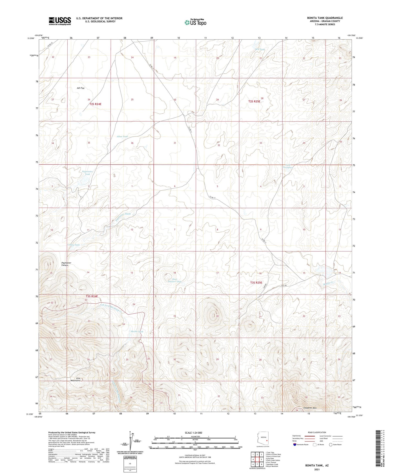
2021 topographic map quadrangle Bonita Tank in the state of Arizona. Scale: 1:24000. Based on the newly updated USGS 7.5' US Topo map series, this map is in the following counties: Graham. The map contains contour data, water features, and other items you are used to seeing on USGS maps, but also has updated roads and other features. This is the next generation of topographic maps. Printed on high-quality waterproof paper with UV fade-resistant inks.
Quads adjacent to this one:
West: Gila Peak
Northwest: Tule Tubs
North: Point of Pines West
Northeast: Point of Pines East
East: Park Creek Cabins
Southeast: Bryce Mountain
South: Markham Creek
Southwest: Fort Thomas
This map covers the same area as the classic USGS quad with code o33109b7.
Contains the following named places: Allan Tank, Bonita Dam, Bonita Tank, Hells Hollow Tank, Horse Camp, Lasley Tank, Mocho Tank, Paymaster Canyon, Paymaster Dam, Paymaster Tank, Paymaster Wash, SCS Tank, Sevenmile Creek, Shortys Well, Slaughter Camp, Steer Pasture Tank, Tank Thirtythree, Tank Thirtytwo


