MyTopo
Red Lake Arizona US Topo Map
Couldn't load pickup availability
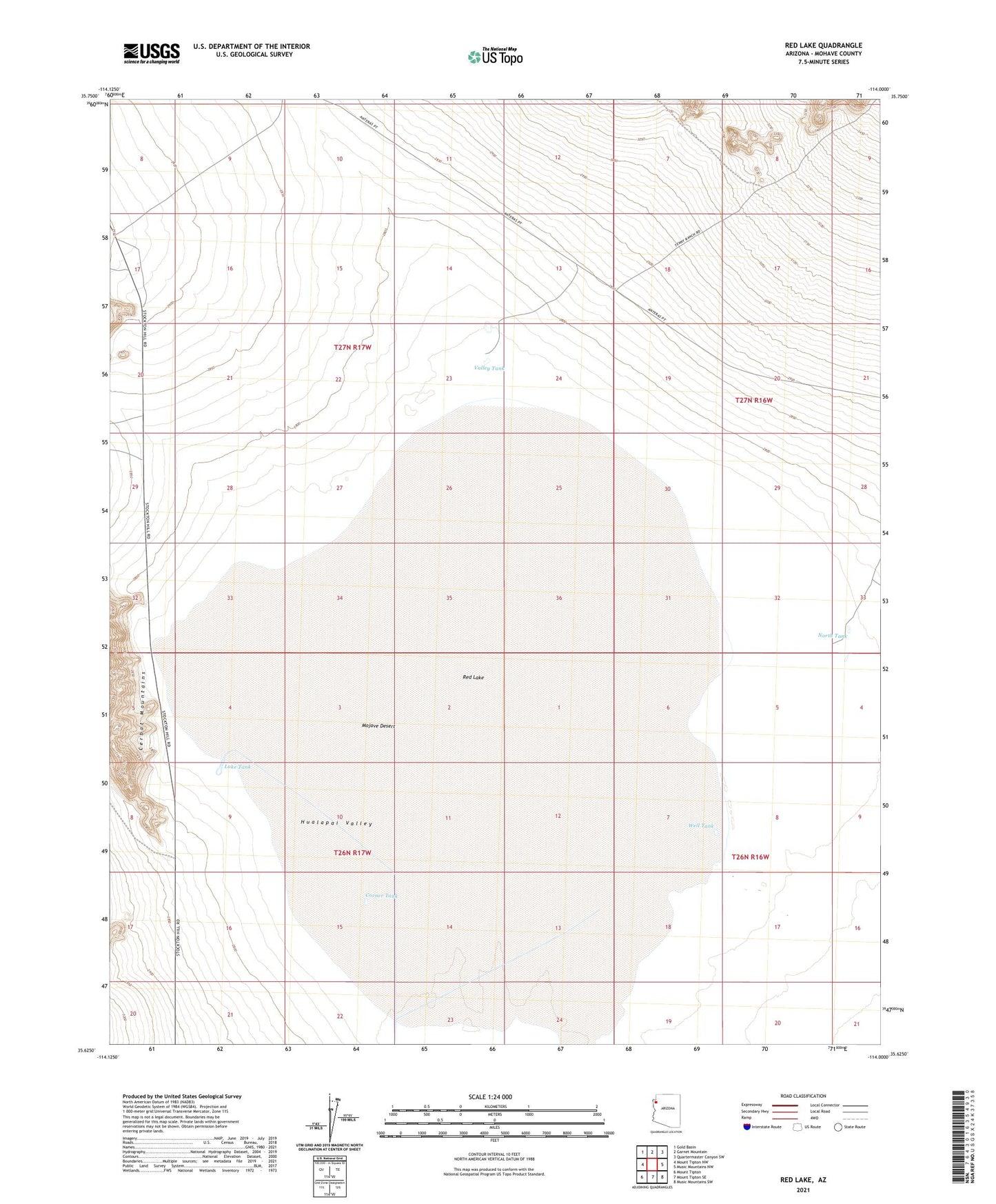
2021 topographic map quadrangle Red Lake in the state of Arizona. Scale: 1:24000. Based on the newly updated USGS 7.5' US Topo map series, this map is in the following counties: Mohave. The map contains contour data, water features, and other items you are used to seeing on USGS maps, but also has updated roads and other features. This is the next generation of topographic maps. Printed on high-quality waterproof paper with UV fade-resistant inks.
Quads adjacent to this one:
West: Mount Tipton NW
Northwest: Gold Basin
North: Garnet Mountain
Northeast: Quartermaster Canyon SW
East: Music Mountains NW
Southeast: Music Mountains SW
South: Mount Tipton SE
Southwest: Mount Tipton
This map covers the same area as the classic USGS quad with code o35114f1.
Contains the following named places: Corner Tank, Lake Tank, North Tank, Red Lake, Valley Tank, Well Tank