MyTopo
Gold Basin Arizona US Topo Map
Couldn't load pickup availability
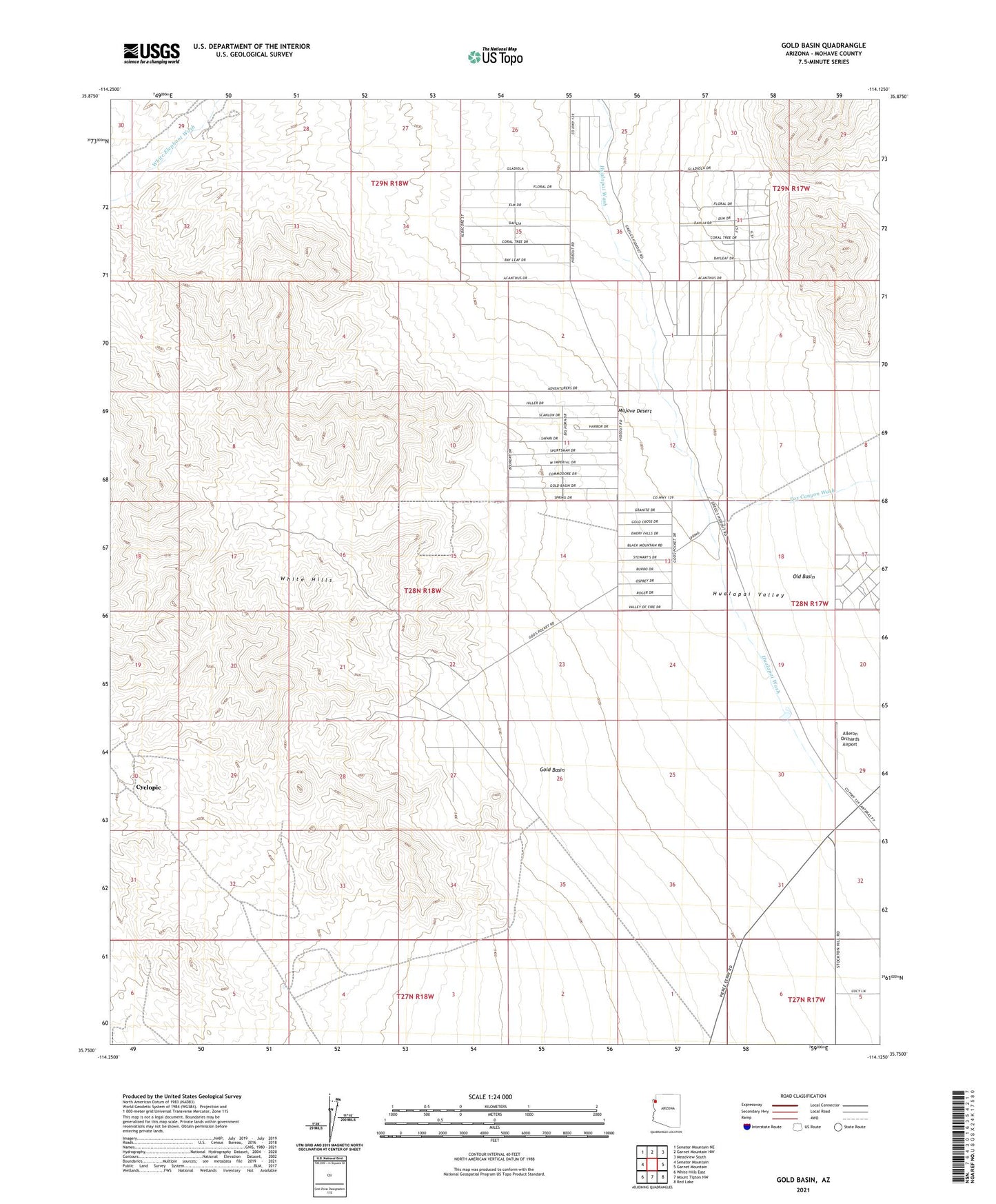
2021 topographic map quadrangle Gold Basin in the state of Arizona. Scale: 1:24000. Based on the newly updated USGS 7.5' US Topo map series, this map is in the following counties: Mohave. The map contains contour data, water features, and other items you are used to seeing on USGS maps, but also has updated roads and other features. This is the next generation of topographic maps. Printed on high-quality waterproof paper with UV fade-resistant inks.
Quads adjacent to this one:
West: Senator Mountain
Northwest: Senator Mountain NE
North: Garnet Mountain NW
Northeast: Meadview South
East: Garnet Mountain
Southeast: Red Lake
South: Mount Tipton NW
Southwest: White Hills East
This map covers the same area as the classic USGS quad with code o35114g2.
Contains the following named places: Aileron Orchards Airport, Burnt Mill Ranch, Cyclopic, Excelsior Mine, Fox Canyon Wash, Gold Basin, Malco Mine, Old Basin