MyTopo
Ryan Draw Arizona US Topo Map
Couldn't load pickup availability
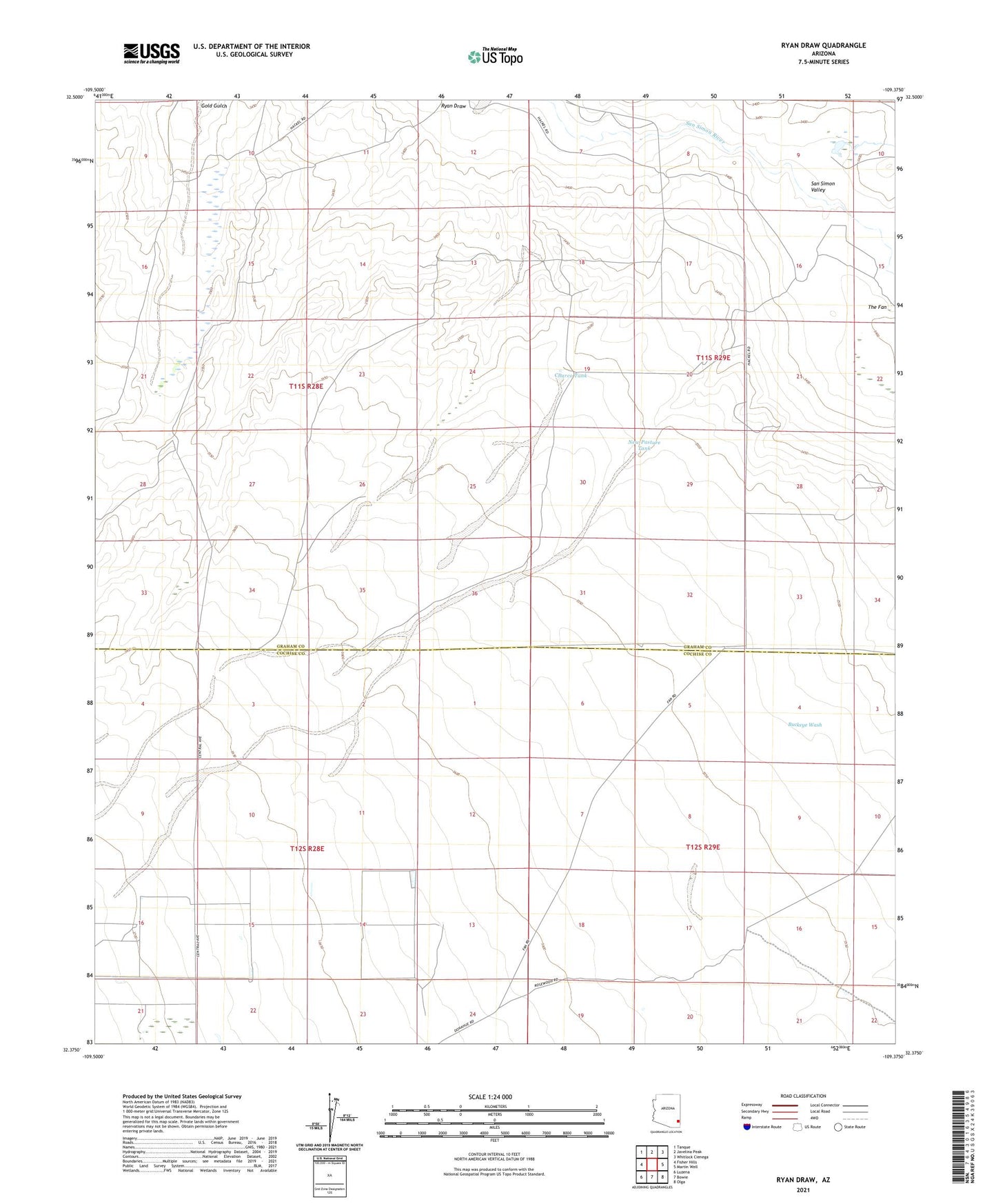
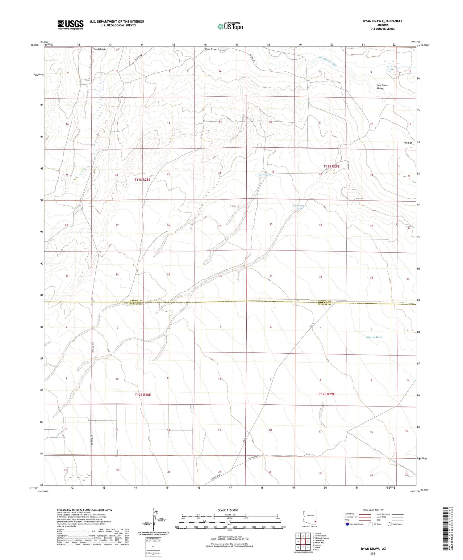
2021 topographic map quadrangle Ryan Draw in the state of Arizona. Scale: 1:24000. Based on the newly updated USGS 7.5' US Topo map series, this map is in the following counties: Cochise, Graham. The map contains contour data, water features, and other items you are used to seeing on USGS maps, but also has updated roads and other features. This is the next generation of topographic maps. Printed on high-quality waterproof paper with UV fade-resistant inks.
Quads adjacent to this one:
West: Fisher Hills
Northwest: Tanque
North: Javelina Peak
Northeast: Whitlock Cienega
East: Martin Well
Southeast: Olga
South: Bowie
Southwest: Luzena
This map covers the same area as the classic USGS quad with code o32109d4.
Contains the following named places: Antelope Well, Charco Tank, Foote Ranch, New Pasture Tank, New Pasture Well, Ryan Detention Dam, Sands Draw Detention Dam