MyTopo
Whitlock Cienega Arizona US Topo Map
Couldn't load pickup availability
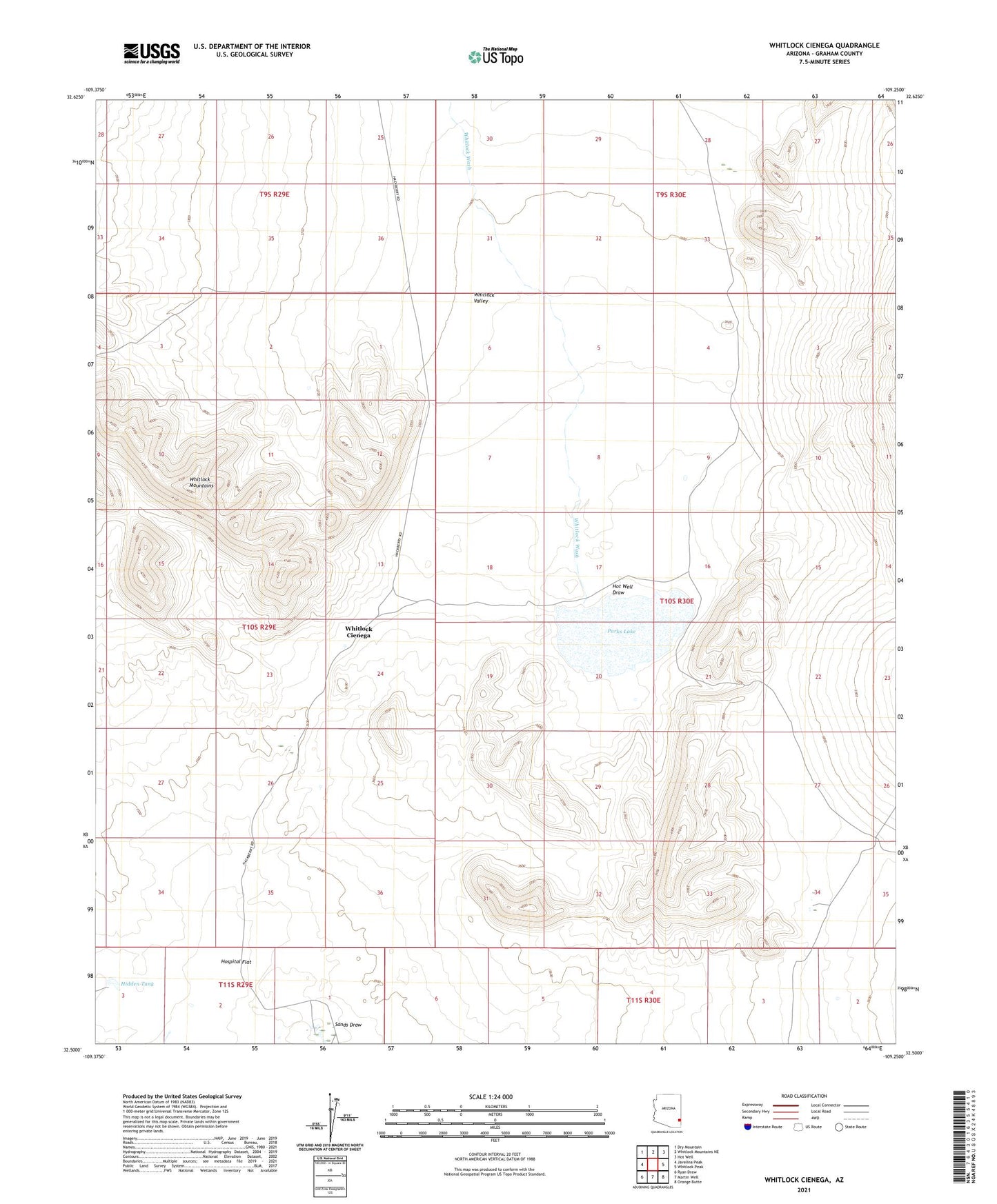
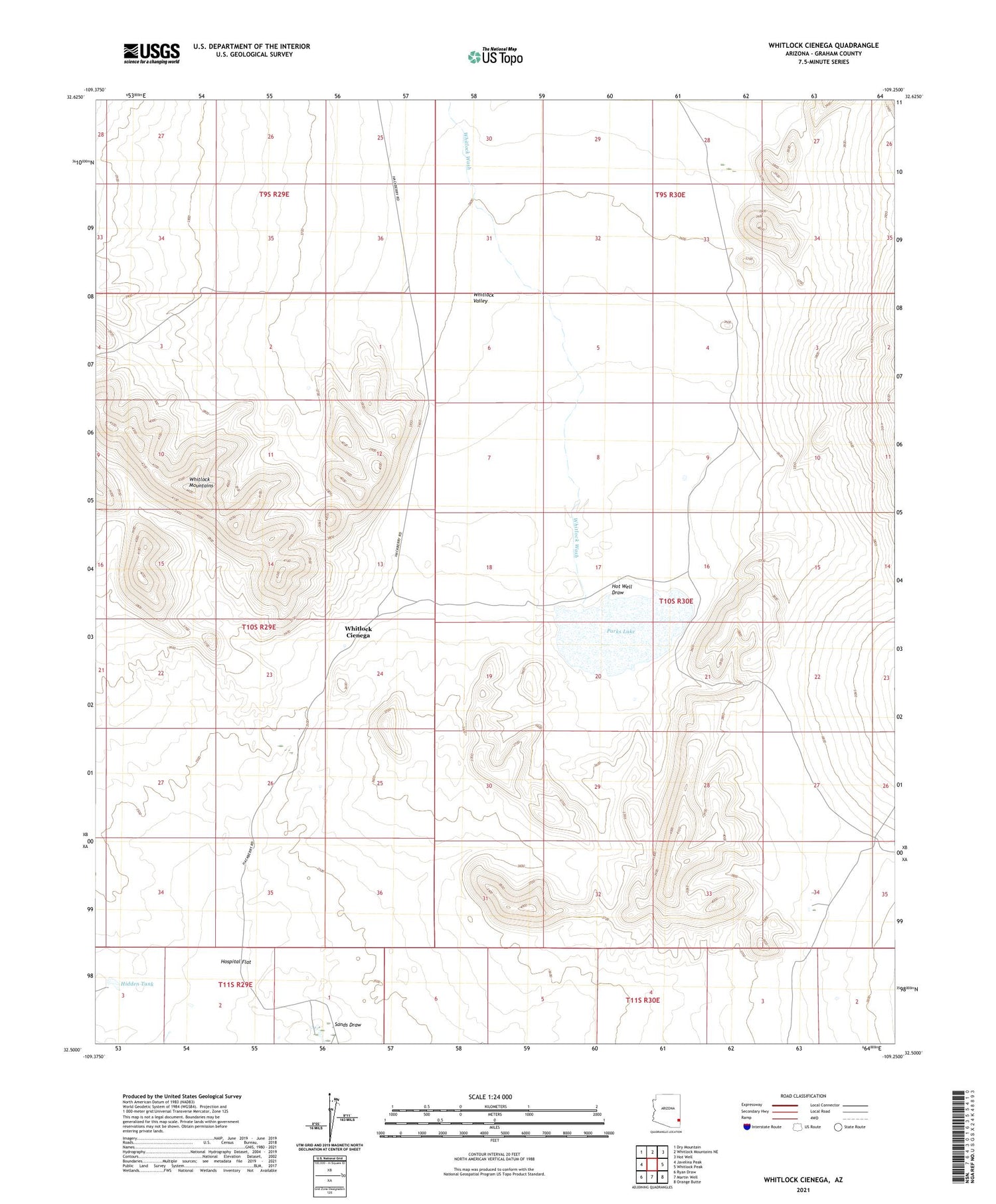
2021 topographic map quadrangle Whitlock Cienega in the state of Arizona. Scale: 1:24000. Based on the newly updated USGS 7.5' US Topo map series, this map is in the following counties: Graham. The map contains contour data, water features, and other items you are used to seeing on USGS maps, but also has updated roads and other features. This is the next generation of topographic maps. Printed on high-quality waterproof paper with UV fade-resistant inks.
Quads adjacent to this one:
West: Javelina Peak
Northwest: Dry Mountain
North: Whitlock Mountains NE
Northeast: Hot Well
East: Whitlock Peak
Southeast: Orange Butte
South: Martin Well
Southwest: Ryan Draw
This map covers the same area as the classic USGS quad with code o32109e3.
Contains the following named places: Clay Well, Delong Ranch, Hidden Tank, Hospital Flat, Hot Well Draw, Old Stage Station, Parks Lake, Sands Draw, Whitlock Cienega, Whitlock Detention Dam, Whitlock Wash