
MyTopo
Sells West Arizona US Topo Map
Couldn't load pickup availability
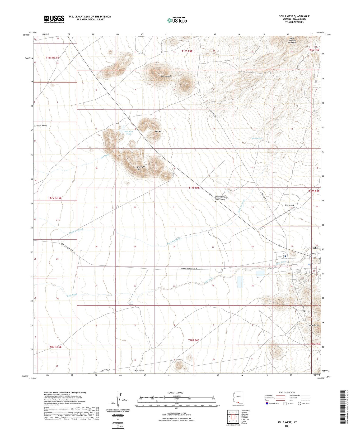
2021 topographic map quadrangle Sells West in the state of Arizona. Scale: 1:24000. Based on the newly updated USGS 7.5' US Topo map series, this map is in the following counties: Pima. The map contains contour data, water features, and other items you are used to seeing on USGS maps, but also has updated roads and other features. This is the next generation of topographic maps. Printed on high-quality waterproof paper with UV fade-resistant inks.
Quads adjacent to this one:
West: Gu Oidak
Northwest: Vainom Kug
North: Ko Vaya
Northeast: Comobabi
East: Sells East
Southeast: Topawa
South: Cowlic
Southwest: Chukut Kuk
This map covers the same area as the classic USGS quad with code o31111h8.
Contains the following named places: Bird Nest Hill, Bird Nest Tank, Etoi Ki, Indian Oasis Primary Elementary School, Mimsh Wahia, Pan Nepodk, Papago Indian Agency, Papago Indian Tribal Council, Sells, Sells Airport, Sells Census Designated Place, Sells Indian Hospital, Sells Post Office, Tohono Oodham Nation Police Department


