MyTopo
Topawa Arizona US Topo Map
Couldn't load pickup availability
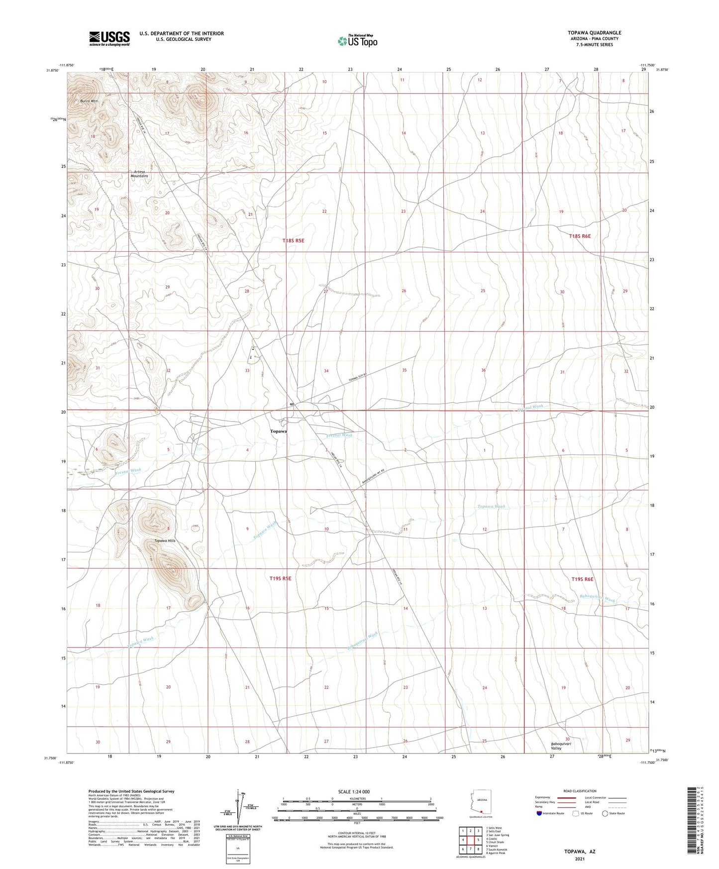
2021 topographic map quadrangle Topawa in the state of Arizona. Scale: 1:24000. Based on the newly updated USGS 7.5' US Topo map series, this map is in the following counties: Pima. The map contains contour data, water features, and other items you are used to seeing on USGS maps, but also has updated roads and other features. This is the next generation of topographic maps. Printed on high-quality waterproof paper with UV fade-resistant inks.
Quads adjacent to this one:
West: Cowlic
Northwest: Sells West
North: Sells East
Northeast: San Juan Spring
East: Chiuli Shaik
Southeast: Aguirre Peak
South: South Komelik
Southwest: Vamori
This map covers the same area as the classic USGS quad with code o31111g7.
Contains the following named places: Baboquivari High School, Baboquivari Middle School, Burro Mountain, Indian Oasis School, San Solano Mission, Topawa, Topawa Census Designated Place, Topawa Hills, Topawa Post Office, Topawa Well