
MyTopo
Shungopavi Arizona US Topo Map
Couldn't load pickup availability
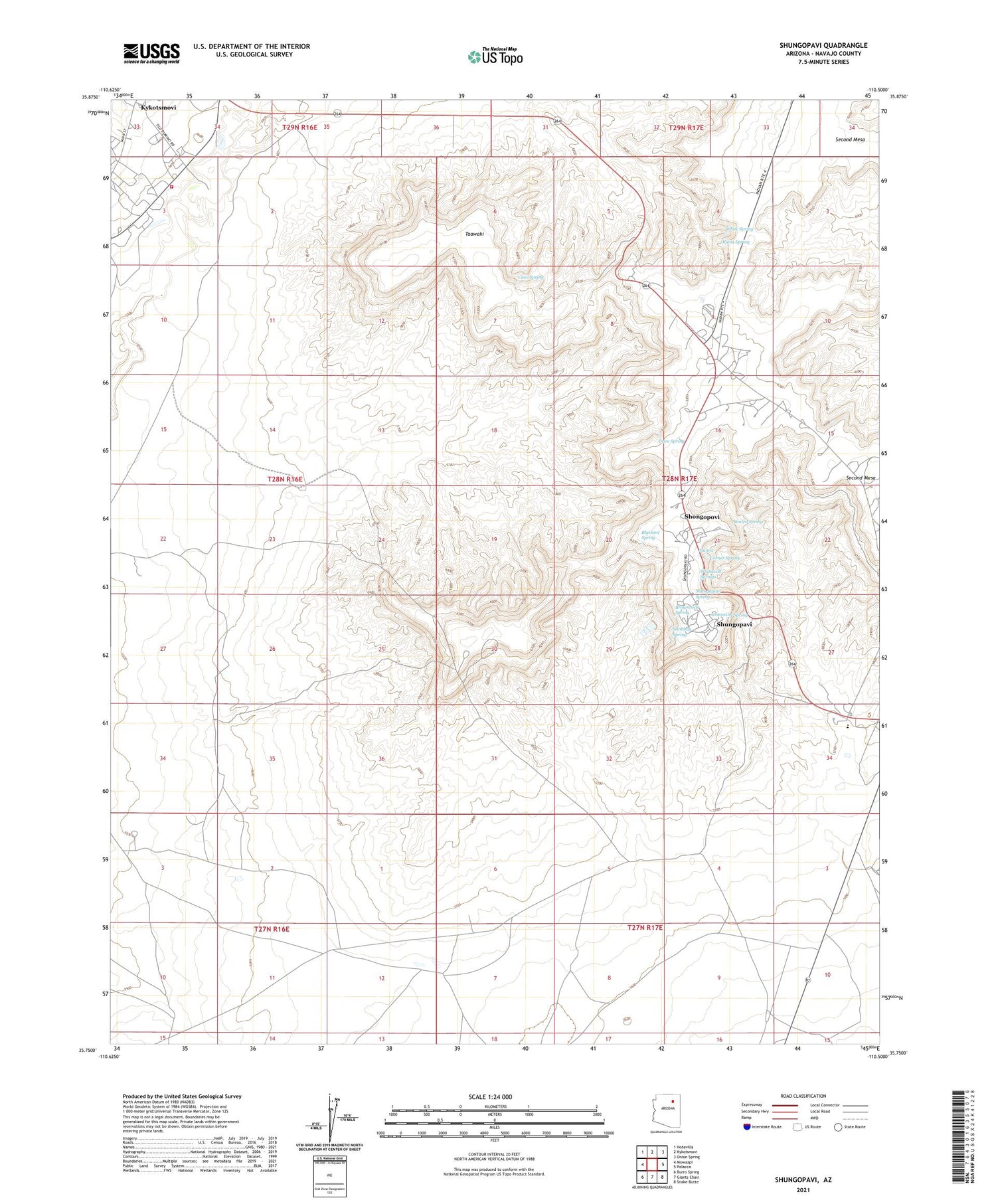
2021 topographic map quadrangle Shungopavi in the state of Arizona. Scale: 1:24000. Based on the newly updated USGS 7.5' US Topo map series, this map is in the following counties: Navajo. The map contains contour data, water features, and other items you are used to seeing on USGS maps, but also has updated roads and other features. This is the next generation of topographic maps. Printed on high-quality waterproof paper with UV fade-resistant inks.
Quads adjacent to this one:
West: Mowaapi
Northwest: Hotevilla
North: Kykotsmovi
Northeast: Onion Spring
East: Polacca
Southeast: Snake Butte
South: Giants Chair
Southwest: Burro Spring
This map covers the same area as the classic USGS quad with code o35110g5.
Contains the following named places: Bluebird Spring, Brownrock Spring, Cave Spring, Corner Spring, Dove Spring, Grooming Spring, Hopi Cultural Center, Hopi Tribal Offices, Hopi Tribe Picnic Area, Kykotsmovi Village, Old Second Mesa School, Old Shongopavi, Oraibi Community Building, Ruins Spring, Second Mesa, Second Mesa Day School, Shaded Spring, Shongopavi Community Building, Shongopovi Census Designated Place, Shongopovi District, Shungapavy Post Office, Shungopavi, Shungopavi Spring, Stinkbug Spring, Suviva, Taawaki, Toreva District, Tusayan, White Spring, Whitewall Springs, ZIP Code: 86043


