MyTopo
Snake Butte Arizona US Topo Map
Couldn't load pickup availability
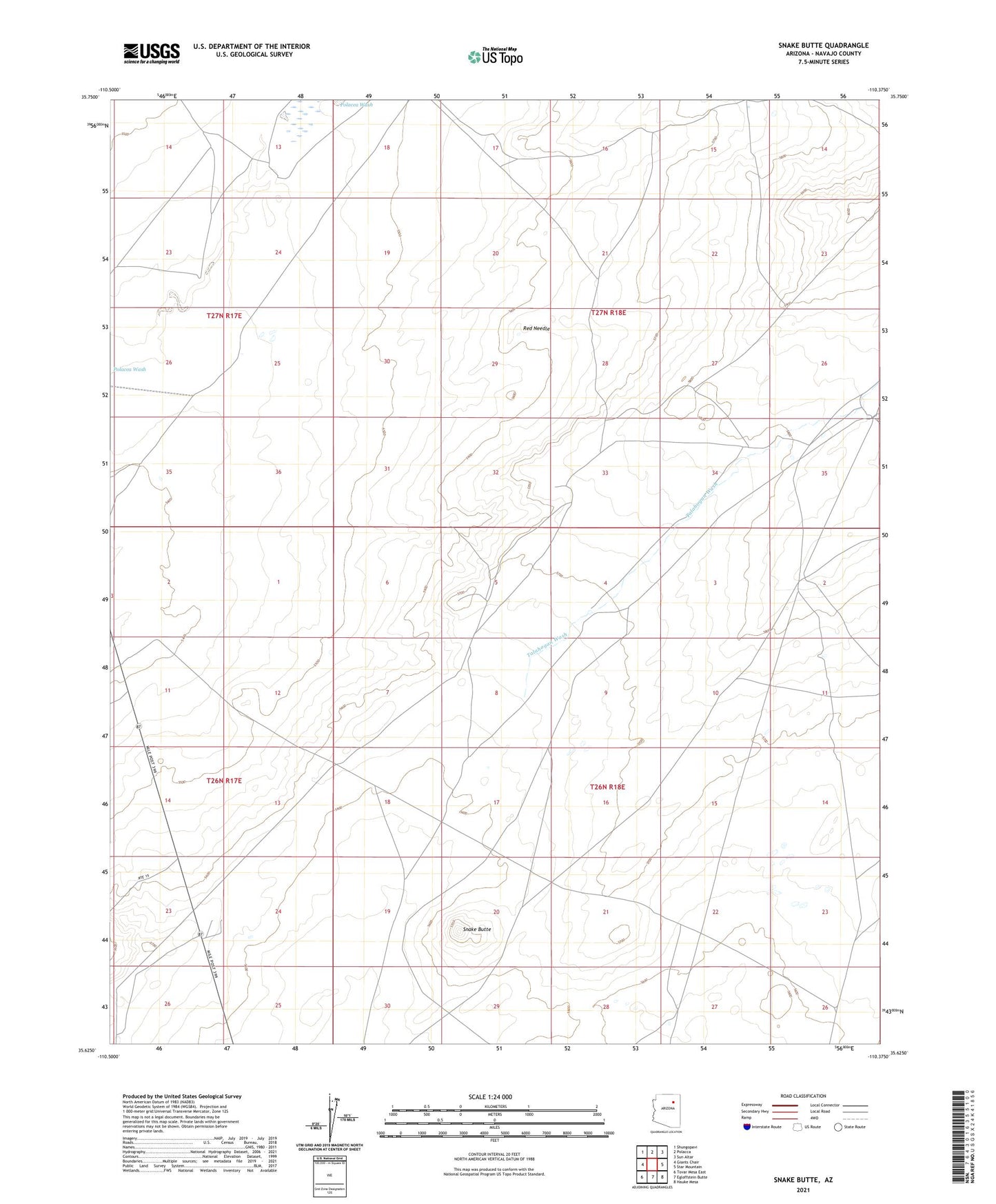
2021 topographic map quadrangle Snake Butte in the state of Arizona. Scale: 1:24000. Based on the newly updated USGS 7.5' US Topo map series, this map is in the following counties: Navajo. The map contains contour data, water features, and other items you are used to seeing on USGS maps, but also has updated roads and other features. This is the next generation of topographic maps. Printed on high-quality waterproof paper with UV fade-resistant inks.
Quads adjacent to this one:
West: Giants Chair
Northwest: Shungopavi
North: Polacca
Northeast: Sun Altar
East: Star Mountain
Southeast: Hauke Mesa
South: Egloffstein Butte
Southwest: Tovar Mesa East
This map covers the same area as the classic USGS quad with code o35110f4.
Contains the following named places: Polacca Wash District, Red Needle, Snake Butte, Talahogan Wash