MyTopo
Hotevilla Arizona US Topo Map
Couldn't load pickup availability
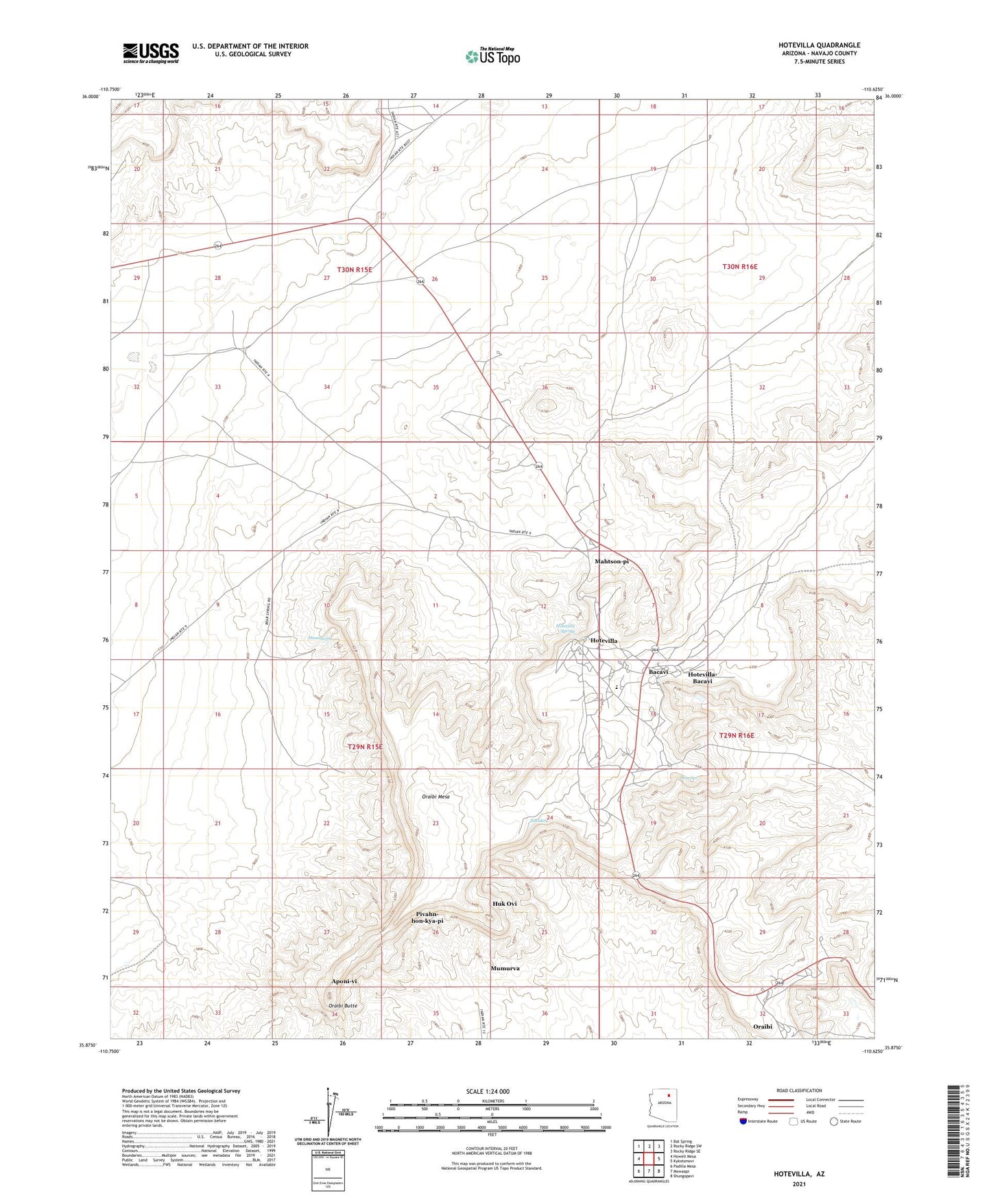
2021 topographic map quadrangle Hotevilla in the state of Arizona. Scale: 1:24000. Based on the newly updated USGS 7.5' US Topo map series, this map is in the following counties: Navajo. The map contains contour data, water features, and other items you are used to seeing on USGS maps, but also has updated roads and other features. This is the next generation of topographic maps. Printed on high-quality waterproof paper with UV fade-resistant inks.
Quads adjacent to this one:
West: Howell Mesa
Northwest: Bat Spring
North: Rocky Ridge SW
Northeast: Rocky Ridge SE
East: Kykotsmovi
Southeast: Shungopavi
South: Mowaapi
Southwest: Padilla Mesa
This map covers the same area as the classic USGS quad with code o35110h6.
Contains the following named places: Aponi-vi, Bacavi, Bacobi Community Building, Hoonawpa, Hotevilla, Hotevilla Bacavi Community School, Hotevilla Post Office, Hotevilla Spring, Hotevilla-Bacavi, Hotevilla-Bacavi Census Designated Place, Howiipi, Huk Ovi, Mahtson-pi, Mumurva, Old Orchard Picnic Ground, Oraibi, Oraibi Butte, Oraibi Mesa, Pivahn-hon-kya-pi, Siwukva, Tug-Of-War Historical Marker, ZIP Code: 86030