MyTopo
Silver Bell East Arizona US Topo Map
Couldn't load pickup availability
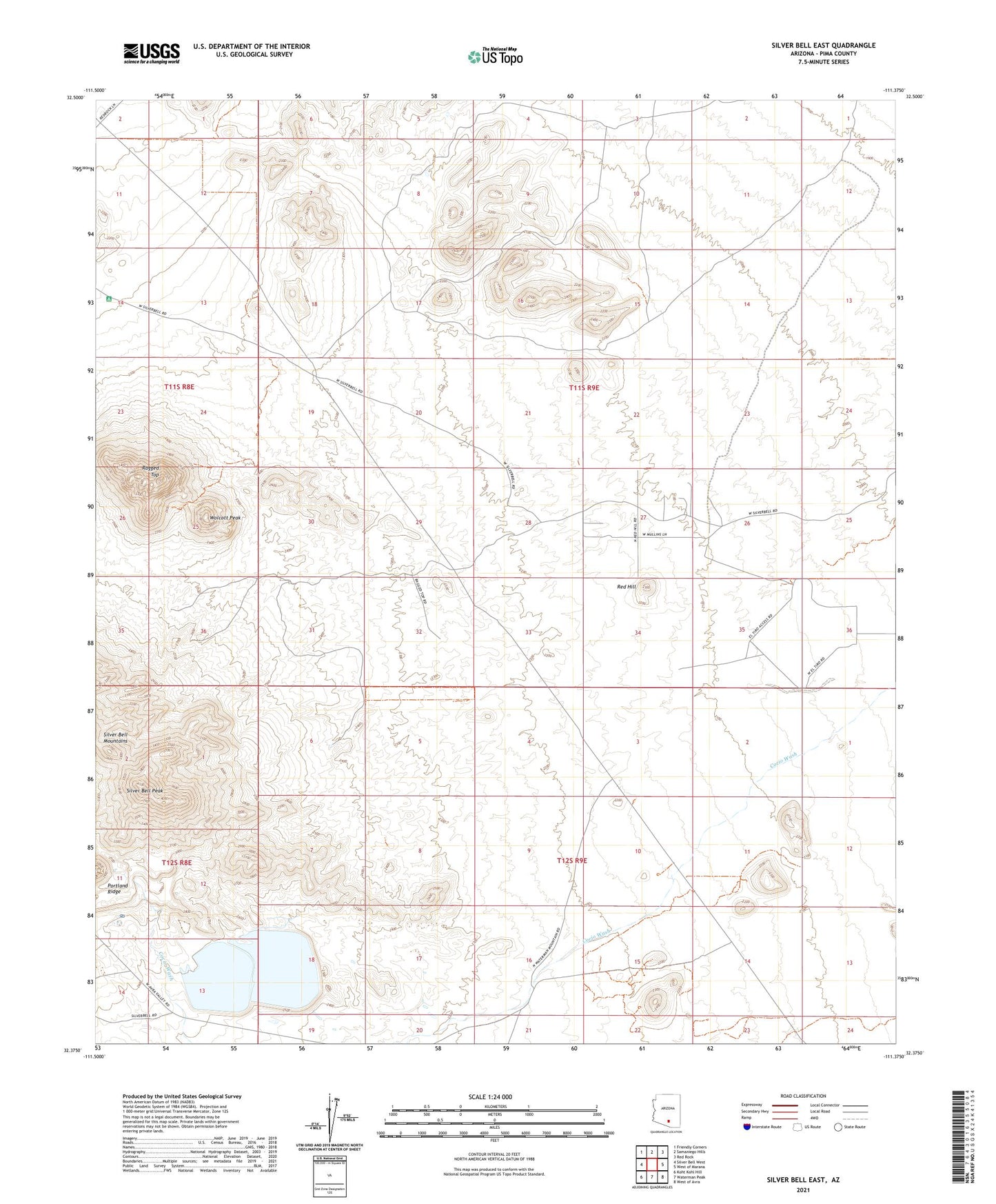
2021 topographic map quadrangle Silver Bell East in the state of Arizona. Scale: 1:24000. Based on the newly updated USGS 7.5' US Topo map series, this map is in the following counties: Pima. The map contains contour data, water features, and other items you are used to seeing on USGS maps, but also has updated roads and other features. This is the next generation of topographic maps. Printed on high-quality waterproof paper with UV fade-resistant inks.
Quads adjacent to this one:
West: Silver Bell West
Northwest: Friendly Corners
North: Samaniego Hills
Northeast: Red Rock
East: West of Marana
Southeast: West of Avra
South: Waterman Peak
Southwest: Koht Kohl Hill
This map covers the same area as the classic USGS quad with code o32111d4.
Contains the following named places: El Tiro Gliderport, Mesquite Well, Portland Ridge, Ragged Top, Red Hill, Silver Bell Mountains, Silver Bell Peak, Silver Bell Tailing Dam, Silver Bell Tailings Pond, Silverbell Number One Dam, Silverbell Number Two Dam, Wolcott Peak, ZIP Code: 85653