MyTopo
Sorrel Horse Mesa Arizona US Topo Map
Couldn't load pickup availability
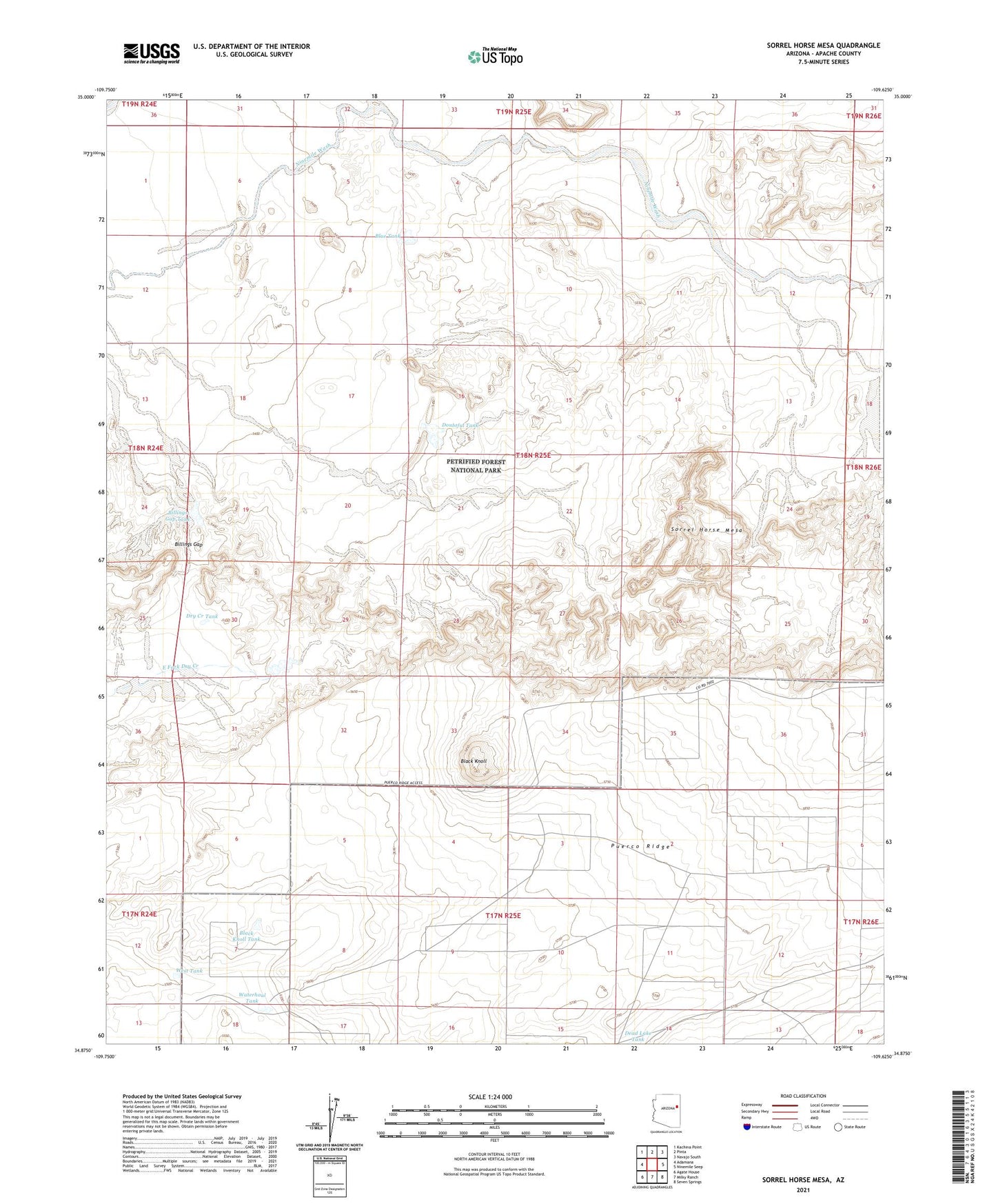
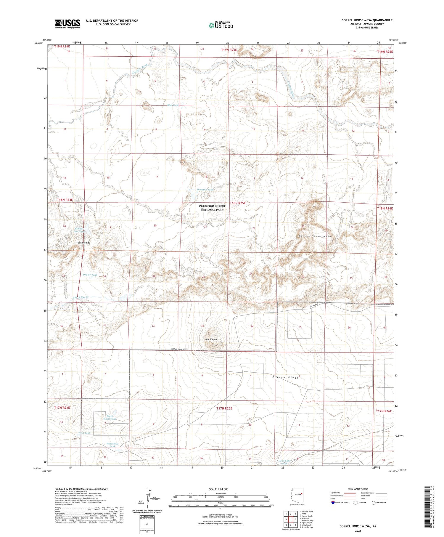
2021 topographic map quadrangle Sorrel Horse Mesa in the state of Arizona. Scale: 1:24000. Based on the newly updated USGS 7.5' US Topo map series, this map is in the following counties: Apache. The map contains contour data, water features, and other items you are used to seeing on USGS maps, but also has updated roads and other features. This is the next generation of topographic maps. Printed on high-quality waterproof paper with UV fade-resistant inks.
Quads adjacent to this one:
West: Adamana
Northwest: Kachina Point
North: Pinta
Northeast: Navajo South
East: Ninemile Seep
Southeast: Seven Springs
South: Milky Ranch
Southwest: Agate House
This map covers the same area as the classic USGS quad with code o34109h6.
Contains the following named places: Billings Gap, Billings Gap Tank, Black Knoll, Black Knoll Tank, Blue Tank, Cedar Tank, Doubtful Tank, Dry Creek Tank, Navajo Number Four Airstrip, Sorrel Horse Mesa, Waterhaul Tank, West Tank