MyTopo
Adamana Arizona US Topo Map
Couldn't load pickup availability
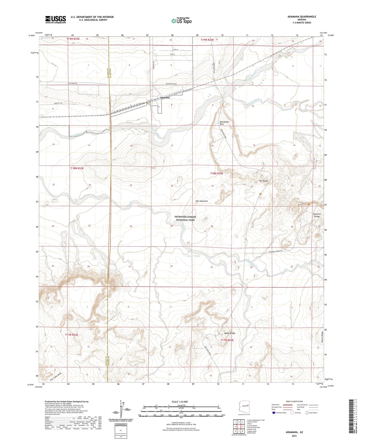
2021 topographic map quadrangle Adamana in the state of Arizona. Scale: 1:24000. Based on the newly updated USGS 7.5' US Topo map series, this map is in the following counties: Apache, Navajo. The map contains contour data, water features, and other items you are used to seeing on USGS maps, but also has updated roads and other features. This is the next generation of topographic maps. Printed on high-quality waterproof paper with UV fade-resistant inks.
Quads adjacent to this one:
West: Carrizo Butte
Northwest: Little Lithodendron Tank
North: Kachina Point
Northeast: Pinta
East: Sorrel Horse Mesa
Southeast: Milky Ranch
South: Agate House
Southwest: Padilla Tank
This map covers the same area as the classic USGS quad with code o34109h7.
Contains the following named places: Adamana, Agate Bridge, Blue Mesa, Dead Wash, Dry Creek Tanks, East Fork Dry Creek, First Forest, Jasper Forest, Jensen Well, Keystone Bridge, Newspaper Rock, Ninemile Wash, Paulcell Place, Petrified Forest National Park, The Haystacks, The Tepees