MyTopo
Spider Rock Arizona US Topo Map
Couldn't load pickup availability
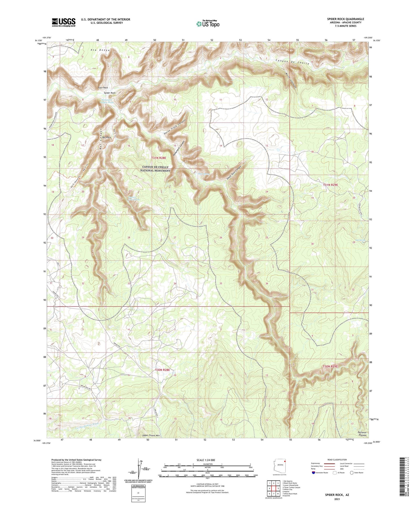
2021 topographic map quadrangle Spider Rock in the state of Arizona. Scale: 1:24000. Based on the newly updated USGS 7.5' US Topo map series, this map is in the following counties: Apache. The map contains contour data, water features, and other items you are used to seeing on USGS maps, but also has updated roads and other features. This is the next generation of topographic maps. Printed on high-quality waterproof paper with UV fade-resistant inks.
Quads adjacent to this one:
West: Three Turkey Canyon
Northwest: Del Muerto
North: Black Rock Butte
Northeast: Lower Wheatfields
East: White Clay
Southeast: Sawmill
South: White Rock Wash
Southwest: Nazlini
This map covers the same area as the classic USGS quad with code o36109a3.
Contains the following named places: Bat Canyon, Bat Rock, Canyon de Chelly National Monument, Elephant Grass Spring, Face Rock, Glofer Spring, Horse Track Canyon, Hot Rock Windmill, Monument Canyon, Monument Canyon Wash, Mule Canyon, Oak Spring, Small Twin Canyon, Spider Rock, Spider Rock Overlook