MyTopo
Lower Wheatfields Arizona US Topo Map
Couldn't load pickup availability
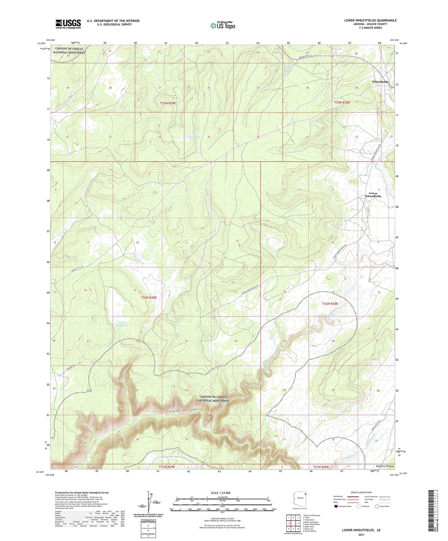
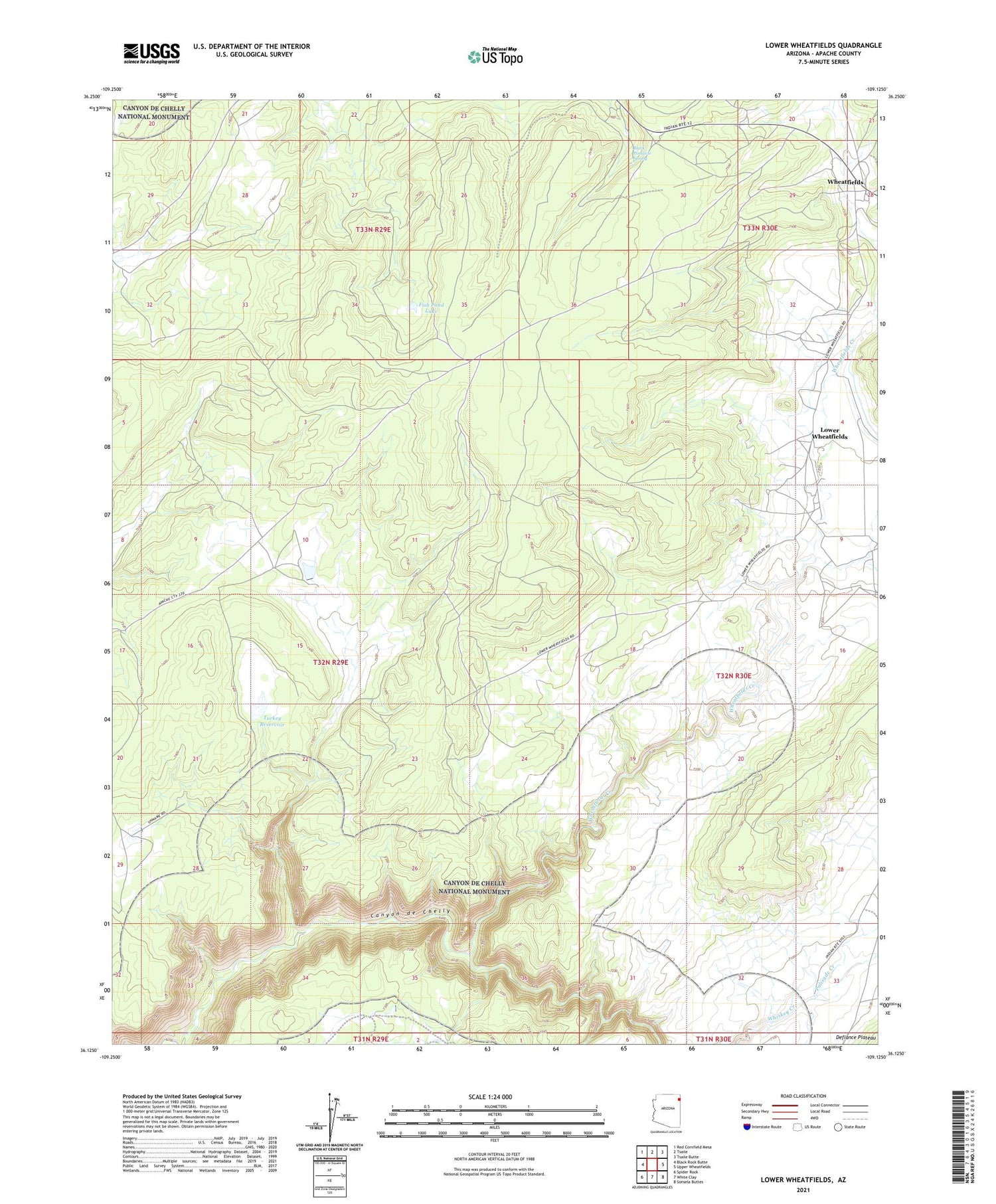
2021 topographic map quadrangle Lower Wheatfields in the state of Arizona. Scale: 1:24000. Based on the newly updated USGS 7.5' US Topo map series, this map is in the following counties: Apache. The map contains contour data, water features, and other items you are used to seeing on USGS maps, but also has updated roads and other features. This is the next generation of topographic maps. Printed on high-quality waterproof paper with UV fade-resistant inks.
Quads adjacent to this one:
West: Black Rock Butte
Northwest: Red Cornfield Mesa
North: Tsaile
Northeast: Tsaile Butte
East: Upper Wheatfields
Southeast: Sonsela Buttes
South: White Clay
Southwest: Spider Rock
This map covers the same area as the classic USGS quad with code o36109b2.
Contains the following named places: Black Pinnacle Spring, Fish Pond Lake, Little White Dam, Lower Wheatfields, Palisade Creek, Tsaile-Wheatfields Chapter, Turkey Reservoir, Wheatfields, Wheatfields Chapter House, Wheatfields Creek, White Dam, Yellowbush Well