MyTopo
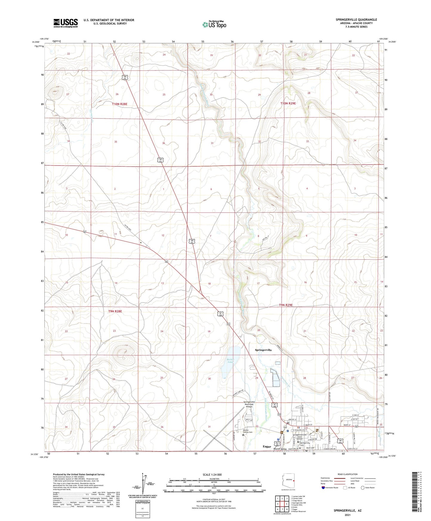
Springerville Arizona US Topo Map
Couldn't load pickup availability
Also explore the Springerville Forest Service Topo of this same quad for updated USFS data
2021 topographic map quadrangle Springerville in the state of Arizona. Scale: 1:24000. Based on the newly updated USGS 7.5' US Topo map series, this map is in the following counties: Apache. The map contains contour data, water features, and other items you are used to seeing on USGS maps, but also has updated roads and other features. This is the next generation of topographic maps. Printed on high-quality waterproof paper with UV fade-resistant inks.
Quads adjacent to this one:
West: Springerville NW
Northwest: Lyman Lake SW
North: Lyman Lake
Northeast: Voigt Ranch
East: Coyote Hills
Southeast: Nelson Reservoir
South: Eagar
Southwest: Greer
This map covers the same area as the classic USGS quad with code o34109b3.
Contains the following named places: Apache and Sitgraves Forest Supervisor Office, Apache County Sheriff's Office Round Valley, Becker Lake, Casa Malpais Campground, Casa Malpais Site, First Assembly of God, Immanuel Lutheran Church, Jesus First Community Church, Kingdom Hall of Jehovahs Witnesses Eager Congregation, KQAZ-FM (Springerville), KRVZ-AM (Springerville), Nutrioso Creek, Picnic Creek, Round Valley, Round Valley Senior Center, Saint Peter's Catholic Church, Springerville, Springerville Forest Service Facility, Springerville Municipal Airport, Springerville Police Department, Springerville Post Office, Springerville Ranger District Office, Springerville Seventh Day Adventist Church, Springerville Town Hall, Springfield Elementary School, Town of Springerville, United States Forest Service Fire Department Apache - Sitgreaves National Forest, Valle Redondo Trailer Park, White Mountain Regional Medical Center, ZIP Code: 85938