MyTopo
Lyman Lake SW Arizona US Topo Map
Couldn't load pickup availability
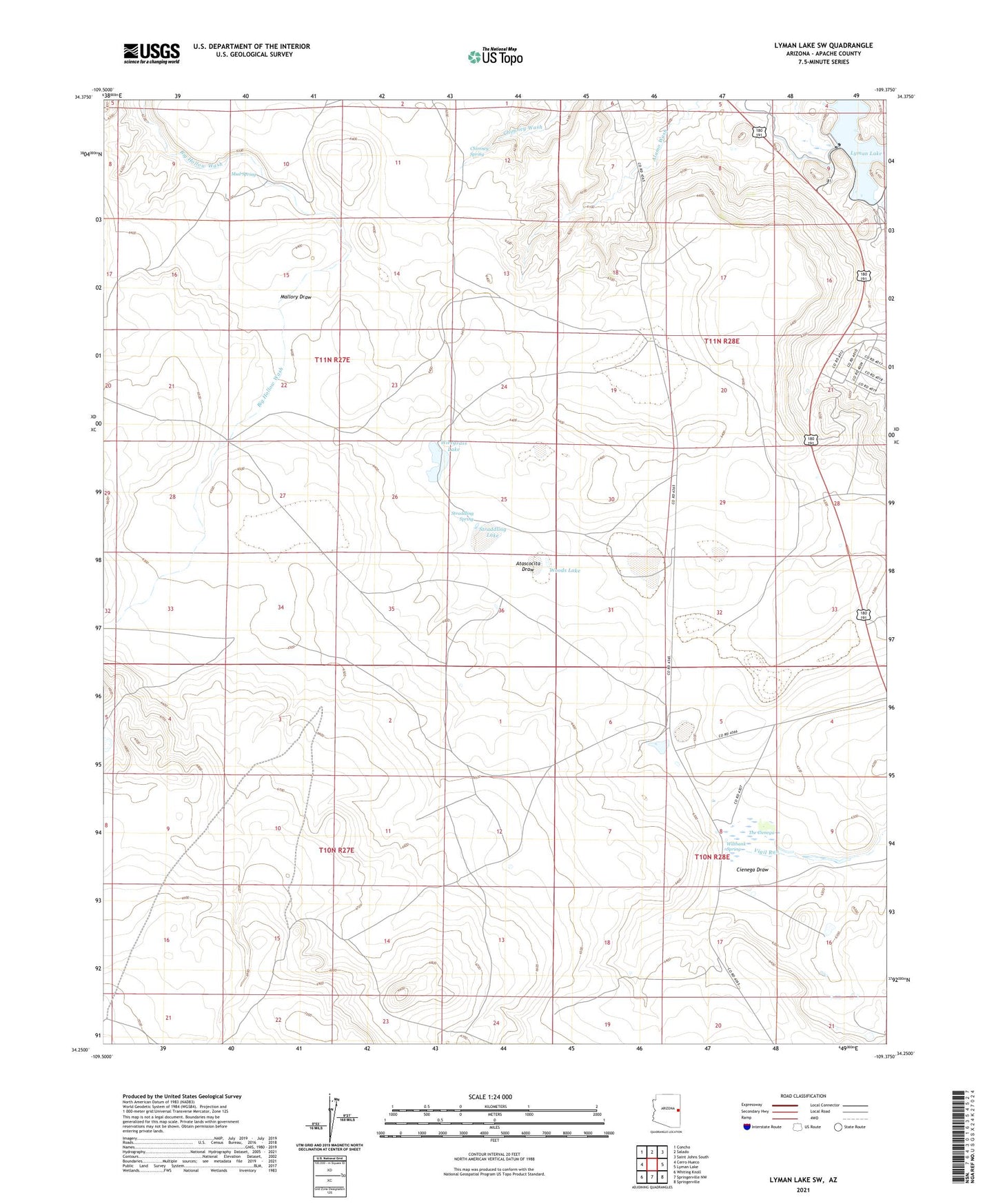
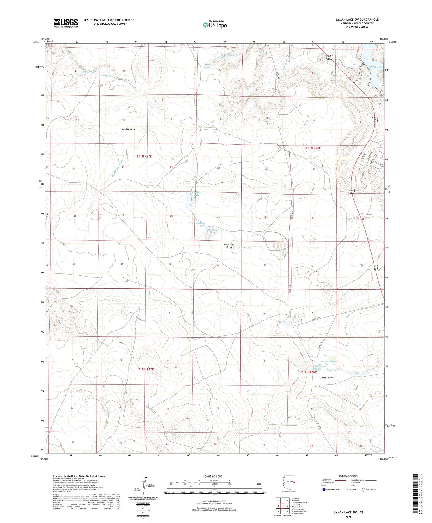
2021 topographic map quadrangle Lyman Lake SW in the state of Arizona. Scale: 1:24000. Based on the newly updated USGS 7.5' US Topo map series, this map is in the following counties: Apache. The map contains contour data, water features, and other items you are used to seeing on USGS maps, but also has updated roads and other features. This is the next generation of topographic maps. Printed on high-quality waterproof paper with UV fade-resistant inks.
Quads adjacent to this one:
West: Cerro Hueco
Northwest: Concho
North: Salado
Northeast: Saint Johns South
East: Lyman Lake
Southeast: Springerville
South: Springerville NW
Southwest: Whiting Knoll
This map covers the same area as the classic USGS quad with code o34109c4.
Contains the following named places: Atascocita Draw, Chimney Spring, Cienega Draw, Hayrock Ranch, Lyman Dam, Mallory Draw, Mud Spring, Straddling Lake, Straddling Spring, The Cienega, Twentyfour Ranch, Wiltbank Spring, Wiregrass Lake, Woods Lake