MyTopo
Stanfield Arizona US Topo Map
Couldn't load pickup availability
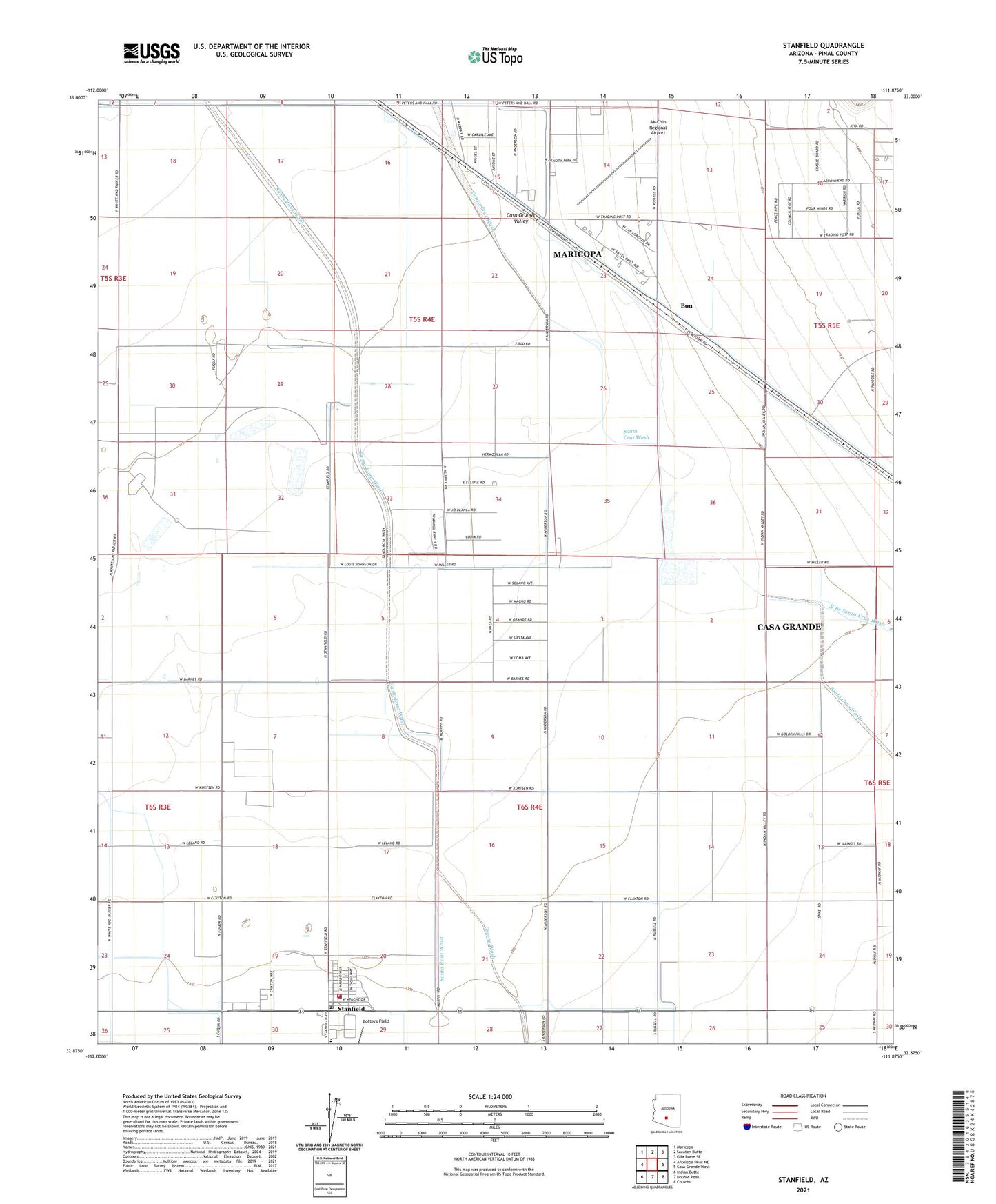
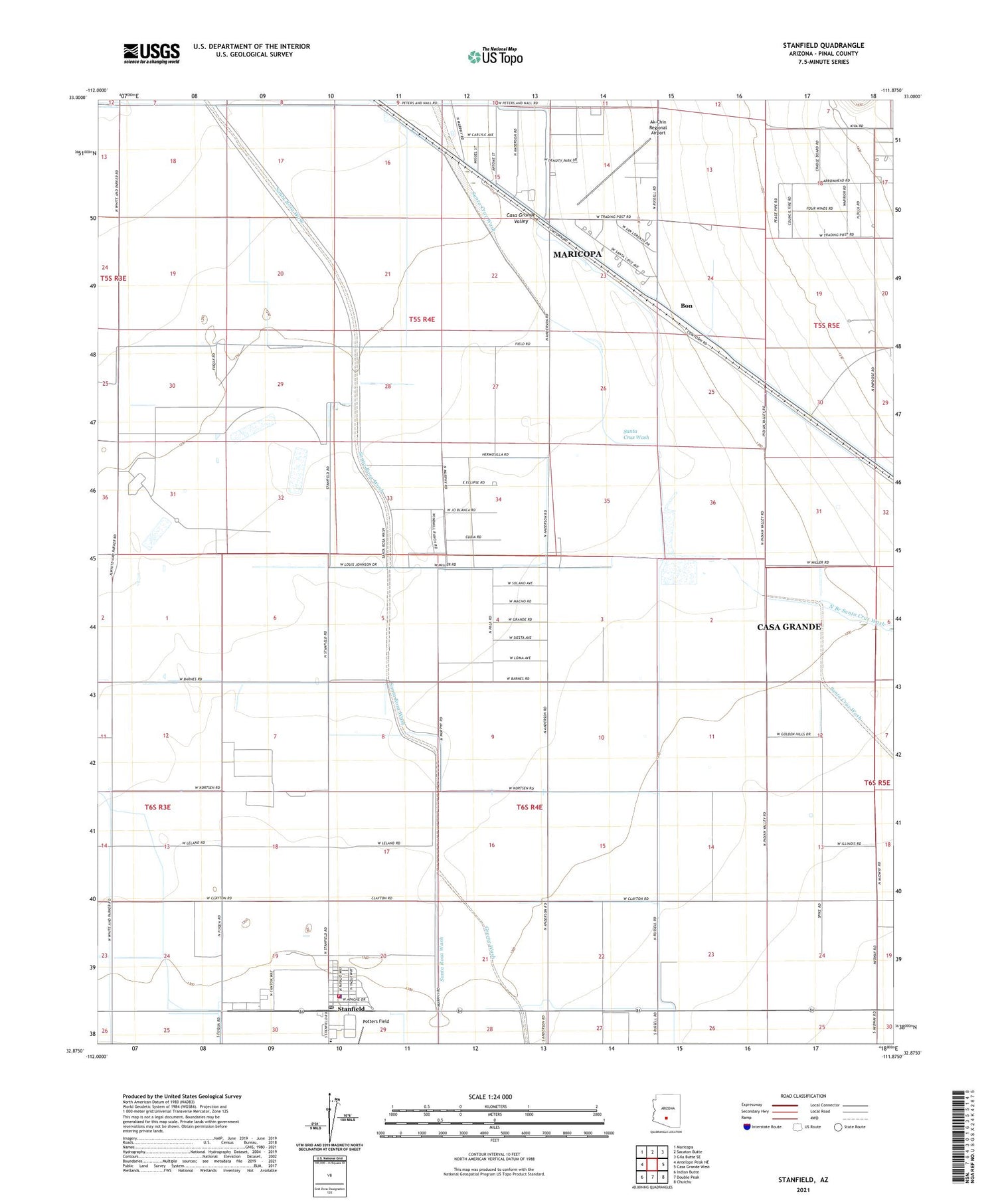
2021 topographic map quadrangle Stanfield in the state of Arizona. Scale: 1:24000. Based on the newly updated USGS 7.5' US Topo map series, this map is in the following counties: Pinal. The map contains contour data, water features, and other items you are used to seeing on USGS maps, but also has updated roads and other features. This is the next generation of topographic maps. Printed on high-quality waterproof paper with UV fade-resistant inks.
Quads adjacent to this one:
West: Antelope Peak NE
Northwest: Maricopa
North: Sacaton Butte
Northeast: Gila Butte SE
East: Casa Grande West
Southeast: Chuichu
South: Double Peak
Southwest: Indian Butte
This map covers the same area as the classic USGS quad with code o32111h8.
Contains the following named places: Ak-Chin Regional Airport, Ben Railroad Station, Bon, Casa Grande Valley, Greene Wash, Indian Assembly of God, North Branch Santa Cruz Wash, Pinal County Sheriff's Office Stanfield Region C, Potters Field, Santa Rosa Wash, Stanfield, Stanfield Census Designated Place, Stanfield Elementary School, Stanfield Post Office, Stanfield Volunteer Fire Department, ZIP Code: 85172