
MyTopo
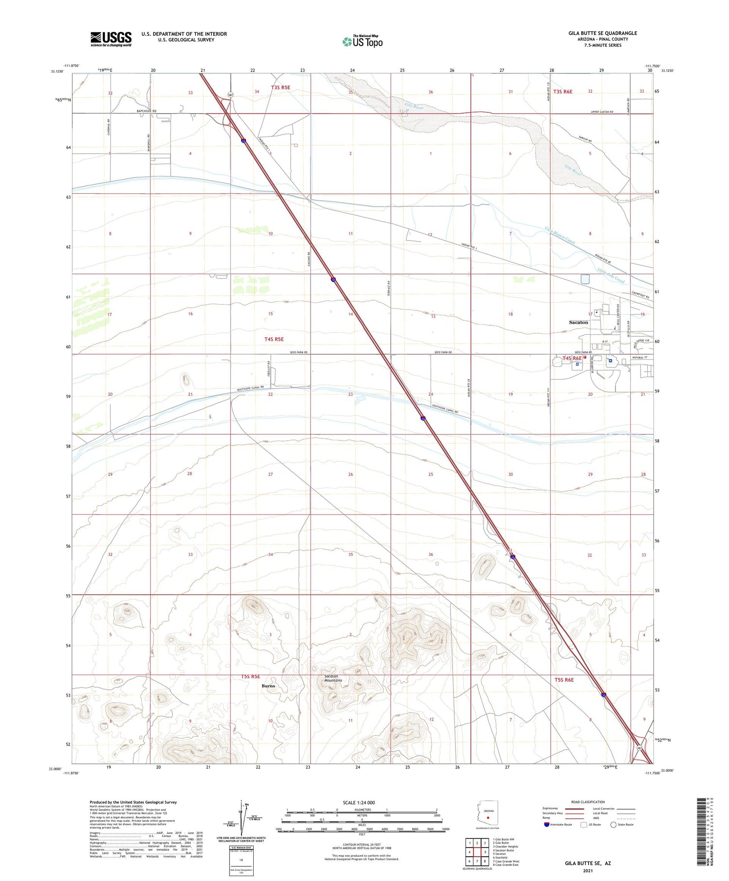
Gila Butte SE Arizona US Topo Map
Couldn't load pickup availability
2021 topographic map quadrangle Gila Butte SE in the state of Arizona. Scale: 1:24000. Based on the newly updated USGS 7.5' US Topo map series, this map is in the following counties: Pinal. The map contains contour data, water features, and other items you are used to seeing on USGS maps, but also has updated roads and other features. This is the next generation of topographic maps. Printed on high-quality waterproof paper with UV fade-resistant inks.
Quads adjacent to this one:
West: Sacaton Butte
Northwest: Gila Butte NW
North: Gila Butte
Northeast: Chandler Heights
East: Sacaton
Southeast: Casa Grande East
South: Casa Grande West
Southwest: Stanfield
This map covers the same area as the classic USGS quad with code o33111a7.
Contains the following named places: Burns, District 3, Gila Reservation Career Center, Gila River Division, Gila River Health Care Hu Hu Kam Memorial Hospital, Gila River Indian Community Fire Department Station 423 Sacaton, Gila River Police Department, Gila River Relocation Center, Indian Health Service Regional Treatment Center, Pima Hospital, Sacaton Census Designated Place, Sacaton Elementary School, Sacaton Middle School, Sacaton Mountains


