MyTopo
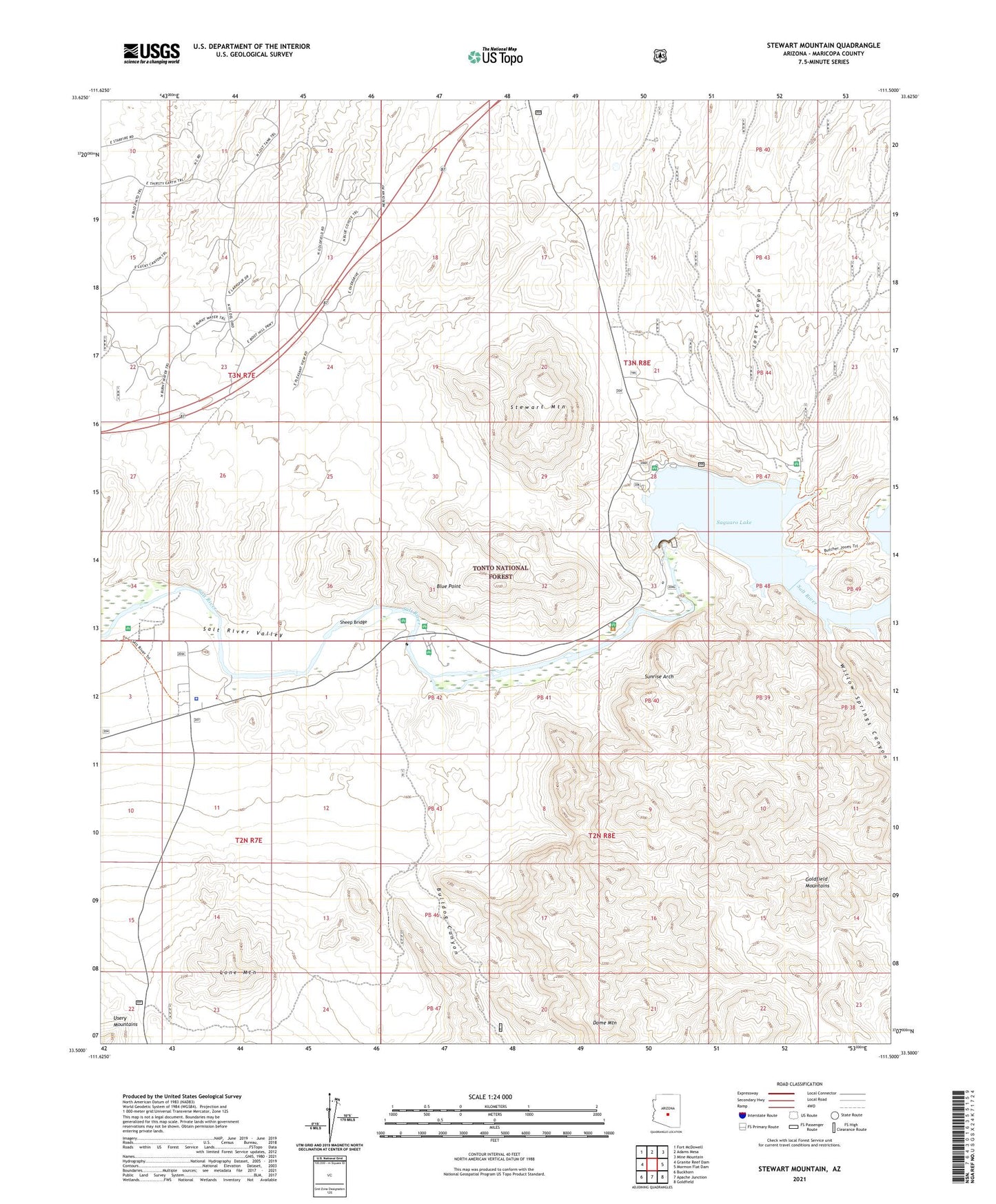
Stewart Mountain Arizona US Topo Map
Couldn't load pickup availability
Also explore the Stewart Mountain Forest Service Topo of this same quad for updated USFS data
2021 topographic map quadrangle Stewart Mountain in the state of Arizona. Scale: 1:24000. Based on the newly updated USGS 7.5' US Topo map series, this map is in the following counties: Maricopa. The map contains contour data, water features, and other items you are used to seeing on USGS maps, but also has updated roads and other features. This is the next generation of topographic maps. Printed on high-quality waterproof paper with UV fade-resistant inks.
Quads adjacent to this one:
West: Granite Reef Dam
Northwest: Fort McDowell
North: Adams Mesa
Northeast: Mine Mountain
East: Mormon Flat Dam
Southeast: Goldfield
South: Apache Junction
Southwest: Buckhorn
This map covers the same area as the classic USGS quad with code o33111e5.
Contains the following named places: Beeline Tank, Blue Point, Blue Point Administrative Site, Blue Point Picnic Area, Blue Point Recreation Site, Bulldog Canyon, Butcher Jones Picnic Area, Butcher Jones Recreation Site, Dome Mountain, Flower Tank, Goldfield Administrative Site, Goldfield Mountains, Goldfield Ranch, Goldfield Ranch Airport, Goldfield Recreation Site, Jones Canyon, Junction Recreation Site, Lone Mountain, Lost Tank, Saguaro Del Norte Picnic Area, Saguaro del Norte Recreation Site, Saguaro Lake, Saguaro Lake Marina, Saguaro Lake Ranch Resort, Salt River Project Housing, Sheep Bridge, Stewart Mountain, Stewart Mountain Dam, Stewart Mountain Dam Heliport, Sunrise Arch, Water Users Recreation Site, Willow Springs Canyon, ZIP Code: 85215