MyTopo
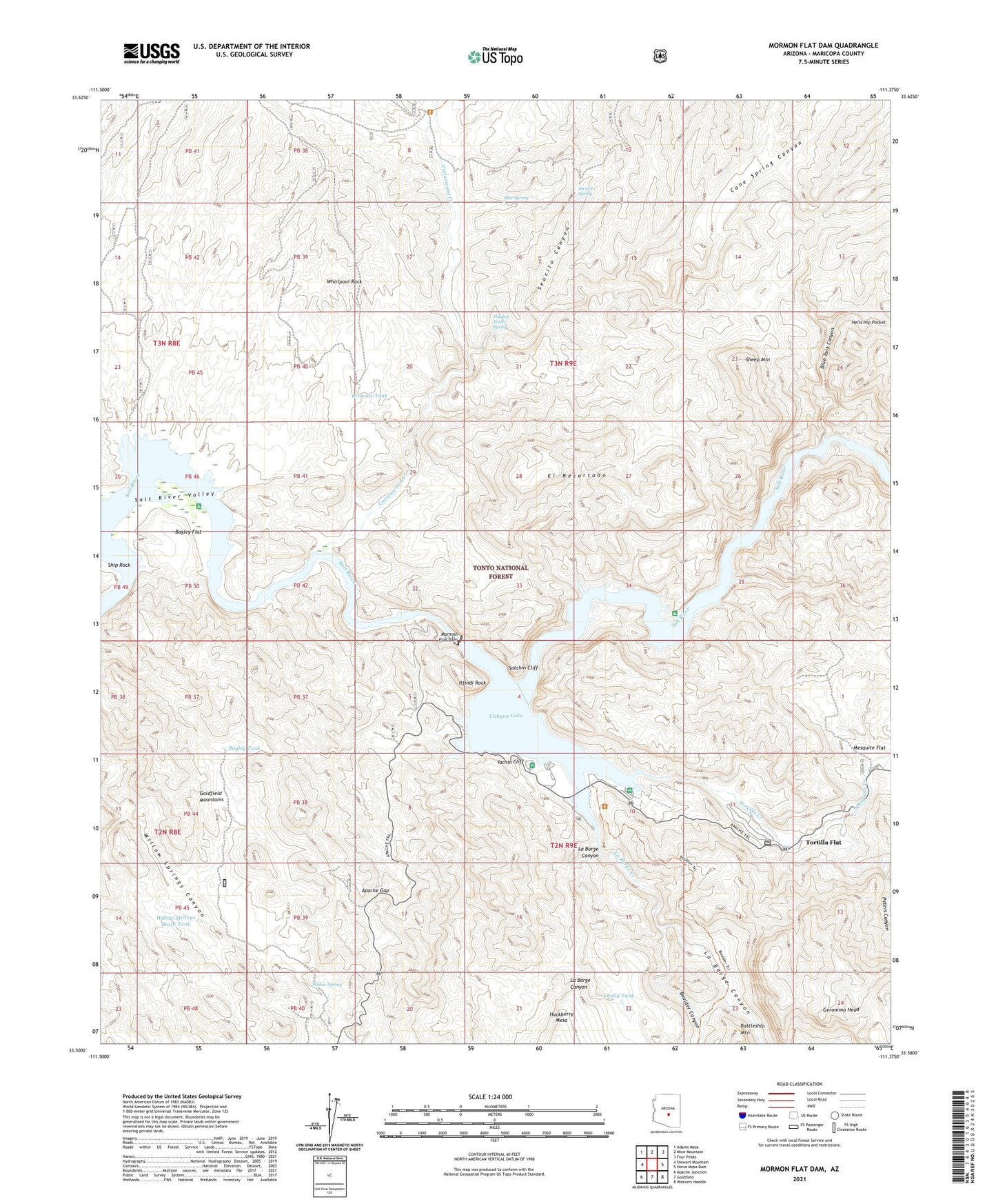
Mormon Flat Dam Arizona US Topo Map
Couldn't load pickup availability
Also explore the Mormon Flat Dam Forest Service Topo of this same quad for updated USFS data
2021 topographic map quadrangle Mormon Flat Dam in the state of Arizona. Scale: 1:24000. Based on the newly updated USGS 7.5' US Topo map series, this map is in the following counties: Maricopa. The map contains contour data, water features, and other items you are used to seeing on USGS maps, but also has updated roads and other features. This is the next generation of topographic maps. Printed on high-quality waterproof paper with UV fade-resistant inks.
Quads adjacent to this one:
West: Stewart Mountain
Northwest: Adams Mesa
North: Mine Mountain
Northeast: Four Peaks
East: Horse Mesa Dam
Southeast: Weavers Needle
South: Goldfield
Southwest: Apache Junction
This map covers the same area as the classic USGS quad with code o33111e4.
Contains the following named places: Acacia Picnic Area, Acacia Recreation Site, Apache Gap, Bagley Flat, Bagley Flat Recreation Site, Bagley Tank, Black Canyon, Blue Spring, Blue Tank Canyon, Boulder Canyon, Boulder Picnic Area, Boulder Recreation Site, Brownie Tank, Cane Spring Canyon, Canyon Lake, Canyon Lake Marina, Cholla Tank, Cottonwood Camp, Cottonwood Creek, Cottonwood Trailhead, El Recortado, First Water Creek, Geronimo Head, Hells Hip Pocket, Hidden Water Spring, Ittindi Rock, La Barge Canyon, La Barge Creek, Laguna Boating Site, Laguna Recreation Site One Hundred Fifty, Mesa Ranger District, Mesquite Creek, Mesquite Flat, Mormon Flat, Mormon Flat Dam, Mormon Flat Dam Heliport, Palo Verde Boating Site, Palo Verde Recreation Site 147, Peters Canyon, Salt River Project Housing, Satchin Cliff, Secucito Spring, Seucito Canyon, Sheep Mountain, Ship Rock, The Point Boating Campground, The Point Recreation Site, Tortilla Campground, Tortilla Creek, Tortilla Flat, Tortilla Recreation Site, Whirlpool Rock, Willow Creek, Willow Spring, Willow Springs Basin Tank, Willow Springs Well, Yachin Cliff